Redemption for Kansas?

Tuesday, 5 September 2017
Lamar, CO to Hutchinson, KS ~ 275 miles
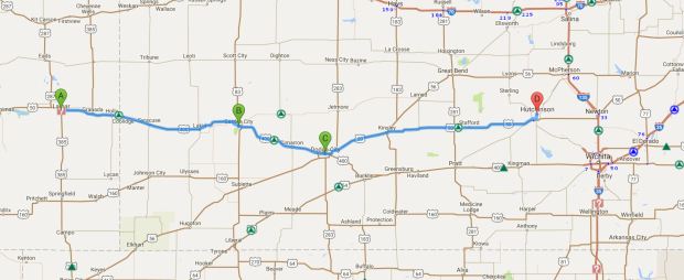
0905 Lamar to Hutchinson route 275

Map credit: Google Maps 2017, courtesy AAA

We kind of figured the Thai Spicy Basil would not be open for breakfast, so we decided to give the nearby Hickory House a try.  Another good call – not only was the food fine, we had another cute as could be and super friendly server!  We had fun chatting with her and sharing our story.   On our way out of town, we stopped by a Roadside America site to see a building made of petrified wood – nothing terribly exciting, but since we’d been to the petrified forest state park, it was kind of interesting.  Soon we were on the road, and before too long we were crossing the border into Kansas.  Have I mentioned that until this trip, Kansas was our least favorite state of all fifty of them?  I had a feeling that after the past few days and the roads we’d been on, Kim may have been looking forward to some flat, boring prairie driving – and she was!

We’ve driven across Kansas (west to east), albeit on the interstate, and we’ve driven south to north across it on Hwy 83 (the Road to Nowhere), and we’ve explored the southeast corner several times (on Route 66), and while some of the sights we’ve seen (Dorothy’s House in Liberal, Monument Rocks in the middle of nowhere (one of the 8 wonders of Kansas), Prairie Dog Town near Oakley (now closed), Baxter Springs (on the Route) have been good ones, others – Garden City, Scott (lake, city, county, state park, etc.) have been underwhelming.  As kids, we rode across Kansas and stopped at the Eisenhower Library in Abilene and then Daddy just drove and drove and drove.  For us, even North Dakota and South Dakota were more interesting; however, after criss-crossing Nevada twice now, Kansas was in good shape to move up a rung or two.  Fingers crossed, because our first stop was to be Garden City. Was redemption at hand?

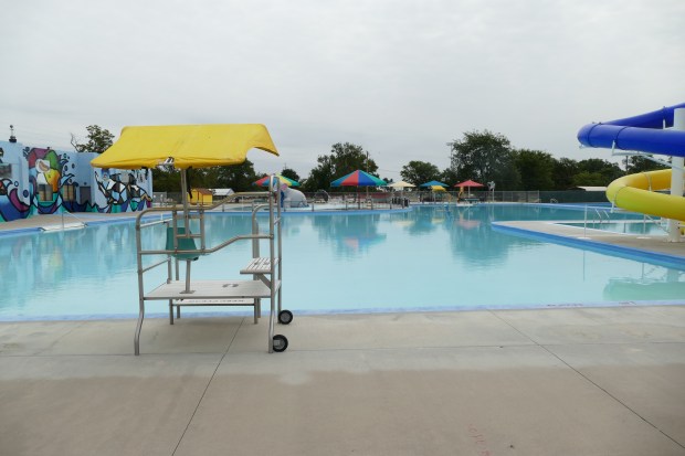
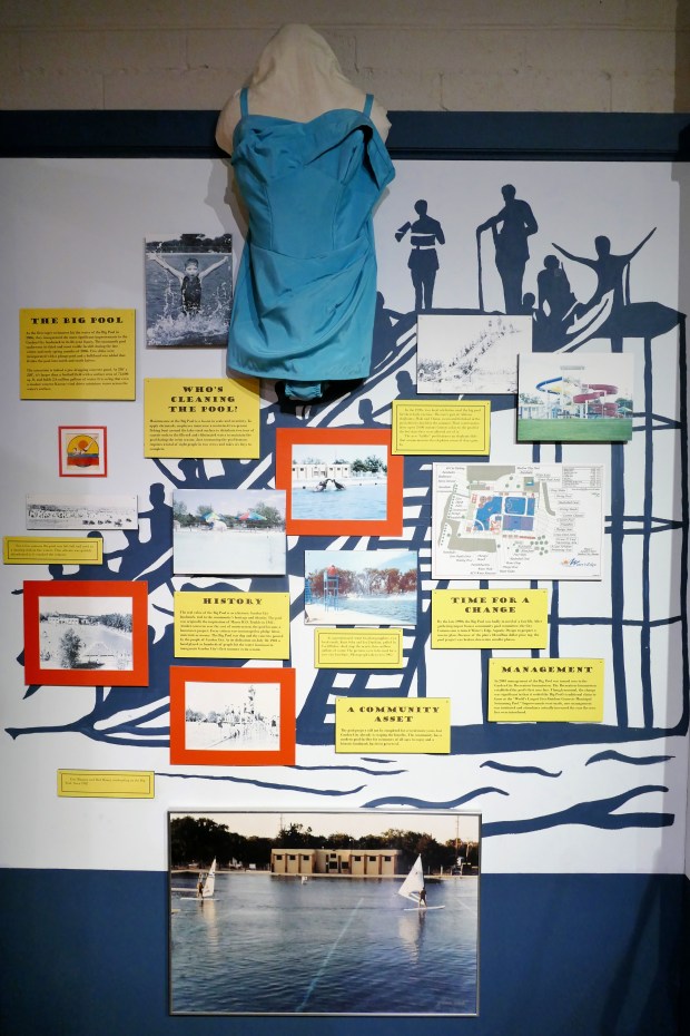
On our first trip to Garden City, back in 2007, the main thing we wanted to see was the Big Pool.  The Big Pool was hand dug and concrete poured by the people of Garden City in 1921 and opened for its inaugural season in 1922. The bath house was a WPA project constructed during the 1930s, and a children’s wading pool was also added in the 1930s. Sounds intriguing, right?  Thing is, we arrived there on the day before Mother’s Day, which was early enough in May that the pool wasn’t open yet.  Bummer.  Not only that, but our meals in Garden City that trip were at Arby’s and Long John Silver’s – not because we were craving fast food (you know it’s against the rules) but because it’s all we could find open!  Well, that’s not exactly true – we were directed to the Ramada Inn for the Mother’s Day buffet, but after about five minutes inside (we had even been seated), we left.  Not happening! Anyway, here we were, back in Garden City, and it’s the day after Labor Day.  I was hoping that the pool would still be full!  You’re probably wondering what could be so exciting about a municipal swimming pool, but this isn’t just any pool – it’s the BIG POOL! When I say big, I mean BIGGEST!  At 330 feet long by 220 feet wide, it’s longer than a football field and four times wider.  It is so big that people have water skied and wind surfed in it!  It takes two teams of eight people SIX DAYS to vacuum it.  A motorized boat is used to sprinkle soda ash in it, and there is a guard stand in the middle of the pool, meaning you would have to get wet to get on the stand – all of you former lifeguards out there – you know what a bitch that would be on a chilly day, a rainy day, or on first or last shifts!  Thankfully, we were rewarded – the pool was closed (meaning we could take all of the photos we wanted) and it was still full of water.  The pool is right next to the city zoo, and we learned that, back in the day, they brought the elephants over to frolic in the pool after it closed for the season.  Sadly, the elephants aren’t there any more, so we missed that spectacle, but there is an elephant slide in the kiddie pool.
P1100380

Some of the history of the Big Pool

P1100160

It really is ENORMOUS! This is the shallow end, with the bathhouse/concession area at left.
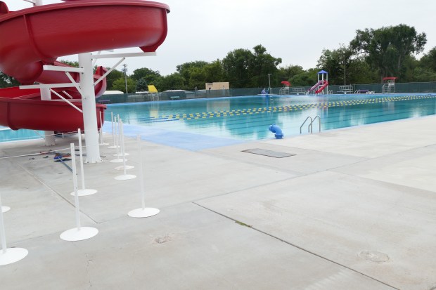
P1100161

Pictures don’t do it justice! Two low dives and two water slides in the deep end.
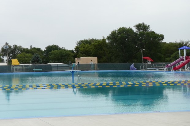
P1100163

See the guard chair in the middle of the pool??

Turns out that the zoo and the city museum (also next door) are free, so we decided to get a few steps by walking through the zoo.  And, if you drive through the zoo, it’s $10, and you don’t see much.  Go figure.  Kim probably wished we had skipped the zoo, since I love taking pictures of animals, but I really enjoyed it.  It was not a huge zoo, but it had some fun stuff.  You can skip the pics if you want – I may have gotten carried away…

This slideshow requires JavaScript.

After the zoo, we had to go to the museum, since the main reason we stopped was to see (I’m not kidding here) the world’s largest hairball.  There, I said it.  And it was right here in Garden City, although we almost missed it!  The museum was nicely done and we learned a bit more about Garden City, the Santa Fe Trail, and life on the prairie.  And about the hairball…

Our next stop after Garden City was Dodge City, which I was concerned would be the Gatlinburg of the Prairie.  In case you are not a long-term Sassy Sister follower, we have a habit of bestowing the ‘Gatlinburg of the ______’ moniker on things that we thought would be cool, interesting, or at least worth a stop but that ended up being tourist traps more than the places we expected (and that they probably once were).  It’s kind of sad, because we grew up going to Gatlinburg and loving it, before it became, well, THE Gatlinburg.  In case you’re wondering about some of our ‘award’ winners:

  • Gatlinburg of the Midwest – Wisconsin Dells
  • Gatlinburg of the Civil War – Gettysburg
  • Gatlinburg of the Coast – Myrtle Beach
  • Gatlinburg of the Badlands – Wall Drug

You get the idea!  Let us know if you have someplace we should include on this list!

Another blessing – Dodge City was not a Gatlinburg!  Our main stop in Dodge was as quirky as they come – the Wild West Wax Museum/Kansas Teacher’s Hall of Fame.  Yep, both of these oddities are housed in the same building, and the story is a funny one. Turns out the guy who owned the building was a photographer who somehow started collecting wax figures, mostly of wild west heroes and villains, with a few exceptions – John Kennedy, Lyndon Johnson, Wolfman, Dracula, and Frankenstein, most notably.  His photography studio was on the first floor, and the entire second floor was filled with these wax figures in semi-elaborate dioramas with a backdrop of black velvet, black light painted murals.  When the teacher’s Hall of Fame was looking for a home, the studio was just perfect, and the wax museum was part of the deal.  The coolest part of the wax museum is that it hasn’t changed since the 60’s!!  We almost didn’t get to see either the museum or the Hall of Fame, as it was open by appointment only after Labor Day, but the nice lady who answered our phone call agreed to meet us at 3 PM or shortly after, and sure enough, when we arrived about ten after three, Miss Mary Lou was there to greet us.  She sent us upstairs to see the wax museum, and then she was our personal tour guide for the Hall of Fame and it’s piece d’resistance, an authentic one-room schoolhouse that has been restored and permanently placed on the property.

This slideshow requires JavaScript.

The Kansas State Teacher’s Hall of Fame was very impressive!  Since 1977, the best teachers in Kansas have been honored by their peers, and it’s not easy to be in this group.  First, a teacher must have taught in Kansas for 25 years, and then, he or she must be nominated for the award.  Of course, many letters and recommendations are needed and then a group selects the award recipients from the larger group.  In addition to being a place of honor for these dedicated educators, there is a small museum featuring desks, books, typewriters. blackboards, musical instruments, etc. through the decades, and there is a gift shop, too – all in addition to the one-room schoolhouse, which is a museum itself.  We appreciated Miss Mary Lou taking time from her day to share these museums with us!

We thought about finding something to eat or drink while in Dodge, so we walked down the hill to the famous (or infamous) Boot Hill.  We opted not to pay to see the recreated Main Street, but we walked by it and then up and down a few blocks of the town.  In the end, we didn’t get refreshments (the brew pub and the distillery were closed) and just decided to head on to Hutchinson, our destination for the day.  On the way, we passed a huge feedyard of cattle and then an even bigger wind farm.  No kidding, the windmills, by the thousand, went on and on for miles!  We had already passed two different windmill-making facilities and a truck with a windmill arm.  This is definitely the place for it!

We were looking forward to staying in a Hampton Inn again, and we had no trouble finding ours in Hutchinson, since we arrived before dark (again!).  After getting some recommendations for dinner, we decided to drive a few miles south to the town of Yoder (population 194) and a place called Carriage Crossing.  Turns out Yoder is the center of several nearby Amish communities, and this restaurant (and bakery and gift shop) is family-owned and is known for its comfort food, which can be served family style if there are enough of you.  We were happy with our choice – good food, plenty of it, great prices, and PIE!

Animals, Dunes, and Depression

Monday, 4 September 2017

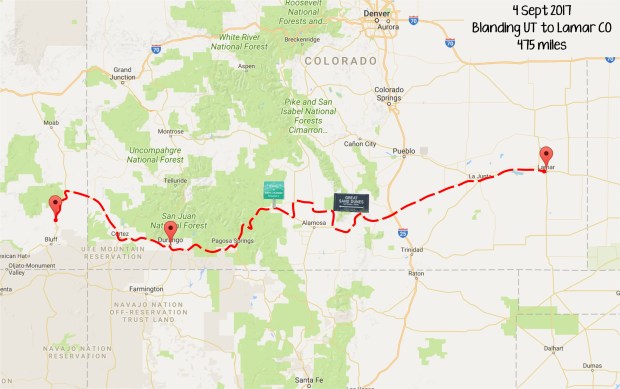
Blanding, Utah to Lamar, Colorado – 475 miles

Colorado route

Map credit: Google Maps 2017

There weren’t many options for breakfast this morning, but we found Yak’s Cafe on our way out of town.  The parking lot was pretty full, and that’s usually a good sign, so we were hopeful – and again, we were not disappointed!  The staff was friendly and though we got the expected ‘you’re not from around here’ looks from the regulars, everyone was nice and the food was hot and good.  Nothing fancy – good ole scrambled eggs, bacon, and hash browns are a great way to start the day.  You may have noticed that we’ve been eating only two meals a day most days.  We’ve learned that a hearty breakfast can go a long way, and we haven’t even been snacking on the snacks we bought at the Dutch Bakery.  Well, except for the vegetable chips which I may be becoming addicted to…  Back to the subject at hand – today’s route would take us across southern Colorado, most of which we had not seen before.  We visited Durango, Mesa Verde, and the Four Corners Monument on our Sassy Sister trip in 2013, and this time we’d be passing through Durango from west to east instead of north to south, although we did reminisce about our stormy, rainy, curvy, scary drive on US 550 past Ouray on that trip.   We also realized that the lovely day we spent soaking in natural hot springs was in Pagosa Springs, which was right on our route on Highway 160 today.  Sadly, we didn’t have time to stop at any of those places this time, as we had lots of ground to cover.

Our first stop of the day was an unexpected one, but who can resist hand-lettered signs for an elk ranch?  We were near Del Norte, and Kim gamely (haha) turned in at my request.  What a hoot!  From the Burma Shave-like signs lining the drive to the ‘Welcome to Ribeye, Colorado’ (population 12) sign to the photo ops to the store full of game meats to the pens of elk and caribou to the cute little kittens hanging out on the steps, we enjoyed our short detour at Anta Grande Elk Ranch.

This slideshow requires JavaScript.

It turned out to be a good thing we stopped here, because from Del Norte to Lamar, there was very little of interest.  The small towns were sad – very depressed, very little open – we wanted to stop for rest and refreshment, but there were no options along our route, even in the bigger places.  We were astonished to learn that there was a National Park in the middle of this nothingness, so we decided to have a look at Great Sand Dunes National Park, and we planned to ‘sled’ down the dunes.  Alas, you needed to have procured your sled in town before arriving at the park.  Oh well, we just opted to take a short hike, get some photos, and learn a bit about the dunes and the surrounding area.

This slideshow requires JavaScript.

The rest of today’s trip was blah!  No scenery, no people, no place to stop, and very little of interest.  We took a little accidental side trip in Walsenburg, and that was even more depressing! We were glad we actually knew a good place to eat in Lamar and we really wished we had known there was a brand new Holiday Inn Express (right next door to our dreary Days Inn) – Booking.com, you let us down this time!  We stopped at a Sonic in Lamar for some iced tea and saw an interesting sight, but we couldn’t get a good photo. Until we stopped for gas a couple of blocks later (whew!) and the same truck pulled up next to us.  Too funny!  We passed our Days Inn and were really tempted to drive on, but it had been a long day and there was nothing promising on the horizon, and we had already paid for the room.  We ate a delicious dinner at Thai Spicy Basil (we had eaten here on our 2013 trip) – Kung Pao Chicken and Moo Goo Gai Pan, with some chicken coconut soup for me – and then we resigned ourselves to the motel.  Just to add insult to injury, there was no elevator, and even though we both had two bags and the guy ahead of us had a tiny bag, he got the first floor room and we got the second floor room that was as far from the front desk (and stairs) as it could have been.  We see how it is.  I think I get cranky when we are heading home!

Surviving the Surreal

Sunday, 3 September 2017

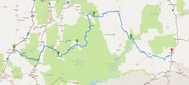
Cedar City to Blanding, Utah, 360 miles

0902 Cedar City to Blanding Route 360

Map credit: Google Maps 2017, courtesy AAA

Thanks to our superb server, Jacee at Centro Pizza, we knew that the place to go for breakfast this morning (another Sunday morning in Utah – sort of limits your breakfast choices!) was the All-American Diner, and we even knew where it was, since we had passed it on our way to dinner the night before.  We were not steered wrong – I had a standard All-American breakfast of eggs over easy, bacon, and hash browns with a splurge of a pancake.  It was all great, and I didn’t even eat all of the pancake or the potatoes.  It was about 9:30 when we started off on what would be one of our most challenging drives ever on our trip across what must be America’s strangest state, at least as far as terrain and topography are concerned!  The drive started out innocently enough, and we were on familiar territory, as we had stayed three nights in Cedar City on our very first Sassy Sister trip in 2006, on our way home from Route 66.  The first part of our journey took us through the Dixie National Forest until we turned onto Utah Scenic Byway 12 (an All-American Road), which took us past Bryce Canyon National Park, but we didn’t stop since we had spent a day there previously.

We made a quick stop at the Grand Staircase/Escalante National Monument Visitor Center in Cannonville and talked to a friendly ranger there who suggested that we stop at the Escalante Petrified Forest State Park and do a short hike there, since we really didn’t have time to explore the Grand Staircase much more than that.  It wasn’t too long before we traveled the 32 miles to the park, where the ranger there didn’t seem to think we would be up to the challenge of the short but steep hike up to see the petrified trees. Needless to say, that decided it.  We filled our water bottles, put on sunscreen, hats, and sunglasses, and after checking out the 50′ petrified tree at the base of the hill, headed up the dirt trail, which was almost completely unshaded.  Mrs. Ranger had given us a map that had info for each of the numbered stops along the trail, so we learned a bit as we hiked.  The trail was at its steepest early on, so the going was hardest at the beginning. Since we were just off of Vernal Fall though, it was a piece of cake!  One of the interesting things we learned was that the town of Escalante was named for a Spanish Franciscan priest who had explored the area in 1776, looking for an overland route from Santa Fe, New Mexico to Monterey, California.

With a little hike under our belts, we were ready for some more driving.  We thought! What no one had mentioned to us (and since we had done no research, we didn’t know) is that the next section of the road we would be traveling was near another road called ‘Hell’s Backbone‘, which is a gravel road built by the Civilian Conservation Corps in 1933, and let me just say that I am sure it is very aptly named!  I have to give total props to Kim, who drove Highway 12 masterfully and didn’t get to enjoy the spectacle nearly as much as I did.  The road featured several sections of 8 to 10% grades, no guardrails, and lots of curves.  The best news was that the road was obviously recently repaved!  The other good news – evidently, most people travel on interstate highways!  We were both thankful that we didn’t come upon any crazy bicyclists on this road and were stunned to read (days later) that Colin had taken this exact route on his travel the opposite direction!  Colin, when you read this, we are SO GLAD you made it safely!! These next photos need no explanation – the first ones were taken over about a 15 minute time period, and the ones with the aspen trees were about 25 minutes after that.

This slideshow requires JavaScript.

About thirty minutes later, we turned off of Hwy 12 onto Hwy 24 at Torrey and soon found ourselves in Capitol Reef National Park, with yet another stunning terrain change. Capitol Dome is a Navajo sandstone feature that was named for its resemblance to the US Capitol. This dome, along with the nearly 100-mile Waterpocket Fold (a barrier of rock that obstructed early travelers like a barrier “reef”), inspired the park’s name.  Capitol Reef became a National Park in 1937, and it has three main districts – the Fruita area, which was a Mormon settlement with a school and orchards, which are one of the largest historic orchards in the National Park Service with almost 3,000 trees, including apple, peach, pear, apricot, cherry, and plum; the Waterpocket District, which encompasses the 100 mile long Waterpocket Fold; and Cathedral Valley, which is a backcountry area.  While we would have liked to have explored this park more, it was quite hot and we still had a long way to go to get to our destination before dark.  And if the road ahead was like the one we had just traveled… Anyway, we stopped in the Fruita district to see the petroglyphs.

This slideshow requires JavaScript.

We continued on Hwy 24 until we reached Hanksville, where we turned south on Hwy 95 (the Bicentennial Highway), headed for Glen Canyon National Recreation Area and Natural Bridges National Monument, and ultimately, the town of Blanding.  Kim was almost over it with the driving (and I can see why) and we really wanted to make sure we were situated well before dark, so we mostly enjoyed the views from the car.  We stopped at an overlook to see Lake Powell, and we were in for a nice surprise.  From the Hite Overlook (which was quite a ways up and a mile or so off the road) we could see not only Lake Powell, but also the bridge over the Colorado River that we would be crossing soon.

This slideshow requires JavaScript.

Before long, we were pulling into Blanding, not sure whether or not we would be happy with our choice of a place to stay.  Let’s just say it was not up to our usual standards, and if we had known then what we know now, we would have gone a bit farther up the road. But we were safe and had beds and a shower – and air conditioning, so no complaints. Before we checked in, we drove around town a bit since it was still light and found pretty much the only place to eat, which looked okay.  Turned out, we really enjoyed the Homestead Steak House!

Staying on the Straight and Narrow

Sunday, 27 August 2017

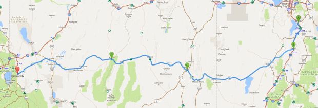
Orem, Utah to Carson City, Nevada  ~570 miles

0827 Orem to Carson City route 570

Map credit: Google Maps 2017, courtesy AAA

We tried to get off to an early start (you may be noticing a pattern here) and were excited about going to Guru’s for breakfast before hitting ‘The Loneliest Road in America”.  It was amazing how little traffic was on the road in Orem and Provo, compared to what we had seen the night before.  We pulled up to Guru’s and found a primo parking place; alas, it was closed on Sunday.  As was almost EVERY place around!  We decided to move on, wishing we had taken advantage of the free breakfast at our Hampton, and were just about to get on the highway when we saw a diner that was open.  Hold the bus!  We didn’t even have to wait to get seated at Café 300, housed in a gleaming chrome building just like diners of the past.  Soon we were fortified and ready to tackle the desert.

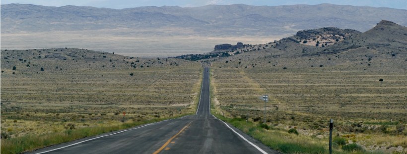
We still had quite a way to go to get out of Utah before we were actually on US 50 in Nevada, and we knew we needed to start that part of the trek with a full tank of gas, so we went ahead and filled up in Nephi, UT with plans to fill up again in Ely, Nevada.   At the gas station in Nephi, we ran into a whole group of antique car owners who had been to a big rally in Bryce Canyon.  Man, those cars were something else! We drove through the smallish town of Delta in Utah, where we picked up US 50, and saw some decent-looking motels – we were a little bit sorry we hadn’t kept driving the day before, until we remembered our wonderful dinner at Communal.  Driving along US 50, we passed a couple of interesting looking brick structures, so Kim u-turned it so we could check them out.  The highway sign said they were ‘Burining Pits”, but we are pretty sure that was a typo. The beehive-shaped charcoal ovens were used from 1876 through 1879 to help process rich silver ore that was discovered in Nevada. Once mining ended, the ovens were used to shelter travelers and even had a reputation as a hideout for stagecoach bandits. We were glad we stopped to investigate!  It was a warm sunny day, and one of us, not the driver, may have dozed off for a little bit…  The road was long and straight, except when it wasn’t, usually because we were going through a mountain pass.  We stopped briefly at the Nevada state line to take some pictures (but not to play the slots) and then went on to Ely and stopped to gas up.


Ely (pronounced eely) looked like a neat little town, so we went to the historic district and walked around a bit until it started raining on us.  There was a pretty park, some great murals, a duck pond with a man on a bike with a big sack of bread for the eager pigeons and ducks, a library, and the semi-famous Hotel Nevada.  It was nice to walk around a bit!  Ely is also the closest town to the Great Basin National Park, which we considered visiting until we realized how far off the route it was.  We definitely got the feel of being in a great basin, ringed completely by mountain ranges.  It reminded us of the Midland/Odessa area of Texas in the Permian Basin.

The only towns of note between Ely and Carson City are Eureka, Austin, and Fallon, so we didn’t anticipate too much excitement today.  We passed one bicyclist and two different walking people (who looked like they were walking across the country), and there were more cars than we expected, but it was a pretty uneventful drive.  We saw a huge archway made of antlers and we passed a large windmill farm.  We stopped in Austin because there was a little restaurant advertising “Breakfast, Lunch, and Dinner” and ice cream; unfortunately, it closed at 4 PM (early dinner, I reckon!) and it was 4:20 when we arrived.  Fortunately, the door was unlocked, and when we and a local father/son combo came in, they relented and sold us some cones (only vanilla, only small cones!) so we did have a little break.  Between Austin and Fallon, we passed some really sandy areas with some dunes and a lot of quicksandy-looking places right next to the road.  We didn’t stop to see if they were really quicksand though!

Fallon is the home of the NAS (Naval Air Station) made famous by the movie Top Gun.  We drove right past it but didn’t get to see any fancy flying going on.  We did get behind a driver who was either drunk, sleepy, or texting though – we kept our distance and finally called 911.  It was pretty bad! Fallon also had a unique irrigation system full of small dams and spillways right next to the highway.

Sooner than we thought, and before dark (YAY!), we arrived in Carson City and made our way to the Hampton Inn.  They even had covered parking there, and in the light of day, it appeared that the covers were actually solar panels.  Very clever!  We got a great recommendation for dinner and showed up slightly underdressed at Glen Eagles, where there were white linen tablecloths!  We sort of got a dining room all to ourselves, and we had HUGE portions of pasta Pomodoro (Kim) and scrumptious pork chops (not one, but TWO) perfectly grilled chops for me, along with mashed potatoes and veggies.  I could only eat one chop – so good!! – but we did get a French Silk pie to go and then didn’t eat it that night!

We were excited to spend the next morning exploring Carson City before meeting our new friend Laura, who had invited us to stay at her place at Lake Tahoe!  Our excitement was tempered by seeing the reports coming in about the horrible flooding taking place in Houston and the area between Houston and Galveston, as well as much of southeastern Texas.  I’d be lying if I said I wish I had been at home, but it sure seemed surreal but very believable and sad to see the damage and reports from afar.

Where the Wind Blows Us, Day 2

Monday, 6 June 2011
Cumberland Falls KY to Ripley WV  324 miles

We started our day with a big delicious breakfast at the Dupont Lodge.  The dining room looks out over the Cumberland River, and one wall of the room is windows.  Just outside the windows is a garden with lots of bird feeders.  Brilliant yellow gold finches were feasting on thistle seeds and ingenious squirrels were doing their best to get a free meal, too.  The window next to our table had little paw prints on it, about two or three feet up.  We weren’t sure which animal had made them until we saw a raccoon out there scrounging around!  We had a good laugh when we looked up to see a man in plaid shorts and a beret out there, too!

We were thrilled to see country ham on the breakfast menu – we had come home!  We shared a breakfast of country ham, potatoes, cooked apples, biscuits, redeye gravy, and eggs.  It was the perfect way to start the day and it made us think of Daddy, who LOVED country ham and redeye gravy.  After our meal, we went up to the patio and took some pictures of the river and the valley below, and then we were off to the Falls.

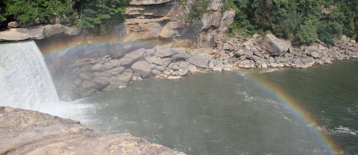
Cumberland Falls is the only waterfall in the western hemisphere that has a regular and predictable moonbow.  Victoria Falls in Africa is the only other waterfall that does, although Niagara sometimes has one.  A moonbow occurs only during a full moon, just after the moon has risen high enough in the sky to cause enough light to shine on the falls in a way that forms a spectrum like a rainbow.  Sadly, we weren’t there during a full moon, but we enjoyed the rainbow that was vibrant and big on this day!  Lots of photos later, we were ready to hit the road.  Never mind that it was after noon before we left – it took us a while to get back in road trip mode!

The first town that we came to was Corbin, home of the Colonel Sanders Cafe and Museum.  Given our late start, along with other things that we wanted to do and see, we didn’t stop…but we did stop at a Farmer’s Market to buy some fresh peaches.  Even though Kim and I grew up in Kentucky, neither of us had been much east of I-75, so we were looking forward to exploring Appalachia in our home state.  It was surprising to us to see so many coal mines still operating.  Our drive through the mountains was beautiful, though, especially in the Daniel Boone National Forest.

Another surprise along the way – a traffic jam in Hazard – go figure!  It was caused by an accident, but still!  Our main route today was Highway 23, also known as the Country Music Highway because of the multitude of talent born and raised along this route.  We stopped at the Country Music Highway Museum in Paintsville to learn some more about these singers.  It was a small museum, but pretty new and very nicely done. The most famous singers from this area are Loretta Lynn and her baby sister, Crystal Gayle, who were born in nearby Butcher Holler.  Other big names that you may recognize are Tom T. Hall, Keith Whitley, Ricky Skaggs, Naomi and Wynonna Judd, Billy Ray Cyrus, Dwight Yoakam, and Patty Loveless. There were others, but that should give you some idea!  The woman in the museum was so friendly and helpful – we were glad we had stopped!

From Paintsville we continued north on US 23 until we were almost to West Virginia.  We crossed the Ohio River on the Kentucky side of Huntington and hopped on US 60 into Charleston.  Highway 60 goes all the way across Kentucky to Paducah, so it was fun to be on it in West Virginia.  We had hoped to stop in at the Blenko Glass museum in Milton, but it was after five by the time we got there, so we just kept going.  Thankfully, the capitol building in Charleston was open until 7 PM, so we knew we would get to see it!  Charleston was much prettier than I expected it to be, and the capitol was big and domed.  It was not the prettiest one we’ve seen, but by no means was it the ugliest, either! My favorite thing there was a cool statue of Abe Lincoln out front.  It was called “Lincoln at Midnight” and he is pacing the halls in his bathrobe.  Oddly enough, just a few yards away was a statue of native son Stonewall Jackson.  That unpleasantness really caused big divisions, didn’t it?

A couple of high school kids were getting their (prom? graduation?) pictures taken on the capitol steps, so that was some good entertainment for us.  She was in a short bright royal blue dress and had a matching blue streak in the front of her very blonde hair.  She wore 4″ high heels (black) and her bra was almost completely exposed in the back as her strapless dress rode lower and lower.  Her boyfriend was wearing a blue tie that matched her dress, and someone’s mom was playing photographer.  A little brother was getting over it pretty quickly.  We just snickered.  And took a couple of pictures.  So mean.

We had thought we would spend the night here, but it was early enough when we left the capitol that we thought we’d move on, provided we could find a place to stay that wasn’t too far away.  Once we got that taken care of, off we went.  Ripley was our destination, and we got there with no problem.  Our biggest fear once there was that we wouldn’t find a place for dinner, and breakfast was a LONG time ago!  The only non-chain restaurant in town (that we could find out about) was a Mexican joint in a nearby strip shopping center, so that’s where we went.  Kim had enchiladas and I had a chili relleno and a burrito.  Not bad!  So there you have it – day two, in the bag!

Where the Wind Blows Us, Part 1

Sunday 5 June 2011
Nashville TN to Cumberland Falls KY  210 miles

My flight was late, but my bags made it (long story, just know it’s a minor miracle that they made it to Nashville with me and not to Austin with Rex.  Rex’s bag was found a few days ago in Baltimore…) and Kim picked me up at BNA about 4 PM.  We were both starving, so we totally broke one of our major Sassy Sister Road Rules and stopped at Wendy’s for a little snack.  It just turned out that we had exited on US 31E, which is exactly where we needed to be, so after we were not starving, off we went.  Our destination – Cumberland Falls State Park in Kentucky, allegedly 3.5 hours from Nashville.  And what was the first photo that we took?  It was a pink elephant!  Who knew it would not be the ONLY one we saw?!?

As we drove along admiring the many large horse farms, old tobacco barns, and the gently rolling hills of middle Tennessee, we realized that a big storm must have recently passed through.  We saw branches and even trees down, and lots of leaves and sticks all over the place, and the road was still wet.  Glad we missed that!  Before long we were in Kentucky, and it was here that I had to really start paying attention to the maps and navigating.  Those of you who have followed us in years past will be glad to know that we remembered to gas up before we got off the main highway!  We also had to stop around 9 PM or so at an Arby’s (twice in one day we are ordering from chain restaurants!!) and get some food to take with us so that we could have a little supper if we ever arrived.

Along the way, we saw lots of critters – dogs, cats, alpacas, skunk (well, we mostly smelled them, and knew we were home again!), and LOTS of deer.  Our favorite critters of the night – a rock formation on the side of the road that was painted to look like a cow jumping over the road, and the thousands of fireflies that decorated the countryside and transported us back to our childhoods.  Kim did a great job dodging the deer, many of whom jumped out onto the road as if they wanted to ride with us.

We’ve learned a few things about the numbering system of highways – the big US highways are usually one digit or two; state roads are often double or triple digits; county roads are the triple digits; and the four digit roads….well, they are often like single lane streets, and they don’t always find their way onto printed maps.  We’ve become pretty familiar with some of them over the past few years!   We found ourselves on routes 90, 92, 27, 700, 1162 (as well as some un-numbered and unnamed roads), and 90 again before we made it to Cumberland Falls, but of course, we made it.  One other observation from our evening drive – we are still baffled by roundabouts, especially when listening to the Garmin!

We checked into DuPont Lodge at Cumberland Falls State Park, found our room (not without a bit of difficulty, and without the benefit of elevators), and had a bit of a laugh about it.  We had been told it was a small room, but we figured any room that was big enough for two queen sized beds couldn’t be too small.  Let’s just say it was big enough for two queen sized beds.  But it also had a chair, a table with a TV (old kind, not flat screen) on it, and a night stand.  That was pushing it a little!  We got settled, enjoyed our little Arby’s picnic, and hit the sack, ready for a big adventure.

Graveyards, Ghosts, and Gullywashers

St. Francisville, LA to Vicksburg, MS

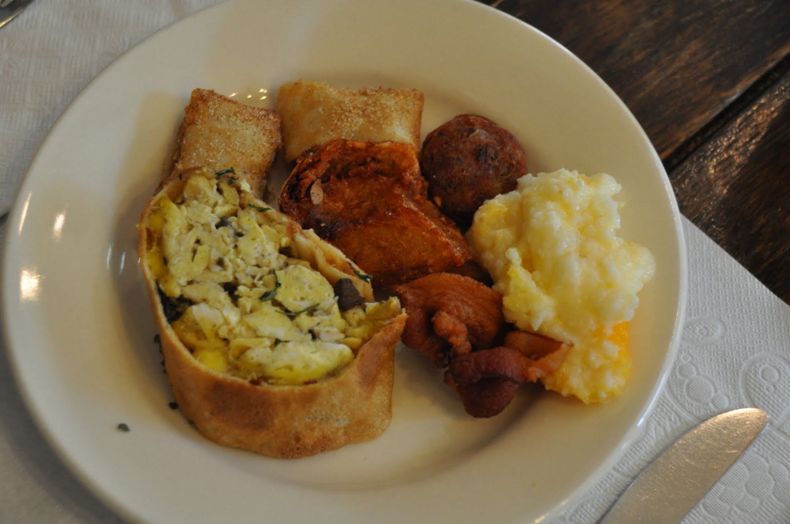
No rush this morning, except to get to breakfast at the inn by ten o’clock, as we thought we’d just be going to Natchez tonight.  It was nice to wake up slowly!  We looked around the inn now that we could see it in the daylight – I had stuck my toes in what I had hoped was the hot tub part of the pool last night, but since it felt the same as the rest of the pool…Kim watched a big ole frog hop right in the pool this morning – made me feel right at home!  We eventually wandered over to the dining room for breakfast, which was a nice buffet.  I had an egg roll (not the Chinese variety), a bite of sausage, some bacon, fried potatoes, some really yummy little apple treats, and cheese blintzes with blueberries.  Nice way to start the day!

As you may have noticed, we’ve been indulging in some mighty good food on this trip, so we thought we might take a little walk this morning in hopes of getting rid of a fried something or two.  Armed with Laurie’s map, we headed off for the visitor center/museum.  Before we had even gone a few blocks, we were glowing.  Seriously.  Like with sweat dripping off of us – it was just a bit humid!  We passed several houses with official-looking plaques and descriptions on them, but according to our map, we were not officially on the walking tour yet.  Where was that visitor center??

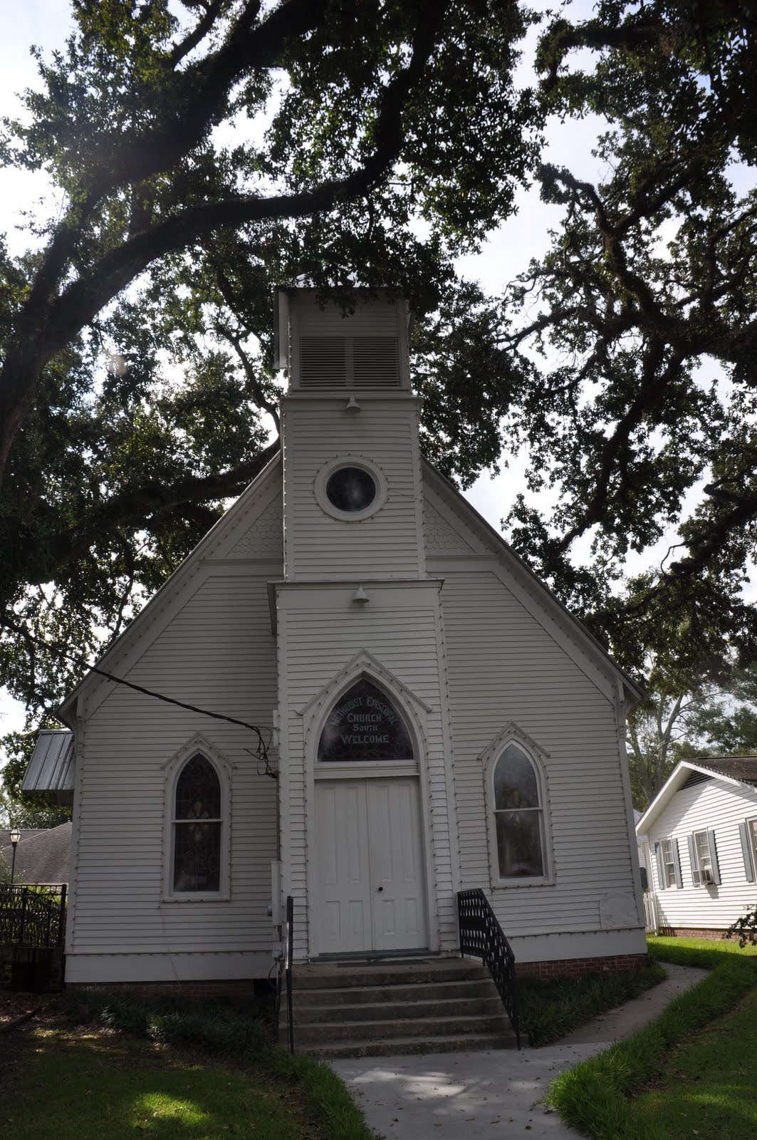
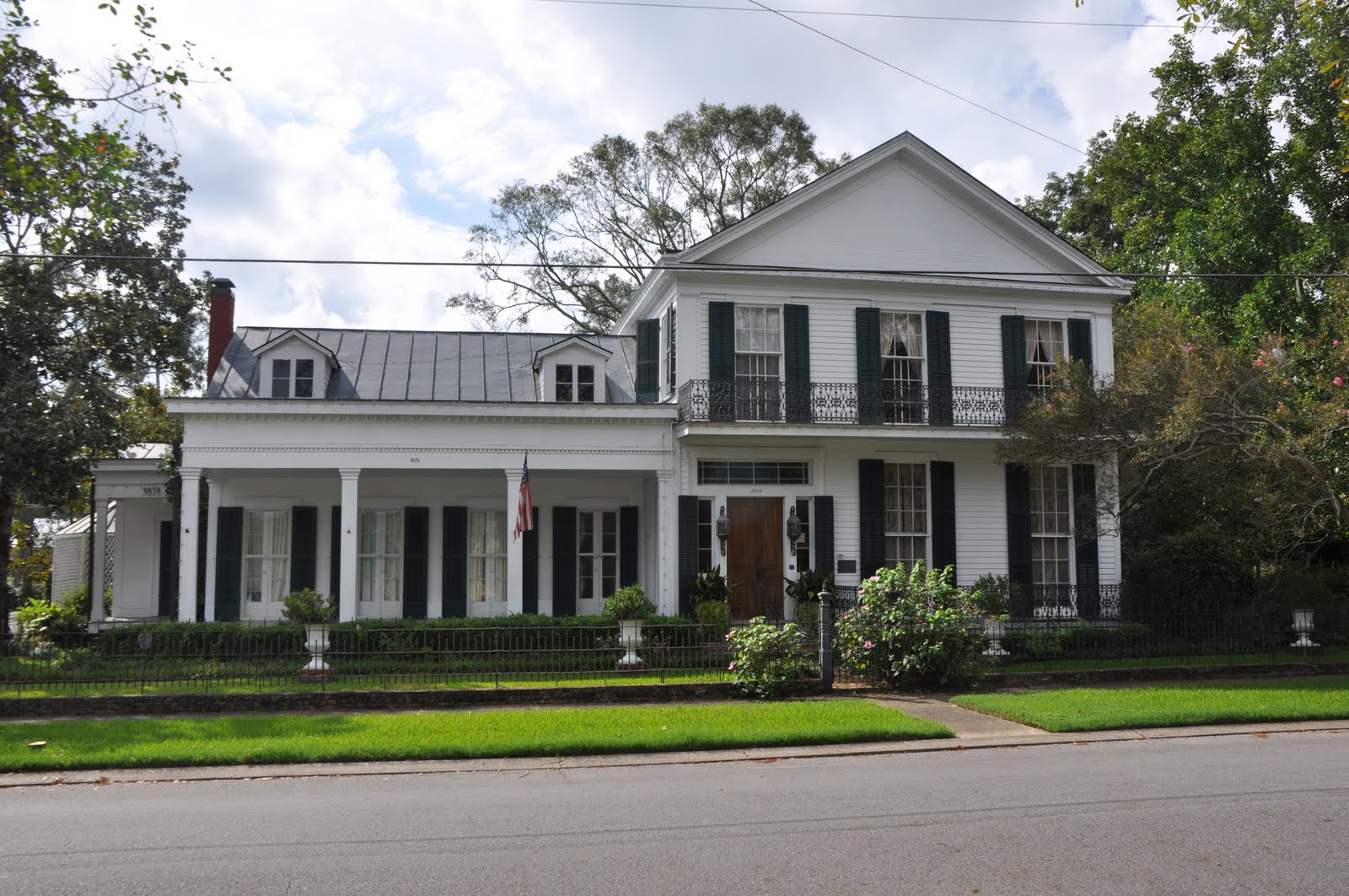
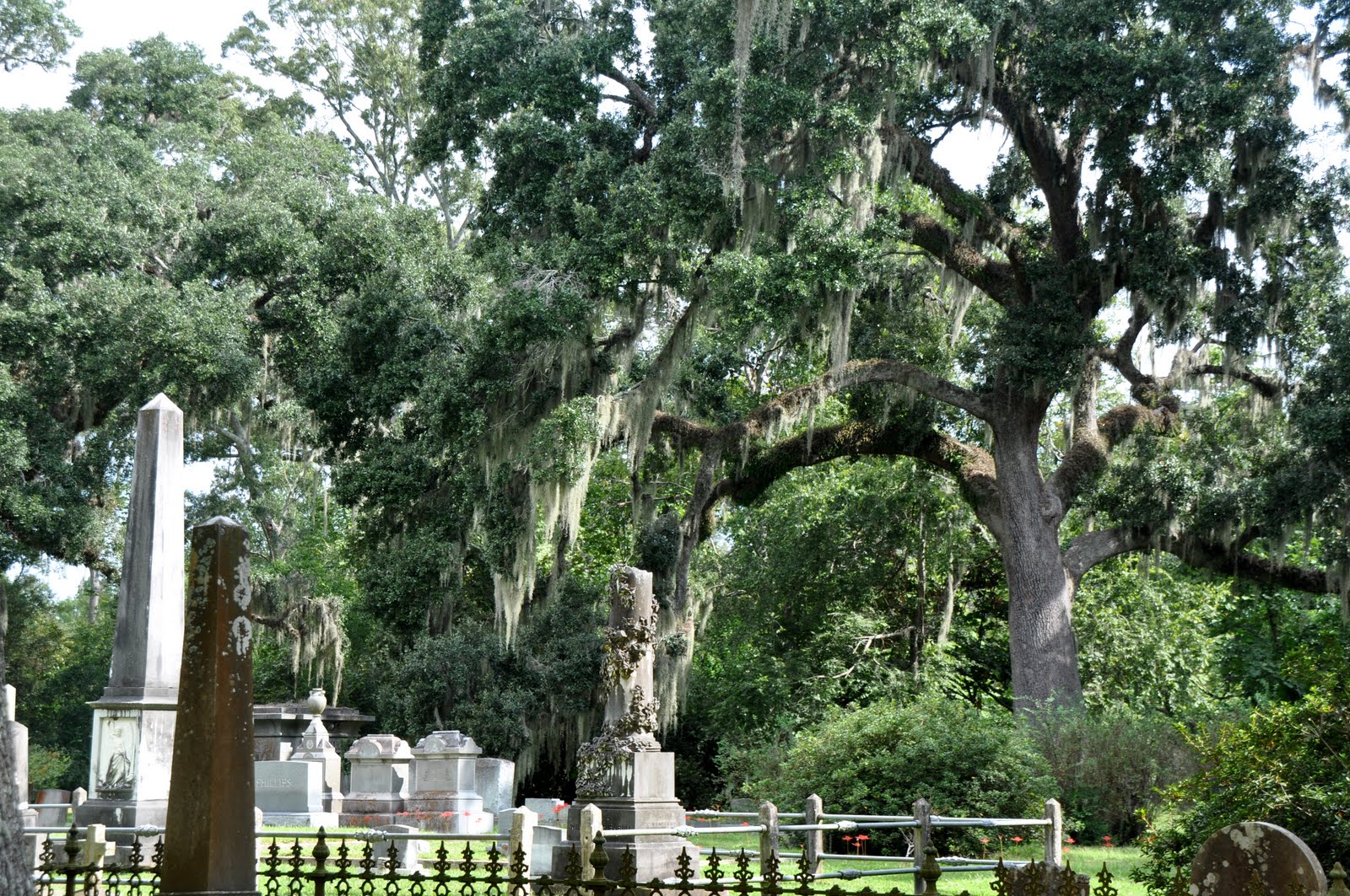
We found it!  And it was air-conditioned!!  We took our time examining the exhibits, and seriously, they had done a good job giving us a taste of what life was like in antebellum St. Francisville.  When we were ready to face the heat again, we started our tour.  There are a lot of old homes here, most of which appear to have been restored and are being lived in today.  We passed the Methodist Episcopal Church, which is now the Methodist Church, several houses with lovely gingerbread trim and wrought iron balconies, the old bank building, the courthouse, and the Episcopal Church.  There was a wonderful old graveyard next to the Episcopal Church, and since it was full of huge old live oaks covered with Spanish moss, it was shady and several degrees cooler, so we took our time exploring it.

We finished our walking tour and made it back to the inn to collect our car, and we went straight to George’s for some cold tea!  They weren’t quite open yet, but we must have looked really hot and thirsty, because they let us have our liquid refreshment!  Now we were off to tour one of the plantation houses in this area, and we had chosen Rosedown, the home of Jefferson Davis’s mother and named for the flowers she loved.  It wasn’t far away, and we got there shortly after eleven, with the sky looking fairly threatening.  Bad news for us – a tour was just underway, and the next one didn’t start until noon.  We decided to pass, and then the lady asked us if we didn’t want to tour the gardens between now and then.  We were going to just have a short stroll through the rose gardens and then leave, until she wanted to charge us half price just for that.  And mind you, it’s late September – there was not all that much in bloom!  So we just said thanks, but no thanks and went on in search of a plantation that suited our schedule. 

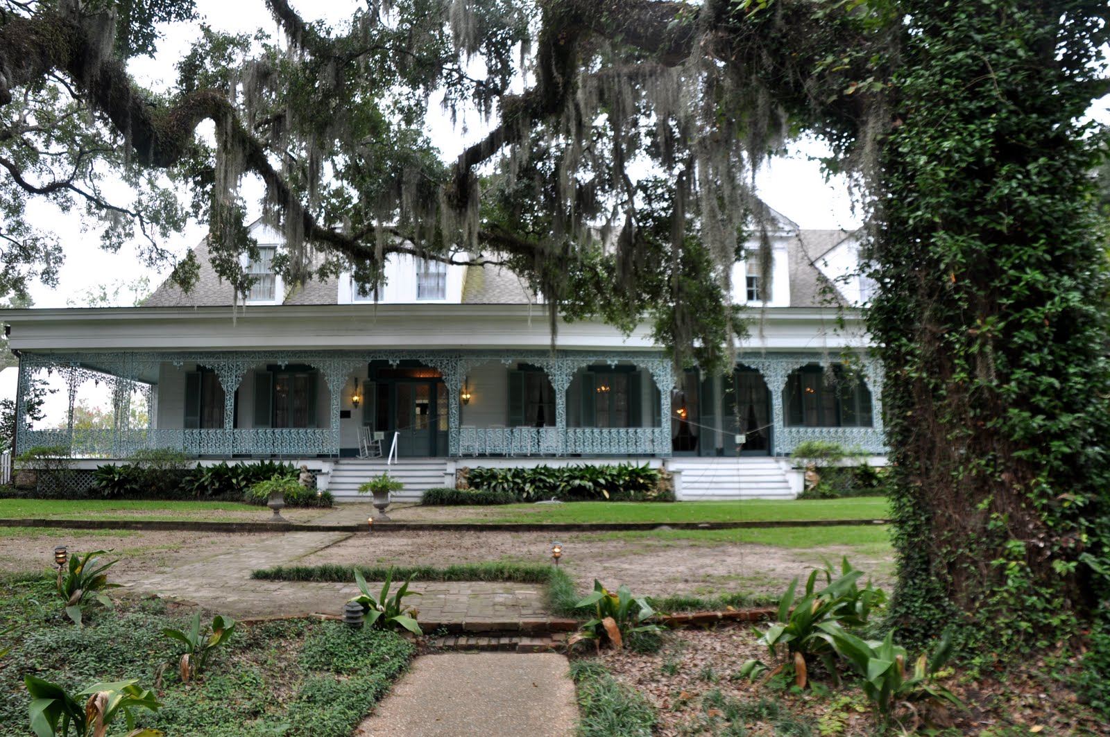
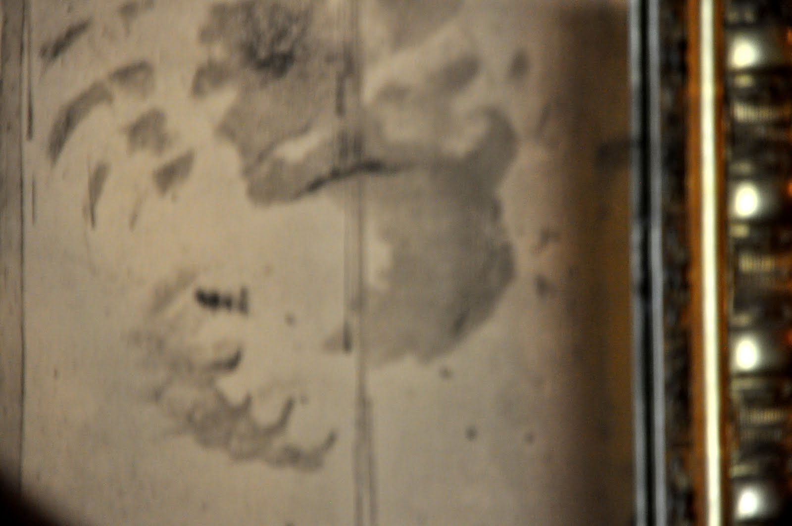
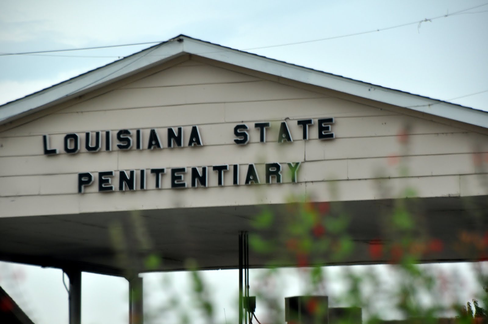
That led us to The Myrtles, which was built in 1796 by General David Bradford, who led the Whisky Rebellion.  Guess he decided to come South after that worked out so well…  Anyway, The Myrtles is haunted, or so the story goes.  We were only allowed to take pictures in one area of the interior of the house, and that was this huge mirror in the entryway.  Even though the glass in the frame has been replaced on multiple occasions, the same markings always appear back on it in the same places.  We were told a story about a slave girl who supposedly haunts the house, but after reading the accounts at I have decided not to relay what we heard.  Check it out and decide for yourselves!  After our tour, we walked around the grounds for a while, then got some gas and took off for Angola and the Louisiana State Penitentiary.

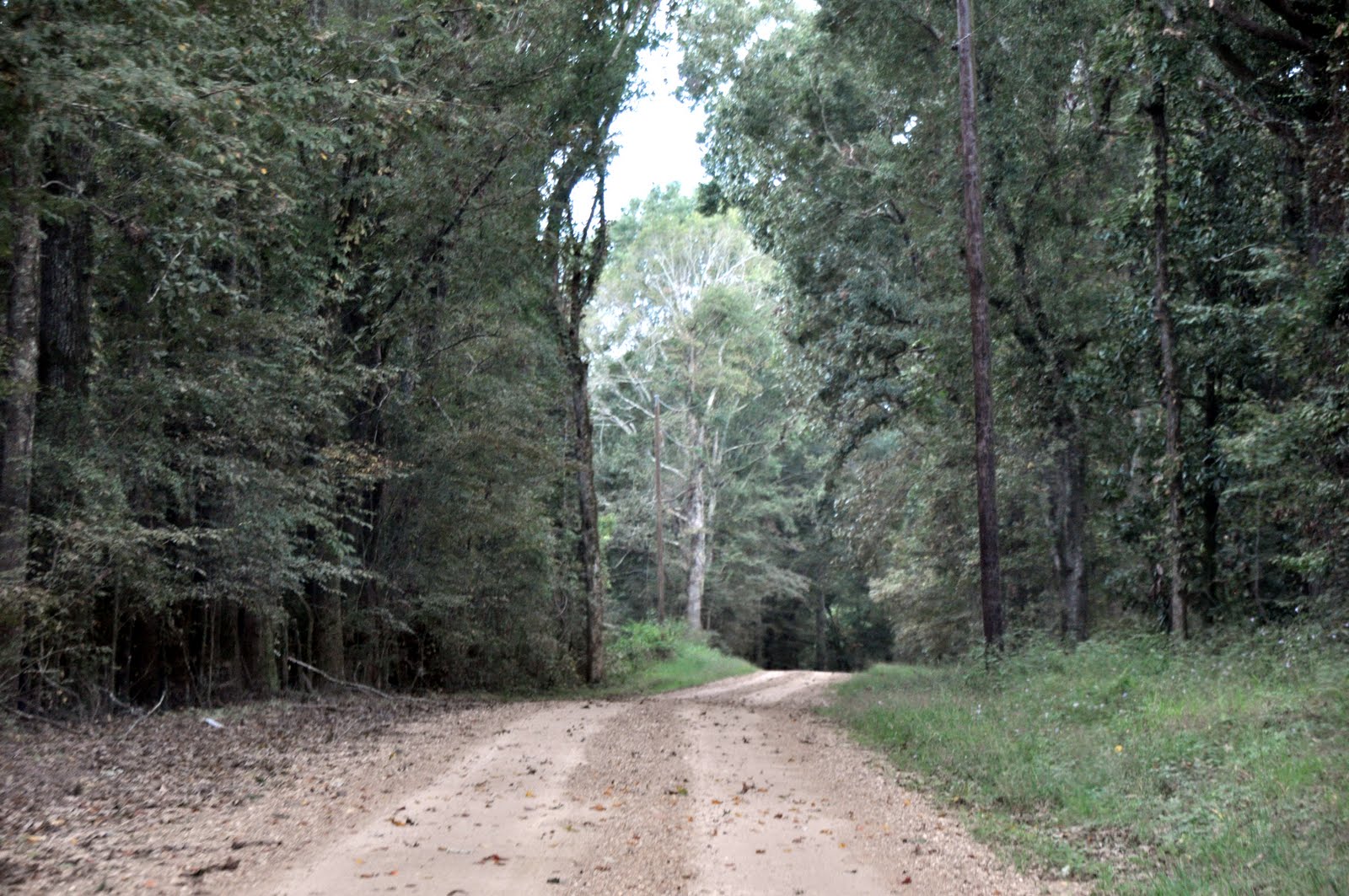
You know how sometimes you just know you should follow your intuition rather than doing what someone or something else is telling you to do?  Well, this afternoon was one of those times.  Once again, Kim was led astray by her navigator, and we soon found ourselves deep in the woods, first on a road, then a gravel road, then a dirt road, and then on a one-lane dirt road, all going nowhere fast!  We saw few signs of life, other than the “Posted: No Trespassing” signs, so after a while, Kim performed a lovely seven or eight point turn and we went back to the highway we never should have turned off of, and before too long we were at the prison gates.

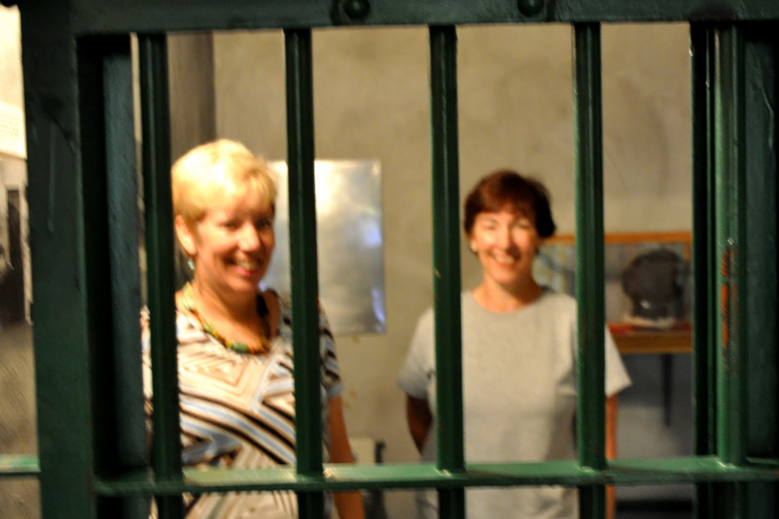
Just outside the gates of the prison was a museum about the history of the Louisiana Penitentiary, which was known as one of the bloodiest and most awful prisons in this country.  I found it interesting that the current warden was willing to share that history, although it’s hard to see how far you’ve come unless you’re willing to admit where you were.  This is the prison where “Dead Man Walking” was filmed as well as the place it was written about, and many other prison movies have been filmed here.

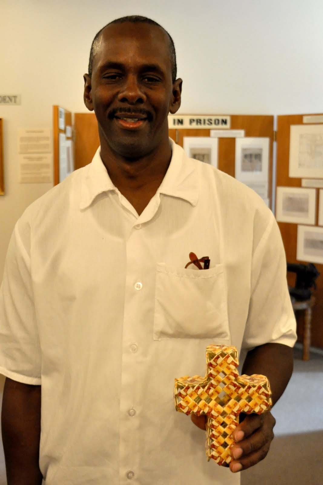
We were the only visitors, and soon we were joined by a nice-looking man, all dressed in white.  He proceeded to give us a guided tour of the museum, and it soon became evident that his knowledge was first-hand.  He was the nicest guy, very gentle and soft-spoken, and he will be turning 50 soon.  He’s been incarcerated for 25 years, serving 60 years for aggravated burglary.  Seemed a shame to us – such a heavy sentence – don’t think they pass those out much these days.  He’s coming up for parole, but he’s been turned down twice already…  Anyway, his name is Edrick and we liked him!  He showed us his ‘crafts’ – remember those chains we used to make out of chewing gum wrappers?  He makes all kinds of things using that same technique and cigarette packages.  The museum was really interesting and well worth the out-of-the-way stop.  Later, when we learned there had been an escapee last week, we were glad we had found our way off of the back roads and back onto the highway…

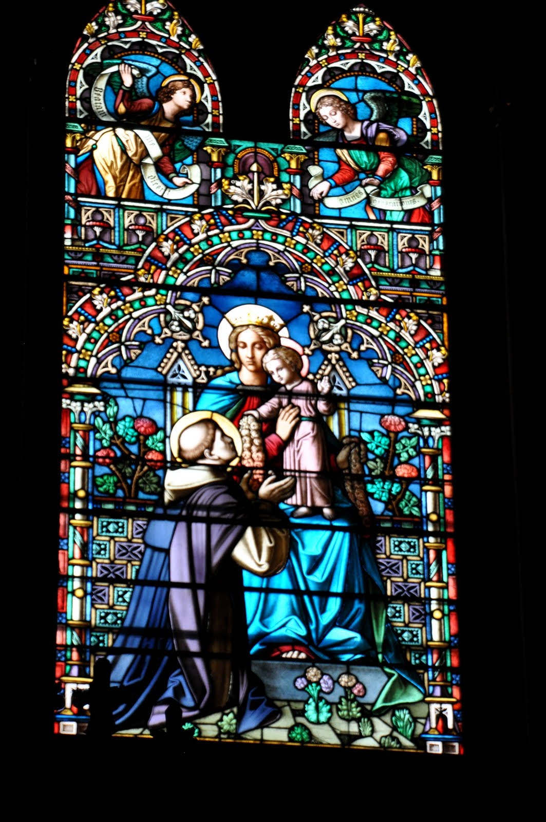
The rain started falling about the time we got back on the road, but it just drizzled on us as we made our way back to Natchez.  Our original plans were to make it there in time for lunch at Mammy’s Cupboard (it was really good!!) but we missed that, so we decided to stop for a treat at The Malt Shop.  We both got chocolate malts and split a shrimp po’boy and enjoyed them on the picnic table out front.  The sky was really gray and threatening, and it was very hot and humid, but  at least it wasn’t raining!  We went back to the Basilica, which we were able to see this time.  Wow – more beautiful stained glass!  There are some gorgeous photos on the website and if you make it to Natchez (we highly recommend it!) be sure to stop at see for yourself.

It started raining in earnest as we drove out of Natchez, so that put a damper on our plans to stop in at the places on the Trace that we missed in the dark on our way down.  We did stop at the Emerald Indian Mound, which is huge and centuries old, but then it started pouring.  Kim gamely drove on to Vicksburg through the driving rain, and we were done for the day.  We ordered pizza and did laundry and called it a night.  We were really sorry to have missed getting to spend more time in Natchez on the flip side – we enjoyed it a lot!  FYI, they do ‘pilgrimages’ in the fall (this year it’s now – Sept 26 – Oct 10) and for four weeks in the spring where the plantation homes are on tour with guides in antebellum attire.  It would be a fun time to be there!

A little soggy but overall, I can’t complain about the rain!

Jan

From Elvis to Fat Mama

17 September 2009

We got off to a fairly early start, at least for us, in Tupelo.  Not finding any mention of good breakfast places in any of our books, we went looking on our own and arrived at Shockley’s, which looked pretty grim, outside and in, but had decent enough breakfast.  Kim liked her hash browns and said her ham was mighty tasty.  I had a cheese omelet, which was fine.  Since the atmosphere was depressing (think school cafeteria, or worse), we didn’t linger.  Besides, we were off to see where Elvis grew up.

We’ve learned that no matter where we travel, Elvis finds us – hunts us down and pretty much haunts us – and begs us to have something to do with him.  So here we were in his birthplace, Tupelo, Mississippi.  Did we have a choice?  It was not difficult to find the two-room shotgun shack that Vernon Presley built for his wife and what was to have been twins, but instead was the larger-than-life Elvis.  Sadly, two tour busloads of people, some from England, had beat us to the punch, so we opted not to pay money to stand in a single file line to go through the house.  We got photos of the actual Assembly of God church where Elvis and his parents attended (it had been moved to the site, complete with an outhouse, which I’m not sure belonged with the church or the house) and where Elvis first discovered gospel music.  We saw a modern chapel with brilliant stained glass windows that was built and dedicated to Elvis’s memory after his death, and then we stood around the Fountain of Life, which marked the years Elvis lived in Tupelo.  I thought the most interesting exhibit was an outdoor wall which was lined with memories about Elvis from the now-grown children that he went to school with and played with as a boy in Tupelo.  They painted a picture of a poor but proud boy who always knew he would be somebody and who had a God-given talent for music.  The house looked much better than it probably ever did when Elvis lived in it, and it was encircled by a sidewalk of squares commemorating every year of Elvis’s life (but only telling things about the Tupelo years).  Did you know Vernon had been imprisoned when Elvis was young?  The family moved to Memphis when Elvis was entering his teen years in hopes of finding a better job for Vernon and a better life for the family. 

After a quick Sonic stop for our morning tea, we were back on the Trace, headed for Natchez.  The sky was not promising, and the weather reports were grim – RAIN, and lots of it, was predicted for the whole southeast.  We were not sure we would be able to avoid it today.  The first interesting thing we saw along the parkway was another Indian burial mound site, but we just did a drive-by and didn’t stop to see them.  We did stop at French Camp, which turned out to be most enlightening. French Camp was established by Louis LeFleur as a stand (inn) in 1812, and it became a school for boys in 1822.  It later had a sister school for girls that served as a finishing school, which burned down long ago.  Today French Camp Academy is a private Christian boarding and day school serving area youth.  There was a house that’s been restored, a blacksmith shop, an old school building that now serves as a museum, and several other outbuildings, and they make sorghum here in the fall.  We spent about an hour just poking around and talking to the museum lady (don’t think she gets much business) who showed us her senior picture (class of 1947) from FCA.  The sun was shining brightly, and it felt like you would expect a summer day in Mississippi to feel – a little sticky!  While looking at the house, we came across a mother cat and three little kittens – that was about the extent of our excitement.

Our next stop was the town of Kosciusko, which you may have heard of since it is Oprah’s birthplace.  It was named for a Polish general who served with Washington in the Revolutionary War.   He was an amazing engineer who designed many forts all over the eastern US and who fortified West Point.  We had a little picnic at the welcome center here, where the nice folks manning the desk allowed me to charge my laptop while we ate.  We sat out on the slightly damp picnic benches and had the pimiento cheese from Glasgow on our leftover rolls from Nashville, the tomatoes we bought in Danville, and some almonds that Kim had brought.  It was all good!

The crazy weather continued after we got back on the Parkway – it rained on us while the sun was shining.  We were getting so frustrated because we couldn’t find the rainbow that we KNEW had to be there!!  This ended up being a theme for the afternoon, as this action was repeated about six times!  At one point, we pulled off at a turnoff just to try to find the rainbow, and instead we happened upon the most lovely sight – the Pearl River, covered with lily pads and with several beautiful birds wading in the water.  We finally found a couple of rainbows, too!

We pulled into the parking lot of the Cypress Swamp and got out for a little nature hike just as the thunder started in earnest.  We didn’t let it scare us and we had a really nice, albeit wet, walk through the swamp.  Lots of fungi and other cool nature all around us!  It is hard to believe that at one time, ALL of the cypress trees in Louisiana had been harvested.  They are so pretty!

We made one other stop before it got too dark, and that was at the “waterfall” at Owens Creek.  My oh my, worse than the other waterfall we stopped for, but at least this time we didn’t end up hiking down (and back up) 900 feet to see it!  It started raining again, and this time it was getting dark, too, so no rainbows.  We did see lots of deer lining the parkway, so Kim did well to avoid hitting them and to drive in the rain with no streetlights.  By the time we arrived in Natchez, the rain had stopped.

On the way to our hotel, we passed Fat Mama’s Tamales, which I knew to be the home of “Fat Mama’s Knock You Naked Margaritas”, so we were thrilled to find it was within walking distance of the hotel. Like next door.  No need to tell you where we ate dinner!!  And boy, were those margaritas good!

Keeping my clothes on despite the margaritas,

Jan

Slow Movin’, Good Eatin’, Parkway Kind of Day

16 September 2009

It was pouring down rain when we got up, so we just didn’t get moving.  We caught up on some computer time and were just avoiding the inevitable when we got a call from the place where our mom lives in Durham.  They reported that mom had been found on the floor next to her bed that morning, and that while she seemed okay, could I please come take her to the doctor?  Needless to say, that was a no, so they took her to the ER at Duke, where she spent the day but was released in good shape.  David and Rex went to visit her last night and said she seemed none the worse for wear and that she apparently just rolled out of the bed in her sleep.  We are grateful that it was nothing more!

We had thought we might go back to the Loveless Café for breakfast, but Laura had told us about another place we might want to try called Barbara’s Home Cookin’ on Old Hillsboro Road. It was almost 11:30 and still raining by the time we got over there, but boy, was it worth it.  We were greeted at the door by a lovely South African woman and a sign that said “Barbara’s Home Cookin’ welcomes all families HOWEVER, unruly children Will Be DEEP FRIED (the secret is in the sauce)” – ya gotta love it!  We had the CUTEST server in the world named Matt.  We knew we loved him when he brought us a basket of three huge hot rolls with our iced teas.  For those of you Clark School kids who remember how you never wanted to miss Thursdays because it was hot roll day in the cafeteria – these were the closest thing to those that I’ve had in years!  Heaven in a yeast roll, with a huge bowl of butter, too!

NOTE: Barbara’s Home Cookin’ closed in December 2025 after being in business for almost 30 years.

Matt proceeded to help us order from the giant blackboard right above our table.  Kim chose a vegetable plate with cucumber and tomato salad, broccoli cheese casserole, and fried okra, and I had a scoop of the chicken salad on top of a bed of spinach with feta cheese and fresh fruit – strawberries, grapes, and oranges – with a little yummy dressing.  Right after we ordered, one of Kim’s college roommates, Debbie, called.  She lives just up the road, so she came over and joined us.  She got the poppyseed chicken casserole with turnip greens and zucchini and tomato casserole.  Dessert proved to be impossible to resist – we were going to share the peach cobbler, until it became either blackberry or blueberry, so I went for the chocolate chip bread pudding with caramel sauce, and Kim had ice cream.  Debbie abstained, and she also didn’t eat her basket of rolls, so we took them with us to go with our pimiento cheese.  We wanted to take Matt with us, but we didn’t have room in the car…

It was still raining when we left Barbara’s, so Debbie led us to the terminus of the Natchez Trace, which is right next to the Loveless.  It was almost two when we started off, and it’s 444 miles of 40 to 50 mph parkway.  Yikes!  Right away we pulled off to photograph the beautiful Birdsong Hollow bridge, and the rain even let up some.  The bridge is 155 feet above the valley below, and its double-arch construction has won design awards. 

We considered stopping at the historic Leiper’s Fork, but it was raining too hard to be worth it.  The rain was short-lived, though, once we got going on the Trace, and we stopped off at several overlooks, historic sights, and hiking spots along the way.  In fact, we stopped so much that after almost three hours, we’d only covered about 50 miles!  We hiked down about 900 feet to see a waterfall that we thought would be raging, given the recent rains, but we were wrong.  It was better than the Western Australia waterfall, but it was not much!  We stopped at an old tobacco barn and were able to drive about a mile down an original section of the Trace, and we hiked down to a place where there was a ferryboat landing, way back in the day.  We stopped at Meriwether Lewis’s grave, crossed the bridge spanning the Tennessee River, and saw several ancient Indian burial mounds.  For those of you unfamiliar with the Natchez Trace, make plans to drive it someday when you are not in a hurry to get anywhere.  It was originally a buffalo trail, then an Indian one, and then it was a postal route from Natchez, Mississippi to Nashville, Tennessee.  Now it’s a parkway, similar to the Blue Ridge Parkway, just without the mountains.  It’s a beautiful drive!

It was almost dark when we rolled into Tupelo and found our hotel.  We got the car unloaded and then went to Harvey’s, a local restaurant.  Great food and friendly service!  Kim and I both had Blue Moons, then she had a salad and I had the tenderloin kabobs with rice pilaf, vegetables, and a side salad.  We split a delicious coconut chess pie for dessert, then headed back to the hotel.  We had a long drive ahead of us tomorrow since we still had about 270 miles of Parkway to go before we got to Natchez.

Dreaming of fluffy hot yeast rolls,

Jan

It’s a Grand Old Flag Day!

14 June 2008

We got up at 7:00 this morning (Saturday) and had the car packed and loaded and were ready for breakfast a little after 8:00. We had thought about eating at Hershey Family Restaurant, but since they didn’t want us last night we opted for the Red Caboose instead. They have two real dining cars that serve as their restaurant, so we ate in one of them. We, and about 20 little boys who were about to wet their pants in anticipation of a Thomas the Tank Engine sighting. They were too excited to eat, but we weren’t. We managed to exert some degree of control, though, and we each ordered a “Little Engineer” – one pancake and a couple of slices of bacon. It hit the spot! Since we could get a wireless connection in the dining car, we took that opportunity to finish posting Friday’s blog and try to clean up the previous ones. Sometimes blogspot seems to have a mind of its own – must be related to Ms. Garmin…

While we were eating, we had plenty to watch out our dining car window. There was an Amish man plowing the fields with his horses and then a real train, being pushed by THOMAS (!!!), came chugging down the tracks. We soon had the dining room to ourselves. Once we finished, we decided to go up to the top of the View Tower (read abandoned silo now fitted with stairs) and look out over the Lancaster countryside. It was gorgeous! Very hazy (we learned at breakfast that rain was expected later in the day) but the terrain is rolling hills, green pastures, and fertile farmland. And we expended a few calories (maybe two bites of pancake) in the process. Finally, we were ready to depart from the wonderful Red Caboose Motel (check them out at http://www.redcaboosemotel.com/) and see what adventures awaited us today.


In case you are considering a trip to the Red Caboose – while it was sort of cool to say we’d slept in a caboose, it had nothing on the earthen lodge or the wigwams, and since it cost well more than both of those put together (higher rates on Thomas weekends…) we would have to say you’d really have to want to be there to pay those prices. We enjoyed our private (honeymoon) deck and it was great to be able to have internet access (a new router and a signal booster made it a wonderful connection!). If you were taking kids with you, it’s a great place for them – lots of wide open spaces for bike riding, a playground, the barnyard animals, Amish buggy rides, and it’s close to many attractions – The Choo Choo Barn, the Toy Train Museum (right next door), Dutch Wonderland, Amish Village, etc. And of course, there’s Thomas… we’re thinking he comes there right often. The food in the dining car was good and the people couldn’t have been nicer. So just file it on your list of places you might want to go if you had a good reason to.

Once on the road, we had in mind to take a couple of pictures – a giant Amish boy with some pigs, the Old Village Store in Bird-in-Hand, and the famous “Welcome to Intercourse” sign.


We are not sure about these Amish – besides Lititz (in Leacock County), Intercourse, Bird in Hand, and Paradise, there is also a town called Blue Ball, which we missed. Maybe it’s just me, but do you notice a theme here? We took our pictures and then we stopped at an Amish roadside stand and bought some homemade bread, and we found ourselves just a tiny bit behind schedule (we wouldn’t want to disappoint you!) but on the road by about 9:30. Ever since we set the Garmin to “shortest route” instead of “fastest route,” we have been traveling not necessarily on secondary roads or even tertiary roads, but the for real back roads. The ones that because only the locals use them, there’s no need for street signs, because they know where they are… Poor Jill, she spends her time recalculating for us. A lot. By the way, did you notice the Amish bicycle/scooter above? We saw lots of kids riding them, and most of the girls we saw were using them barefooted! On the highway!

We were on our way to Reading, PA, and its famous Pagoda landmark, located on top of Mount Penn. Although the Pagoda didn’t open until noon (we knew that) we enjoyed the ride up the mountain and thought the Pagoda was really cool. It was so hazy (pollution?) in Reading that we could barely see the city laid out below us. Jill wanted to make sure we got a real feel for Reading, so we drove through the PJ’s on our way out of town. Kim M, I know you wish you were with me. Kim C is getting used to my propensity for finding the really nice neighborhoods to get a tiny bit lost in…

From Reading, we went north to Shartlesville, PA, and the home of Roadside America, the World’s Greatest Indoor Miniature Village. Let me just say right here – THEY ARE NOT KIDDING!!!!! Kim and I LOVED this place! Picture one room about the size of the ground floor of your house. Now imagine that it has murals of the countryside painted on the walls. Now see if you can envision an entire miniature COUNTRY, through the centuries, complete with roads, cars, houses, factories, lakes, bridges, churches, downtowns, coal mines, caverns, mountains, Indian villages, parks, trains, trolleys, people, an airport, a circus, a waterfall – all in the same room and all created by ONE MAN!!! Laurence Gieringer began working on it as a child in 1905 with his brother, who stopped working with him when he became a priest. It’s been a tourist attraction in the area since the 30’s, and Mr. Gieringer died in 1963, but his family continues to allow his legacy and life’s work to entertain visitors.


Pictures do not begin to do this project justice, but even then I couldn’t pick just one or two, so I’ve posted more on the sidebar of this blog. If you have not been to Roadside America, please put it on your list of places to see before you die. And make sure you have plenty of time to take it all in! It was AWESOMELY STUPENDOUS! [NOTE: Sadly, Roadside America is no more, as of the early 2020s. Believe it or not, we even tried to buy it to move it to Paducah, but the owners (children & grandchildren of the creator) did not think we were serious buyers. Since there were no serious buyers (allegedly) they ended up auctioning it all off in tiny lots. I was so annoyed that I refused to buy any of it. Grrrr.]

Since we were now a little more than a tiny bit behind, we were forced to hop onto the interstate to get to Easton. The ‘slow’ lane was in such bad repair that everyone was driving in the fast lane, so everyone was going very fast. The posted speed limit was 65 for a short way and then 55; the observed speed was about 80. About the time the right lane got smoothed out enough to drive in, one lane was closed for repairs. Work zone speed was posted 45; observed speed, about 80. Has no one informed these people about gas prices? We were in Easton before we knew it, and since we could have been almost anywhere in the country (who could tell, on the interstate?) we almost didn’t know we were there.

We had a couple of destinations in mind here – the Pez Dispenser Museum and the Crayola Factory. We rolled into town about 2:30 and found our way through the seamier part of town into the very lovely and happening downtown area. The Pez Museum (http://www.eastonmuseumofpez.com/) is right next door to the Crayola Factory, but it closed at 4:00 and Crayola was open until 5:00, so we went there first. I had no idea there were so many different PEZ dispensers! The museum was very cool – great exhibits and displays.

The Crayola Factory (http://www.crayolafactory.com/) had an extremely bodacious box of crayons spilling out over the doorway to the factory – great photo op! Once in the factory, we watched a show about how crayons and markers are made (and really got to see that happen) and then we got free crayons and markers, and then we got to go make things! Saturday afternoons are a big birthday party day at Crayola. We were just a little out of place. And we thought all the children within a 100 mile radius were at the Red Caboose…

By now we were wishing we had ordered the Big Engineer for breakfast, so we found our way to Pearly Baker’s Ale House and enjoyed a delicious lunch of a small Chicken Cobb Salad and some ‘yam fries’, which is yankee for sweet potato chips. It was yummy and just hit the spot. We were able to summon enough energy to keep going, but first we took a picture of Centre Square, which was where one of only three readings of the Declaration of Independence took place on July 8, 1776. On our way out of town we saw Easton’s Free Bridge, which was built in 1895. It is the last of its type in the US – very Gothic. Again, we took a tour through the sketchier side of town. Just getting a flavor for all kinds of lives in America!

We aimed north towards the Delaware Water Gap National Recreation Area, which took us right along the banks of the Delaware River. It was a very scenic drive! We wished that we had had time to walk around a bit and enjoy the park, but remember the rain that was forecast? We could tell it might be meeting us soon, so we continued on towards the famous Pocono Mountains. Kim was really upset that I had not booked us a honeymoon suite in the Poconos. NOT!! The drive was gorgeous, although again it was like we were in the land time forgot. I’ll bet some of the same cabins, resorts, and signs we saw have been there for fifty or sixty years!


Unfortunately, it was during this drive across the mountains on one of those very rural roads that the rains came. Since we were not in traffic (unless you call meeting maybe 10 cars traffic) it was not a big deal. Just limited our visibility somewhat and caused us to take the safer option of getting on the interstate for a few miles. Again, we had hardly been on the big road when we were greeted by lofts of firemen with flares and many emergency vehicles with lights flashing. There had been a horrible accident involving a car that had left the southbound lane, driven through the grass on the median, hit a guard rail, and then flipped down the hill to the northbound lane (that would be where we were). Thankfully it did not appear he had hit anyone head on. EMTs were extracting the accident victims as we crept past the site. So much for trying to be safe! We realized though that at least that guy got found in an expedient manner… We have been a bit shocked by how often we have not had cell phone service up here in the well populated north. How do these people live?

We made it to Scranton a little before 7 PM, and we took a lovely scenic route through town in search of the Glider Diner. Jill extracts her revenge at the most inopportune times. We found it, though, and had the house specialty of hot roast beef sandwich with mashed potatoes and gravy. Diner food at its finest! We passed on pie but had just a tiny bit of ice cream. And then we were off in search of the Weeping Willow! Jill knew right where to go, with just a couple of extra turns just to prove who was in charge. We were again driving along a river, the Susquehanna we think, and got to witness a gorgeous sunset. It was a great day – we rolled in about 8:45 after covering about 250 miles today. It was a fine Flag Day!


Patriotically yours,
Jan

PS This entry is being posted from Pollywogg Holler, NY, which is a story in and of itself. Pictures and the story to come later, when we have returned to civilization. Pray for us!