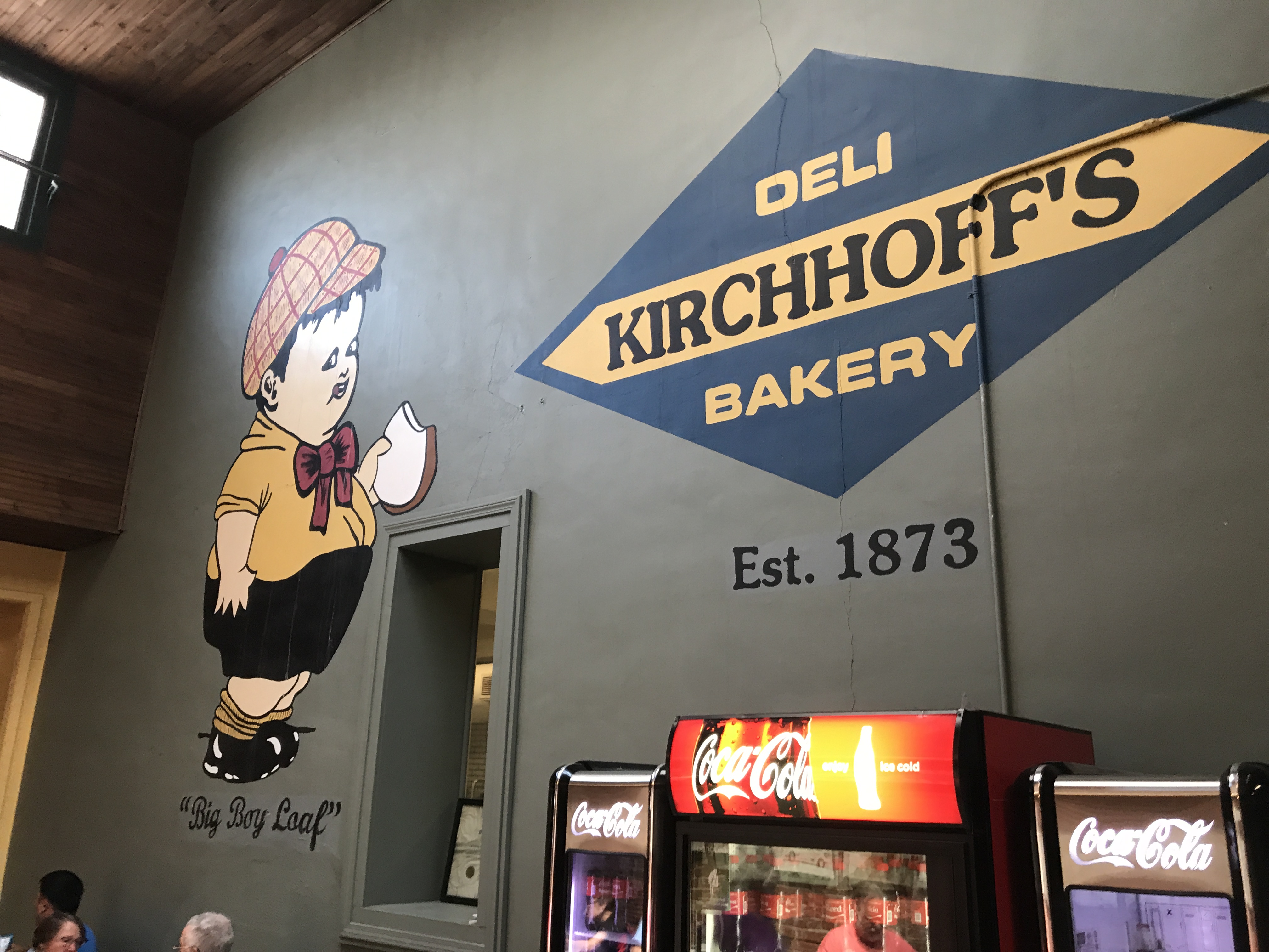
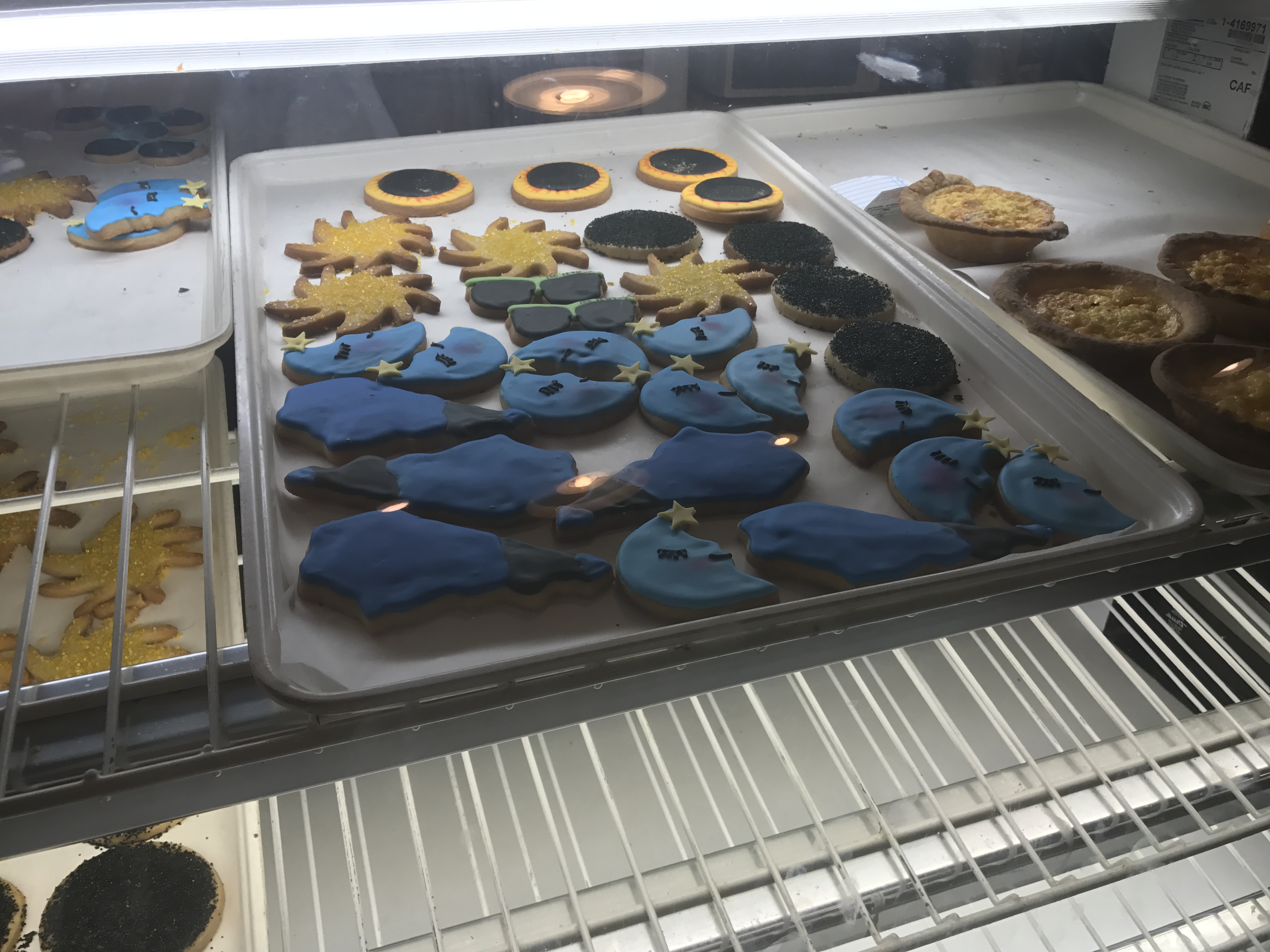
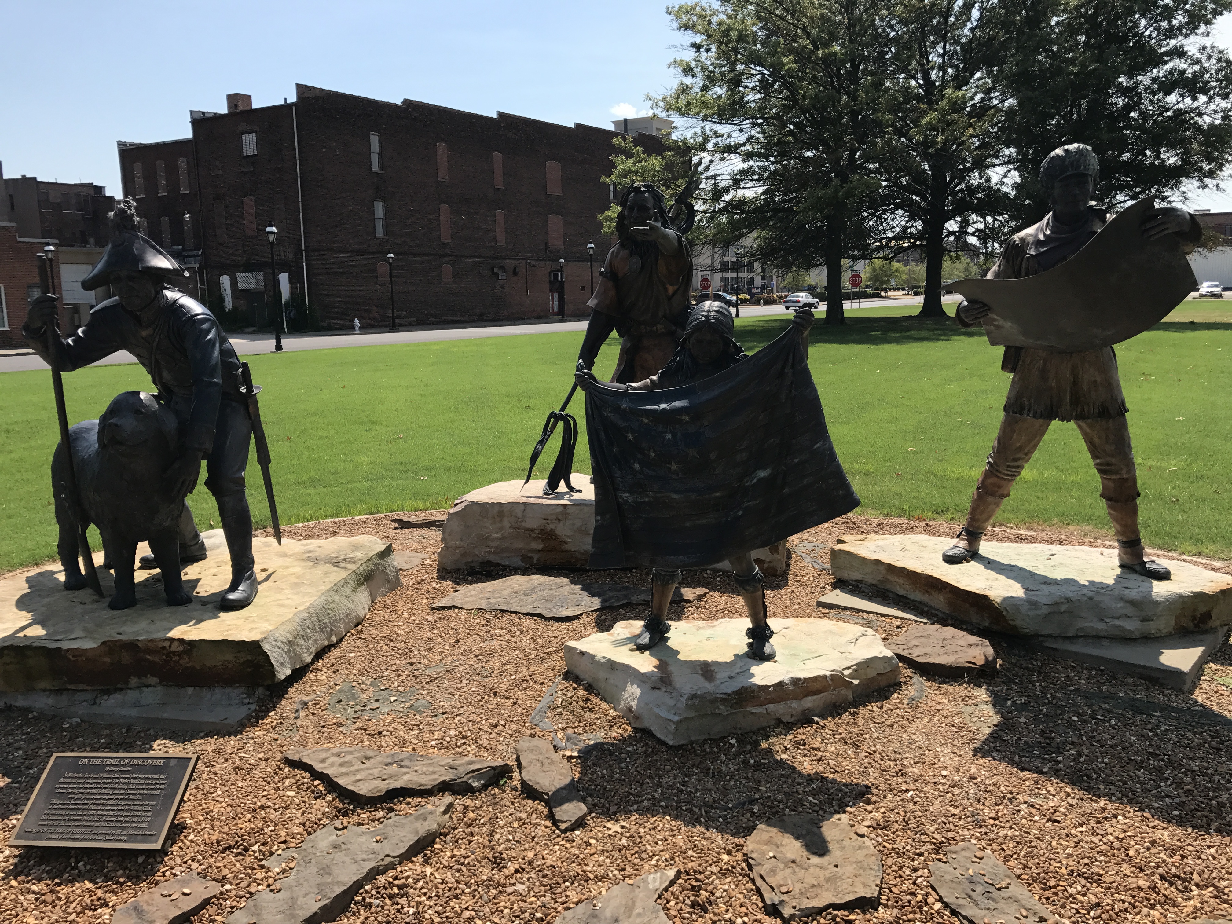
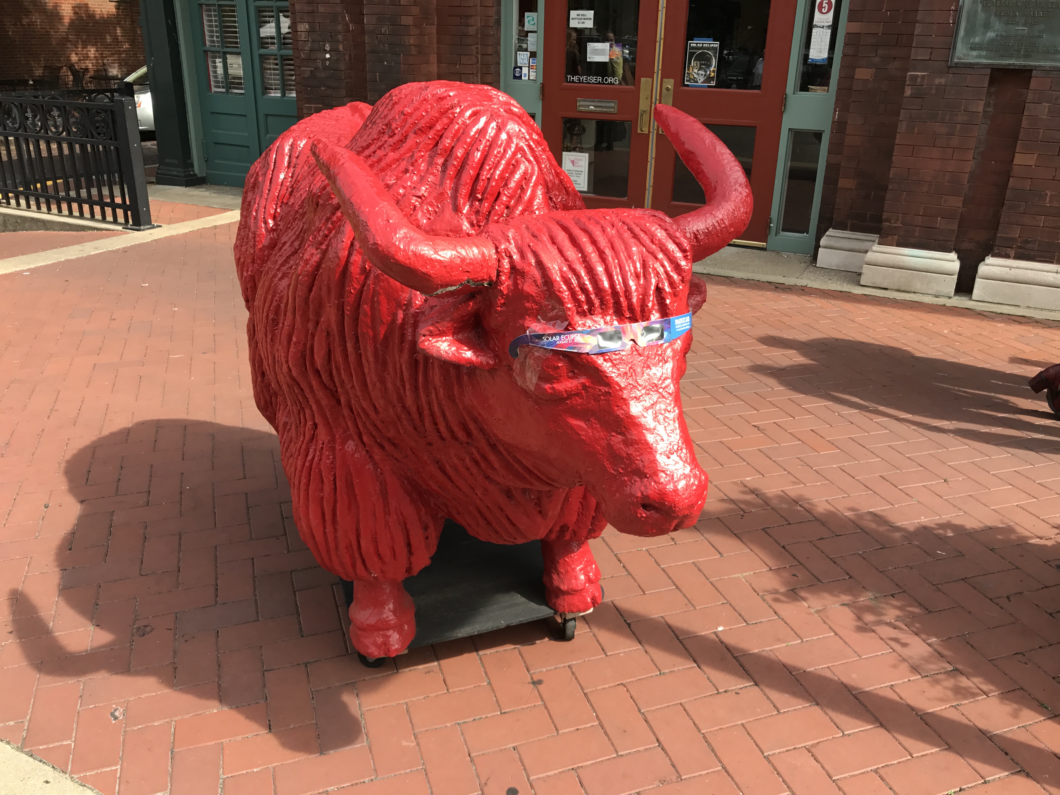
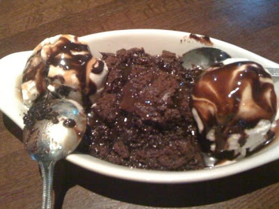
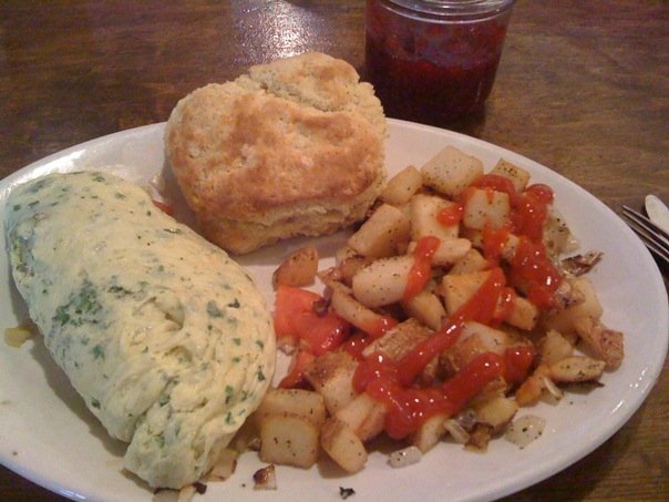
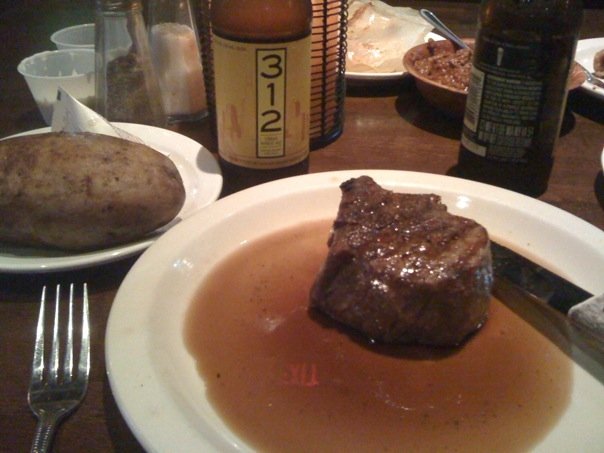
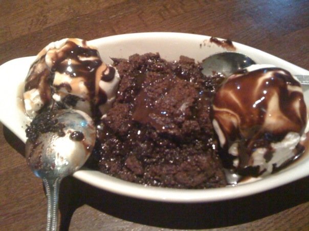
Just call us Adventurers. Food Adventurers!

Friday, 9 August 2019

Our food tour was not starting until 11 AM, so we enjoyed a lazy morning of snoozing, TV, and surfing the internet, until there was a knock at the door and a call of room service.  I told the man we hadn’t ordered room service, and he said he had a package for us.  Since I was expecting a package (I forgot my camera charger and extra battery and Rex was kind enough to find it and send it to me), I opened the door and scared poor Clifton with my bed head!  But I’ve got the batteries and the charger!

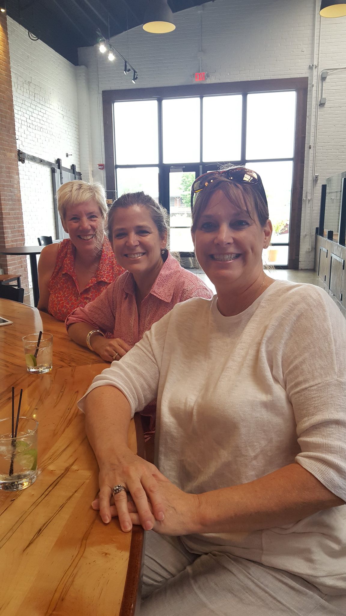
We strolled down to the North Market and saw a few other women waiting at the meeting spot.  Soon our guide Debra appeared as did ten more women.  It was definitely sisters day!!  Of the three women, two were twins and the other had been friends with them since 4th grade.  Of the group of six women, four were sisters and the other two were married to their brothers.  We are pretty sure the other group of four women included a pair of sisters as well.  Debra said it was her first all woman group in 8 years!

Our itinerary for the day included stops at Hot Chicken Takeover, several shops in North Market, The Guild House, Pint House, and Jeni’s.  Good to know we can still pick the good eats!

Debra was a fantastic guide, and we learned some Columbus history was well as tasting some of its fabulous food.  We also had a quick stop at the sculpture garden of an art museum.  

In case a trip to Columbus is in your future, check out http://www.ColumbusFoodAdventures.com or their sister companies, Columbus Brew Adventures or Columbus City Adventures.  The Sassy Sisters give them two thumbs up!

And the moral is…Stick to the Back Roads

Thursday, 8 August 2019

Kim and I both woke up really early (like 4:30 or so) and tried but failed to go back to sleep for any length of time.  I finally got up and got in the shower and then wished I had just gone out for a walk, since Bardstown is a small, safe place to be.  Oh well.  We had plenty of time to get ready and pack before walking down a couple of blocks to our high school friends’ (Bob and Cara Chumbler Blackmon) house for a visit.  

The last time we were here, about three years ago, they had just closed on the house, so we were anxious to see the inside.  It was charming, and you could tell it was arranged especially for their 6 (about to be 7) grandchildren.  Bob had built a ‘dorm room’ with four twin beds (no room for bunks due to low slanted ceilings) and there was a crib room, too.  Not to mention the cool reading nook with a map-papered vaulted ceiling and the little play area/classroom.  I may need to take grandparenting lessons from Cara and Bob!  

Bob took us on a tour of the backyard, which was equally kid-friendly.  There was a gorgeous koi pond, an elevated vegetable garden, a delightfully whimsical fairy garden, and a soon-to-be playhouse built from reclaimed barn wood and cedar shingles.  God knew what he was doing when he blessed Bob, a former star football player and dad to three sons, with FIVE granddaughters!!  I can tell Cara has loved it, too!

We all walked back to the Old Talbott Tavern for breakfast, and Kim and I hit the road a little after 10:30.  Our destinations today were Kettering, Ohio, where my niece Emilee lives, and then Columbus, where we had the only reservations we planned for this trip, which was a food tour on Friday morning.

As usual, our route did not involve interstate highways, so it was going to take us almost five hours to get there.  We ended up hopping on the interstate south of Cincinnati in hopes of shaving a few minutes off of the trip, since Emilee had a work event, but the traffic was so bad that we got right off.  Even with a quick pit stop and that little traffic snarl, we pulled up to Emilee and Gus’s house at about 3:45.  Their son Fynn had just waked up from his nap, but after about two minutes, we were old friends!  This was our first time to meet sweet Fynn, and I hadn’t seen Emilee and Gus since shortly after they learned they were expecting Fynn, who is now three.

Fynn showed us his sea creatures, his room, his dinosaurs, and shared his stickers with us.  He served us the cheese and crackers Em had ready for us, and he even posed for some photos.  We were sad to leave!  Thanks for having us, Emilee and Gus!  We loved your house and your cute son!

Our ride to Columbus was uneventful except for a detour we weren’t expecting.  I had made reservations at the downtown Hampton Inn before falling asleep Wednesday night in hopes that it was close to our food tour, and then we decided we should just stay two nights.  Thankfully, that was not a problem, and it turned out we were not even a block away from the start of the food tour.

The staff at the Hampton was fantastic – so friendly!  Cherokee checked us in and pointed us in the direction of good food; Tiffany checked in to make sure all was well; Clifton the greeter delivered us a FedEx package and blessed us upon leaving and arriving; and James the manager kept it all in control.

We walked a few blocks down the street to the Pint House for dinner on Cherokee’s recommendation.  Even on Thursday night, the place was hopping!  But, it was Thursday night football and the Browns were playing, so that made sense.  Kim had a grilled cheese and fries and I had the short rib tacos.  I got a beer sampler and Kim had the Fat Head Bumbleberry, then we both had a grapefruit beer.  Of course, since there was a Jeni’s ice cream shop (founded in Columbus) on our way home, we had to stop there, too.

It was a fun day, filled with friends, family, and food.  What more could you want?

Off Like a Herd of Turtles…

Wednesday, 7 August 2019
Memphis TN to Bardstown KY

As you know, the Sassy Sisters travel on our own time and without a lot of planning, and this year we are taking it to the limit. We have NO plans and only one reservation (for a food tour). So, we will be as surprised as you to learn where we are going and when!  Our general destination is upstate New York, with a stop in Columbus OH to see the Chihuly exhibit there. 

We left Memphis about 1 PM today after stopping off to see Kim’s daughter, Kerry, and her cute bungalow and lovable dog and then going to Crosstown Concourse for lunch. What a cool venue!  The gigantic building used to be a Sears retail store and distribution center, and at one time it was the country’s largest warehouse. After sitting abandoned and idle for years, it was reclaimed and renovated and is now home to a clinic, condos and apartments, many restaurants, an art gallery, a meeting place, and more. 

We wandered around, then had lunch at the Saucy Chicken, followed by some cookies for Kim from lucy j’s bakery and a Mexican popsicle for me (roasted peaches) from MemPops. It was all good!

We chose to take US 70 and 79 out of Memphis and travelled through some of the towns of our childhood – Bells, Humboldt, and Milan – before making our first stop in Paris. When we saw a sign for the Eiffel Tower Park, of course we had to stop. This was my third Eiffel Tower sighting in five weeks!

We took a short Sonic break then set a course for Bardstown, KY, and the lovely Talbott Inn, owned by our friend Kathy Kuhn Kelley.  We sort of forgot we’d lose an hour to Eastern time, so we opted to stop in Litchfield for dinner while still on Central time. Sorry we missed you, Shan Fox Embry! We had a fantastic pizza at Rough River Pizza. Oh, and of course we made a pit stop at Beaver Dam. Our Kentucky friends know that’s a rule!

We rolled in to Bardstown about 10:15, found our hidden room key, and settled right in our huge and comfortable room. Kim is already off to dreamland. Night!

12 August 2018

Yesterday was a LONG day, and so much fun! We were up early (6 AM early) and had finished breakfast at Jimmy’s Egg in Wichita Falls by 8. We were getting an early start in hopes of meeting up with Kim, Blake, and Momo for lunch in the panhandle; in the end, logistics foiled that plan, but we took advantage of our early start.

Kim told us there was a town called Dodson that wasn’t far from where we were, and since Dodson is the name we grew up with, we had to go there. Also on our route was Memphis (also in Texas), but we would be bypassing Paducah (TX) this time.

Our plan was to meet the kids in Memphis for lunch, but not much there was open on Saturday, so we drove north to Pampa and the Coney Island Cafe, famous for hot dogs and homemade pie. Of course! We walked all over the downtown area and spent time in the White Deer Land Museum, which was very well done and so interesting!

We finally made it out of Texas a little after 4 PM, and 30 minutes later we were out of Oklahoma and in Liberal, Kansas. If you’re a longtime Sassy Sister follower, you may remember we’ve passed this way before, so we had already seen Dorothy’s House (think Oz, Kansas, etc.) I needed to stop driving for a bit, so we went to the Mid-America Air Museum. Fabulous exhibit, and they were open until 6, so we didn’t have to rush. We may have had an ice cream break before getting on the road again…

Somehow, we rolled into Colby, Kansas, just as the sun went down, so we didn’t break our ‘stop before dark’ two days in a row. We had an adult beverage and a snack at the nearby City Limits bar and then called it a day. I was asleep in minutes!

We are taking it easy this morning, but it’s time to get moving!

Getting Seasoned and Cultured

Crystal Bridges 2017

Wednesday, 6 September 2017

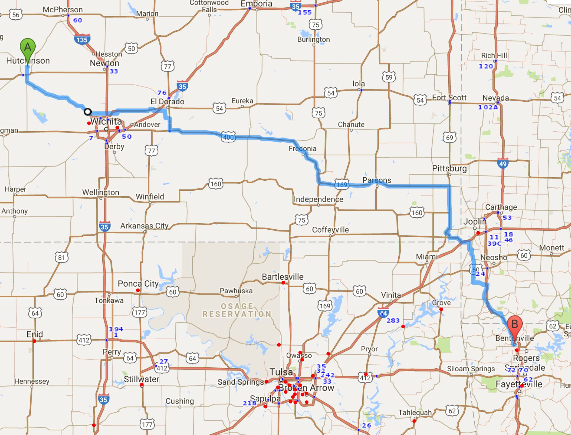
Hutchinson, KS to Bentonville, AR  304 miles

Hutchinson to Bentonville

Hutchinson is home of Strataca, which is a humongous underground salt mine.  We decided it was worth a three hour tour to go 650 feet underground to see what is hiding underneath Kansas, so we were up early this morning so that we could get a good breakfast before going underground.  Our restaurant choice was the Firehouse Cafe, which, you guessed it, was in what used to be a firehouse.  We loved it!  Full of locals, of course, a cool venue, and good, hearty food – what’s not to love?

It was easy to find Strataca, since it’s the main tourist attraction in town and since it’s so flat you could see it coming.   It’s not so easy to get into the mine, since it is WAY down under.  This salt mine was formed 275 million years ago and it’s part of the Permian Basin, which you may remember we visited parts of a few years ago (Sassy Sisters 2013, Rocky Mountain High) when we drove from New Mexico into the western edge of the basin near Midland and Odessa, Texas.  We’d also driven across part of it (Sassy Sisters 2007, Roadside Giant Tour) when we saw the Monument Rocks of western Kansas.  This year, we’re seeing the purest portion of a 27,000 square mile salt vein, which just happens to be right under Hutchinson.  The entire Permian Basin salt deposit covers over 100,000 square miles!  The salt mine that is Strataca is 300,000 square feet and it was discovered in 1887 when Ben Blanchard was drilling for oil and found salt instead.

Emerson Carey, a local entreprenuer, started the Carey Salt Mine in 1923.  The salt mined here is rock salt, used mainly for de-icing roads or freezing homemade ice cream.  Over 500,000 tons of rock salt is excavated each year!  In addition to mining salt, the tunnels that remain happen to be the perfect storage place for important media collections.  Since 1959, Underground Vaults and Storage has been safekeeping data, movies, newspapers, and more (even nuclear waste!), right here in Kansas.

Our tour guide, Bob, got us outfitted with hard hats and buddy tags, and then we hopped on the double-decker six-ton transporter hoist that took us through frozen aquifer and many layers of rock and silt into the heart of the salt mine.  Once there, we had the chance to look at museum-like exhibits about the mine and its history, and then we took a train ride deeper into the mine.  We were able to drive down now-abandoned shafts and tunnels that were mined in the 40s and 50s.  What’s so interesting about the mine is that anything that goes into the mine stays there, so it truly was like traveling back in time.  The trash piles marked the decades as well as the decrepit vehicles that are frozen in their tracks (and in time).  It was one of the most fascinating tours we’ve done!

This slideshow requires JavaScript.

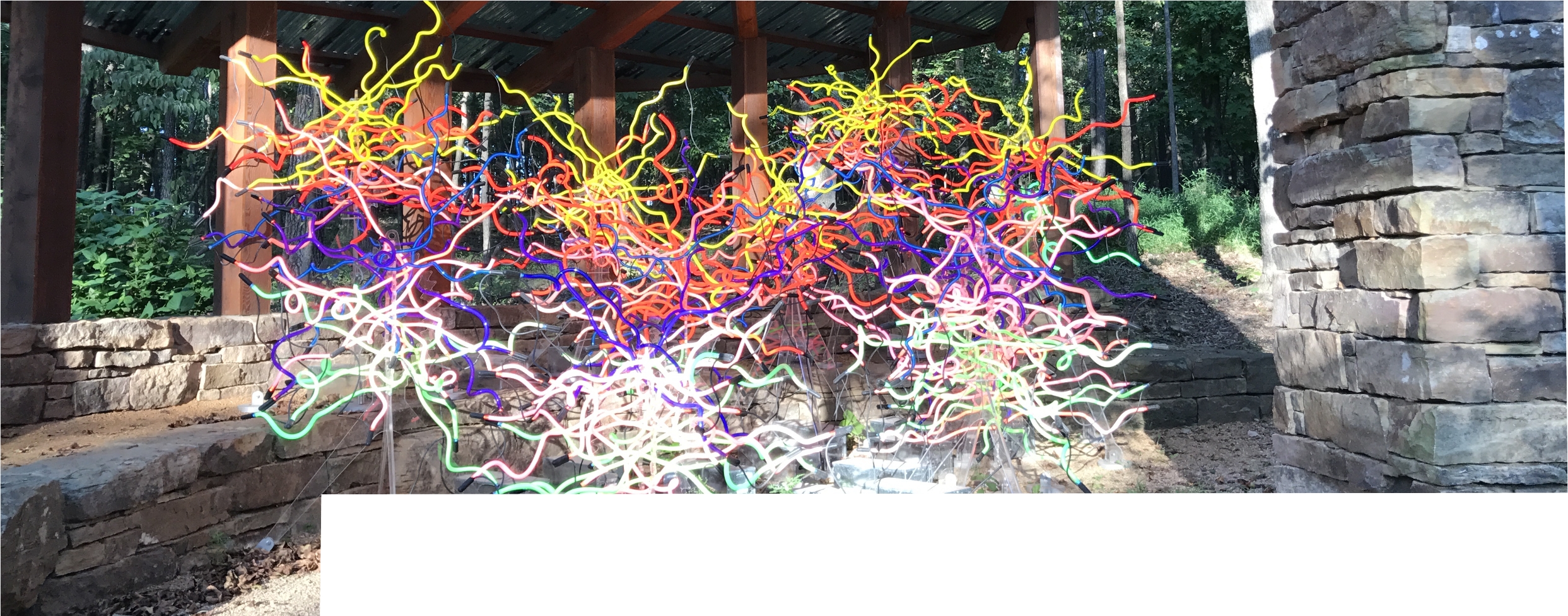
It was almost 1 PM before we left Hutchinson, and we had 300 miles to go to get to Crystal Bridges.  We didn’t want to miss the Chihuly exhibit, so we skedaddled!  We had thought we might stop in Wichita for lunch or to see something of interest there, but we pushed on instead.  We got to Bentonville and found Crystal Bridges with no problem, and the timing was perfect.  We got to see the Chihuly glass in the daylight, then went inside to see the art inside the gallery, and then we went back out to see the glass all lit up at night.  Spectacular!

Crystal Bridges Museum of American Art was founded in 2005 by the Walton Family Foundation.  Sam Walton’s daughter, Alice Walton, is the patron and chair of the museum’s board of directors.  The museum was designed by world-renowned architect Moshe Safdie and the building opened on 11 November 2011.  It was named for a nearby natural spring and the bridge construction incorporated in the building by Safdie.  The museum’s permanent collection spans five centuries of American masterworks ranging from the Colonial era to the current day.

This slideshow requires JavaScript.


By the time we had seen all of the art that we wanted to, it was time for dinner.  We were so hungry (no lunch, after all!) that we opted to eat in the restaurant at Crystal Bridges.  Great choice!  Dinner was fabulous!  Afterwards, we made our way to our hotel and called it a day.  What a wonderful way to wind down our trip!

Redemption for Kansas?

Tuesday, 5 September 2017
Lamar, CO to Hutchinson, KS ~ 275 miles
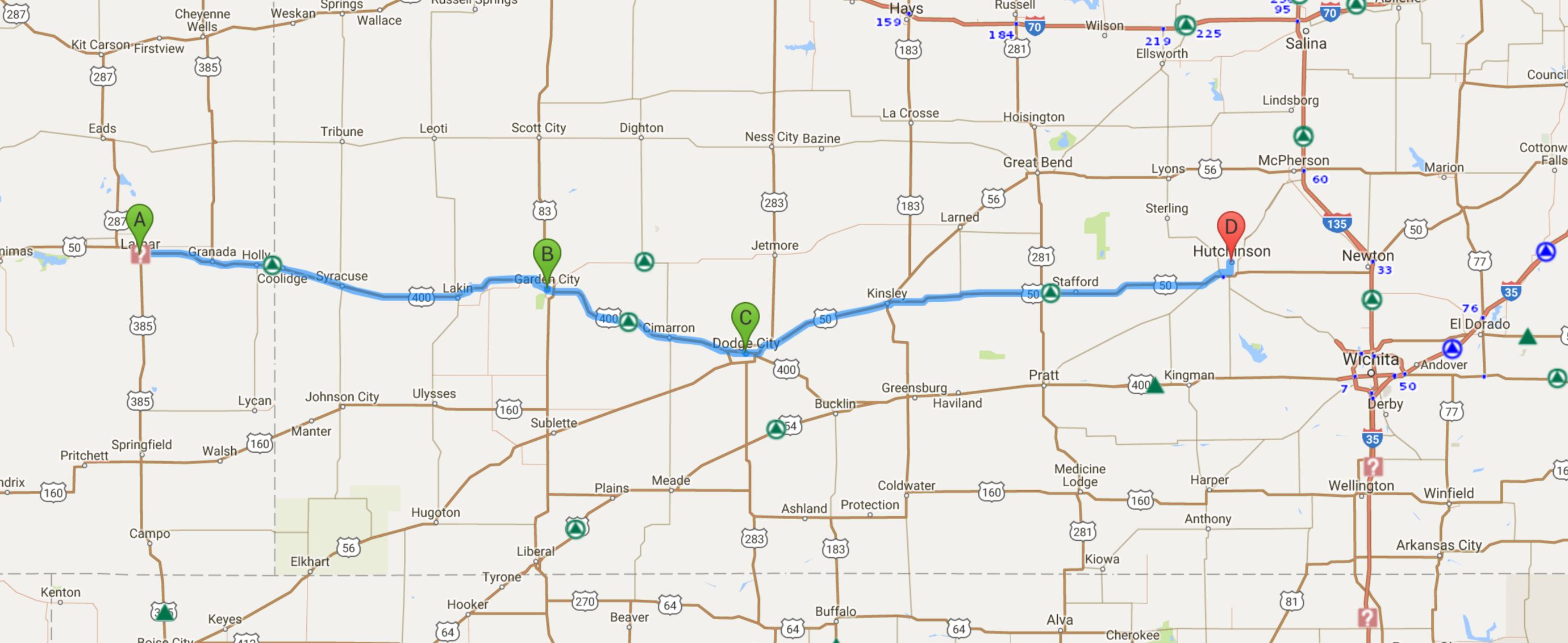
0905 Lamar to Hutchinson route 275

Map credit: Google Maps 2017, courtesy AAA

We kind of figured the Thai Spicy Basil would not be open for breakfast, so we decided to give the nearby Hickory House a try.  Another good call – not only was the food fine, we had another cute as could be and super friendly server!  We had fun chatting with her and sharing our story.   On our way out of town, we stopped by a Roadside America site to see a building made of petrified wood – nothing terribly exciting, but since we’d been to the petrified forest state park, it was kind of interesting.  Soon we were on the road, and before too long we were crossing the border into Kansas.  Have I mentioned that until this trip, Kansas was our least favorite state of all fifty of them?  I had a feeling that after the past few days and the roads we’d been on, Kim may have been looking forward to some flat, boring prairie driving – and she was!

We’ve driven across Kansas (west to east), albeit on the interstate, and we’ve driven south to north across it on Hwy 83 (the Road to Nowhere), and we’ve explored the southeast corner several times (on Route 66), and while some of the sights we’ve seen (Dorothy’s House in Liberal, Monument Rocks in the middle of nowhere (one of the 8 wonders of Kansas), Prairie Dog Town near Oakley (now closed), Baxter Springs (on the Route) have been good ones, others – Garden City, Scott (lake, city, county, state park, etc.) have been underwhelming.  As kids, we rode across Kansas and stopped at the Eisenhower Library in Abilene and then Daddy just drove and drove and drove.  For us, even North Dakota and South Dakota were more interesting; however, after criss-crossing Nevada twice now, Kansas was in good shape to move up a rung or two.  Fingers crossed, because our first stop was to be Garden City. Was redemption at hand?

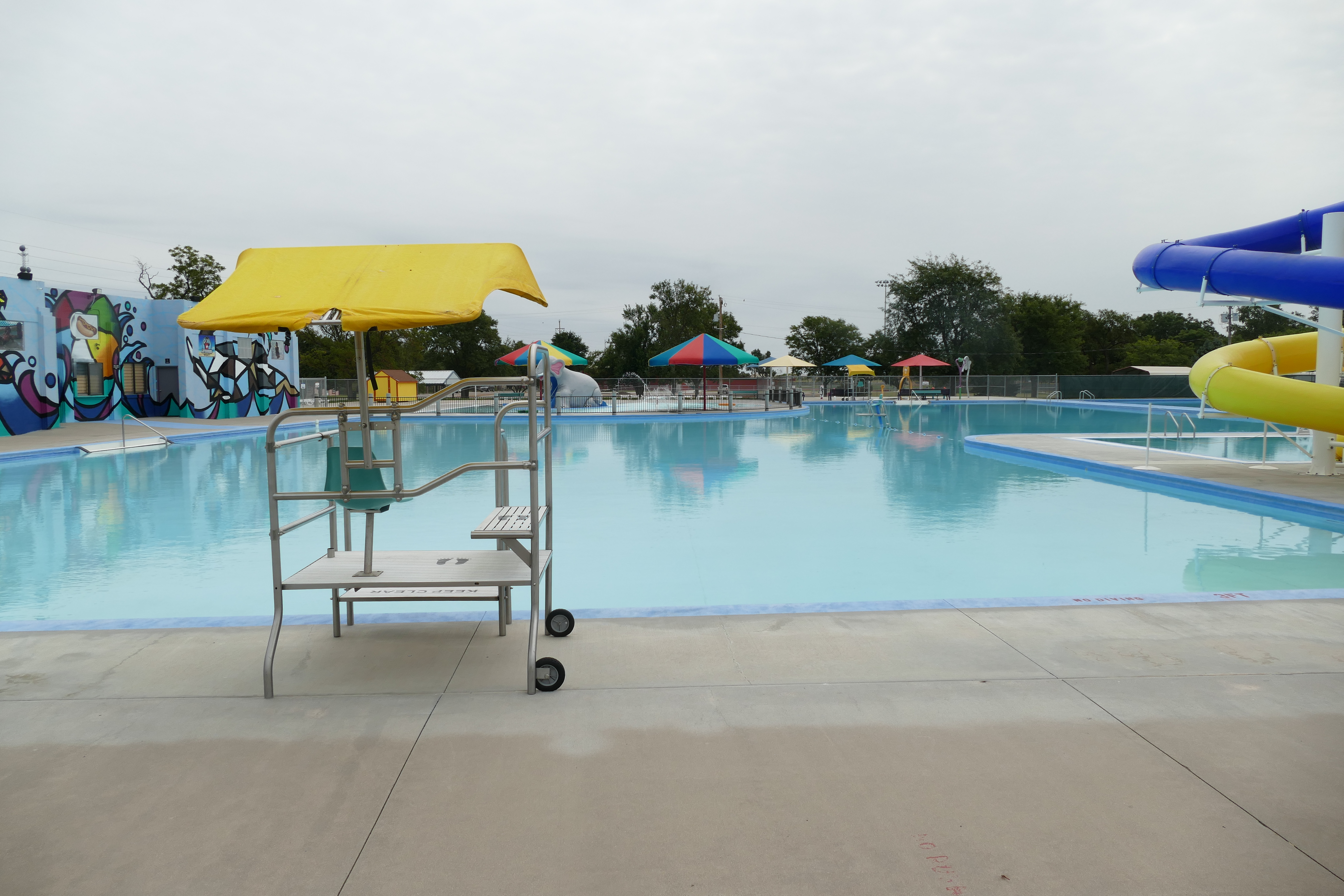
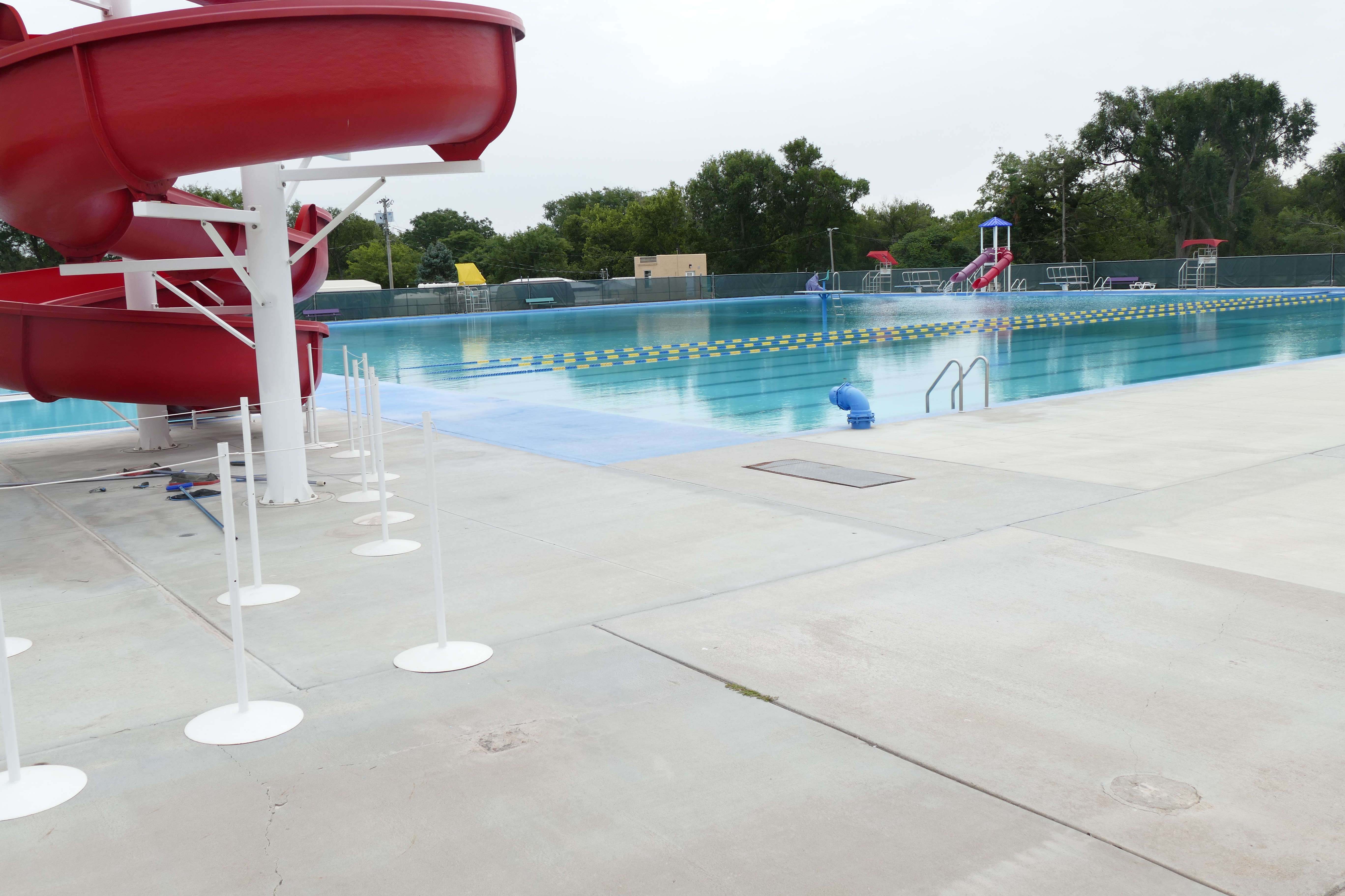
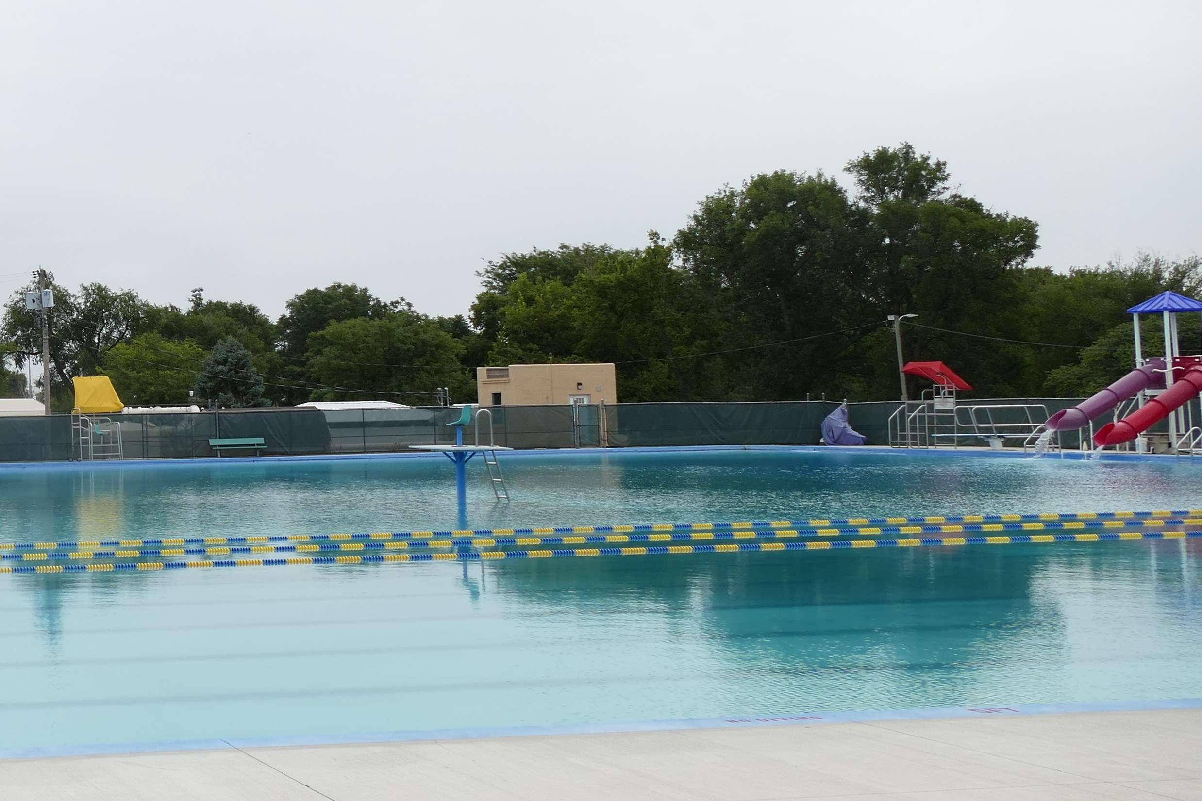
On our first trip to Garden City, back in 2007, the main thing we wanted to see was the Big Pool.  The Big Pool was hand dug and concrete poured by the people of Garden City in 1921 and opened for its inaugural season in 1922. The bath house was a WPA project constructed during the 1930s, and a children’s wading pool was also added in the 1930s. Sounds intriguing, right?  Thing is, we arrived there on the day before Mother’s Day, which was early enough in May that the pool wasn’t open yet.  Bummer.  Not only that, but our meals in Garden City that trip were at Arby’s and Long John Silver’s – not because we were craving fast food (you know it’s against the rules) but because it’s all we could find open!  Well, that’s not exactly true – we were directed to the Ramada Inn for the Mother’s Day buffet, but after about five minutes inside (we had even been seated), we left.  Not happening! Anyway, here we were, back in Garden City, and it’s the day after Labor Day.  I was hoping that the pool would still be full!  You’re probably wondering what could be so exciting about a municipal swimming pool, but this isn’t just any pool – it’s the BIG POOL! When I say big, I mean BIGGEST!  At 330 feet long by 220 feet wide, it’s longer than a football field and four times wider.  It is so big that people have water skied and wind surfed in it!  It takes two teams of eight people SIX DAYS to vacuum it.  A motorized boat is used to sprinkle soda ash in it, and there is a guard stand in the middle of the pool, meaning you would have to get wet to get on the stand – all of you former lifeguards out there – you know what a bitch that would be on a chilly day, a rainy day, or on first or last shifts!  Thankfully, we were rewarded – the pool was closed (meaning we could take all of the photos we wanted) and it was still full of water.  The pool is right next to the city zoo, and we learned that, back in the day, they brought the elephants over to frolic in the pool after it closed for the season.  Sadly, the elephants aren’t there any more, so we missed that spectacle, but there is an elephant slide in the kiddie pool.
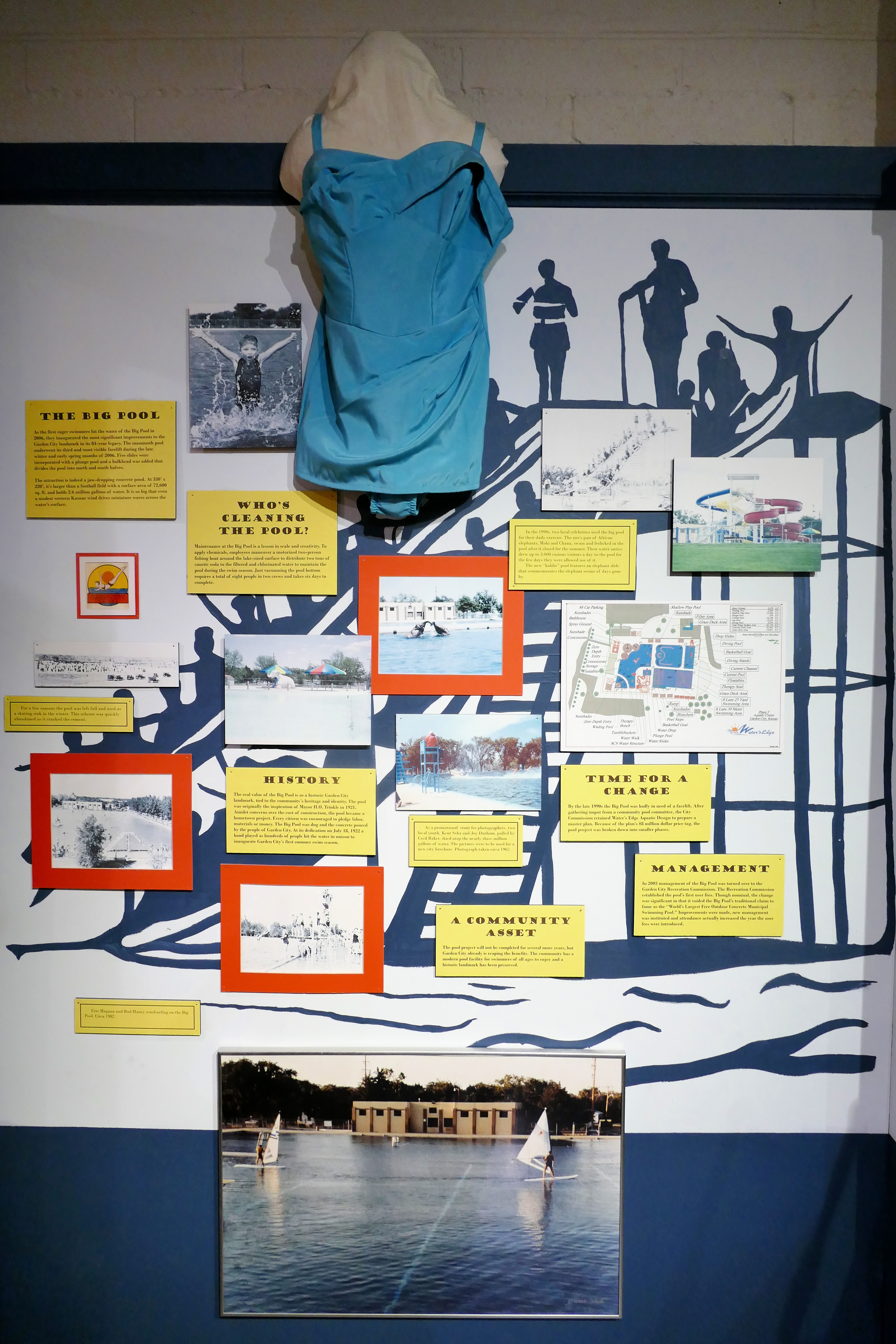
P1100380

Some of the history of the Big Pool

P1100160

It really is ENORMOUS! This is the shallow end, with the bathhouse/concession area at left.
P1100161

Pictures don’t do it justice! Two low dives and two water slides in the deep end.
P1100163

See the guard chair in the middle of the pool??

Turns out that the zoo and the city museum (also next door) are free, so we decided to get a few steps by walking through the zoo.  And, if you drive through the zoo, it’s $10, and you don’t see much.  Go figure.  Kim probably wished we had skipped the zoo, since I love taking pictures of animals, but I really enjoyed it.  It was not a huge zoo, but it had some fun stuff.  You can skip the pics if you want – I may have gotten carried away…

This slideshow requires JavaScript.

After the zoo, we had to go to the museum, since the main reason we stopped was to see (I’m not kidding here) the world’s largest hairball.  There, I said it.  And it was right here in Garden City, although we almost missed it!  The museum was nicely done and we learned a bit more about Garden City, the Santa Fe Trail, and life on the prairie.  And about the hairball…

Our next stop after Garden City was Dodge City, which I was concerned would be the Gatlinburg of the Prairie.  In case you are not a long-term Sassy Sister follower, we have a habit of bestowing the ‘Gatlinburg of the ______’ moniker on things that we thought would be cool, interesting, or at least worth a stop but that ended up being tourist traps more than the places we expected (and that they probably once were).  It’s kind of sad, because we grew up going to Gatlinburg and loving it, before it became, well, THE Gatlinburg.  In case you’re wondering about some of our ‘award’ winners:

  • Gatlinburg of the Midwest – Wisconsin Dells
  • Gatlinburg of the Civil War – Gettysburg
  • Gatlinburg of the Coast – Myrtle Beach
  • Gatlinburg of the Badlands – Wall Drug

You get the idea!  Let us know if you have someplace we should include on this list!

Another blessing – Dodge City was not a Gatlinburg!  Our main stop in Dodge was as quirky as they come – the Wild West Wax Museum/Kansas Teacher’s Hall of Fame.  Yep, both of these oddities are housed in the same building, and the story is a funny one. Turns out the guy who owned the building was a photographer who somehow started collecting wax figures, mostly of wild west heroes and villains, with a few exceptions – John Kennedy, Lyndon Johnson, Wolfman, Dracula, and Frankenstein, most notably.  His photography studio was on the first floor, and the entire second floor was filled with these wax figures in semi-elaborate dioramas with a backdrop of black velvet, black light painted murals.  When the teacher’s Hall of Fame was looking for a home, the studio was just perfect, and the wax museum was part of the deal.  The coolest part of the wax museum is that it hasn’t changed since the 60’s!!  We almost didn’t get to see either the museum or the Hall of Fame, as it was open by appointment only after Labor Day, but the nice lady who answered our phone call agreed to meet us at 3 PM or shortly after, and sure enough, when we arrived about ten after three, Miss Mary Lou was there to greet us.  She sent us upstairs to see the wax museum, and then she was our personal tour guide for the Hall of Fame and it’s piece d’resistance, an authentic one-room schoolhouse that has been restored and permanently placed on the property.

This slideshow requires JavaScript.

The Kansas State Teacher’s Hall of Fame was very impressive!  Since 1977, the best teachers in Kansas have been honored by their peers, and it’s not easy to be in this group.  First, a teacher must have taught in Kansas for 25 years, and then, he or she must be nominated for the award.  Of course, many letters and recommendations are needed and then a group selects the award recipients from the larger group.  In addition to being a place of honor for these dedicated educators, there is a small museum featuring desks, books, typewriters. blackboards, musical instruments, etc. through the decades, and there is a gift shop, too – all in addition to the one-room schoolhouse, which is a museum itself.  We appreciated Miss Mary Lou taking time from her day to share these museums with us!

We thought about finding something to eat or drink while in Dodge, so we walked down the hill to the famous (or infamous) Boot Hill.  We opted not to pay to see the recreated Main Street, but we walked by it and then up and down a few blocks of the town.  In the end, we didn’t get refreshments (the brew pub and the distillery were closed) and just decided to head on to Hutchinson, our destination for the day.  On the way, we passed a huge feedyard of cattle and then an even bigger wind farm.  No kidding, the windmills, by the thousand, went on and on for miles!  We had already passed two different windmill-making facilities and a truck with a windmill arm.  This is definitely the place for it!

We were looking forward to staying in a Hampton Inn again, and we had no trouble finding ours in Hutchinson, since we arrived before dark (again!).  After getting some recommendations for dinner, we decided to drive a few miles south to the town of Yoder (population 194) and a place called Carriage Crossing.  Turns out Yoder is the center of several nearby Amish communities, and this restaurant (and bakery and gift shop) is family-owned and is known for its comfort food, which can be served family style if there are enough of you.  We were happy with our choice – good food, plenty of it, great prices, and PIE!

Animals, Dunes, and Depression

Monday, 4 September 2017

Blanding, Utah to Lamar, Colorado – 475 miles

Colorado route

Map credit: Google Maps 2017

There weren’t many options for breakfast this morning, but we found Yak’s Cafe on our way out of town.  The parking lot was pretty full, and that’s usually a good sign, so we were hopeful – and again, we were not disappointed!  The staff was friendly and though we got the expected ‘you’re not from around here’ looks from the regulars, everyone was nice and the food was hot and good.  Nothing fancy – good ole scrambled eggs, bacon, and hash browns are a great way to start the day.  You may have noticed that we’ve been eating only two meals a day most days.  We’ve learned that a hearty breakfast can go a long way, and we haven’t even been snacking on the snacks we bought at the Dutch Bakery.  Well, except for the vegetable chips which I may be becoming addicted to…  Back to the subject at hand – today’s route would take us across southern Colorado, most of which we had not seen before.  We visited Durango, Mesa Verde, and the Four Corners Monument on our Sassy Sister trip in 2013, and this time we’d be passing through Durango from west to east instead of north to south, although we did reminisce about our stormy, rainy, curvy, scary drive on US 550 past Ouray on that trip.   We also realized that the lovely day we spent soaking in natural hot springs was in Pagosa Springs, which was right on our route on Highway 160 today.  Sadly, we didn’t have time to stop at any of those places this time, as we had lots of ground to cover.

Our first stop of the day was an unexpected one, but who can resist hand-lettered signs for an elk ranch?  We were near Del Norte, and Kim gamely (haha) turned in at my request.  What a hoot!  From the Burma Shave-like signs lining the drive to the ‘Welcome to Ribeye, Colorado’ (population 12) sign to the photo ops to the store full of game meats to the pens of elk and caribou to the cute little kittens hanging out on the steps, we enjoyed our short detour at Anta Grande Elk Ranch.

This slideshow requires JavaScript.

It turned out to be a good thing we stopped here, because from Del Norte to Lamar, there was very little of interest.  The small towns were sad – very depressed, very little open – we wanted to stop for rest and refreshment, but there were no options along our route, even in the bigger places.  We were astonished to learn that there was a National Park in the middle of this nothingness, so we decided to have a look at Great Sand Dunes National Park, and we planned to ‘sled’ down the dunes.  Alas, you needed to have procured your sled in town before arriving at the park.  Oh well, we just opted to take a short hike, get some photos, and learn a bit about the dunes and the surrounding area.

This slideshow requires JavaScript.

The rest of today’s trip was blah!  No scenery, no people, no place to stop, and very little of interest.  We took a little accidental side trip in Walsenburg, and that was even more depressing! We were glad we actually knew a good place to eat in Lamar and we really wished we had known there was a brand new Holiday Inn Express (right next door to our dreary Days Inn) – Booking.com, you let us down this time!  We stopped at a Sonic in Lamar for some iced tea and saw an interesting sight, but we couldn’t get a good photo. Until we stopped for gas a couple of blocks later (whew!) and the same truck pulled up next to us.  Too funny!  We passed our Days Inn and were really tempted to drive on, but it had been a long day and there was nothing promising on the horizon, and we had already paid for the room.  We ate a delicious dinner at Thai Spicy Basil (we had eaten here on our 2013 trip) – Kung Pao Chicken and Moo Goo Gai Pan, with some chicken coconut soup for me – and then we resigned ourselves to the motel.  Just to add insult to injury, there was no elevator, and even though we both had two bags and the guy ahead of us had a tiny bag, he got the first floor room and we got the second floor room that was as far from the front desk (and stairs) as it could have been.  We see how it is.  I think I get cranky when we are heading home!

Surviving the Surreal

Sunday, 3 September 2017

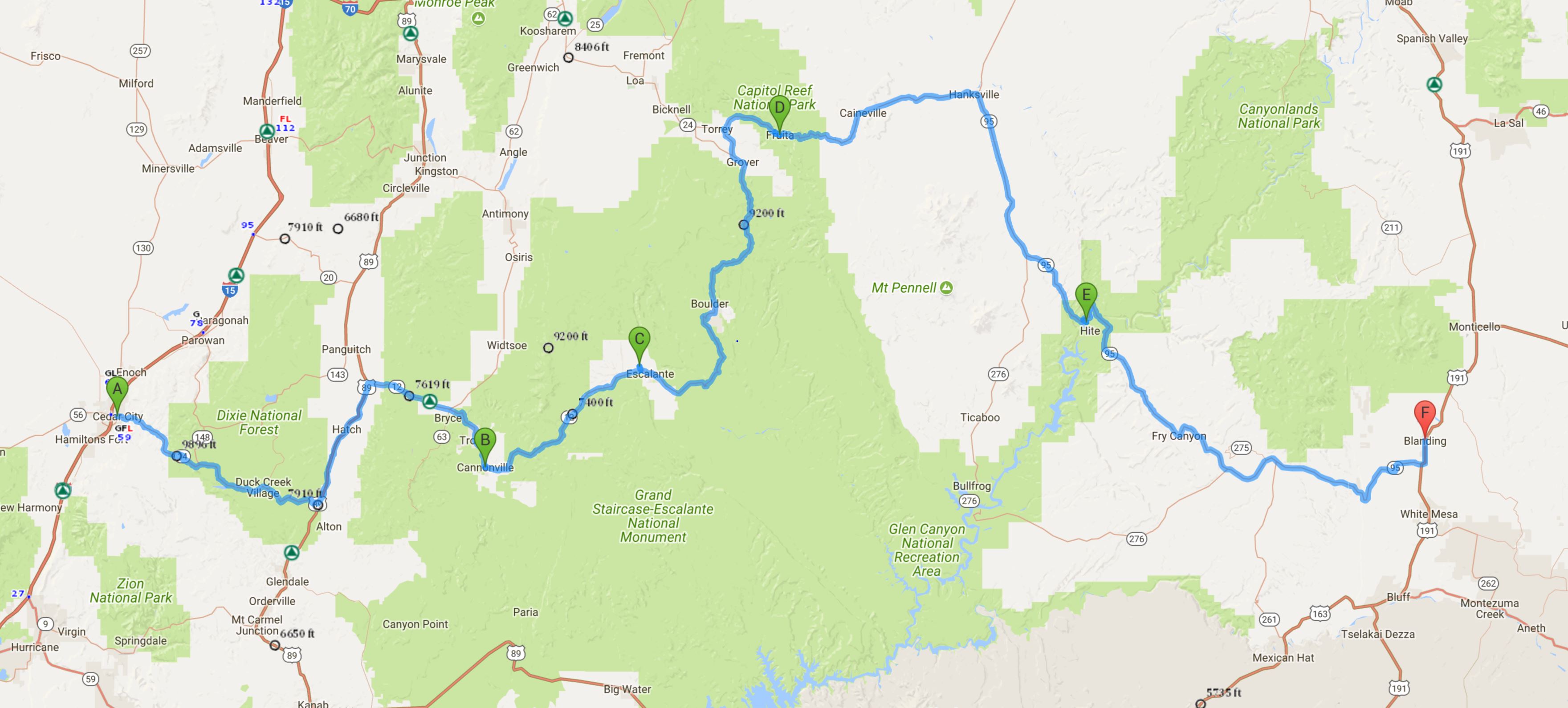
Cedar City to Blanding, Utah, 360 miles

0902 Cedar City to Blanding Route 360

Map credit: Google Maps 2017, courtesy AAA

Thanks to our superb server, Jacee at Centro Pizza, we knew that the place to go for breakfast this morning (another Sunday morning in Utah – sort of limits your breakfast choices!) was the All-American Diner, and we even knew where it was, since we had passed it on our way to dinner the night before.  We were not steered wrong – I had a standard All-American breakfast of eggs over easy, bacon, and hash browns with a splurge of a pancake.  It was all great, and I didn’t even eat all of the pancake or the potatoes.  It was about 9:30 when we started off on what would be one of our most challenging drives ever on our trip across what must be America’s strangest state, at least as far as terrain and topography are concerned!  The drive started out innocently enough, and we were on familiar territory, as we had stayed three nights in Cedar City on our very first Sassy Sister trip in 2006, on our way home from Route 66.  The first part of our journey took us through the Dixie National Forest until we turned onto Utah Scenic Byway 12 (an All-American Road), which took us past Bryce Canyon National Park, but we didn’t stop since we had spent a day there previously.

We made a quick stop at the Grand Staircase/Escalante National Monument Visitor Center in Cannonville and talked to a friendly ranger there who suggested that we stop at the Escalante Petrified Forest State Park and do a short hike there, since we really didn’t have time to explore the Grand Staircase much more than that.  It wasn’t too long before we traveled the 32 miles to the park, where the ranger there didn’t seem to think we would be up to the challenge of the short but steep hike up to see the petrified trees. Needless to say, that decided it.  We filled our water bottles, put on sunscreen, hats, and sunglasses, and after checking out the 50′ petrified tree at the base of the hill, headed up the dirt trail, which was almost completely unshaded.  Mrs. Ranger had given us a map that had info for each of the numbered stops along the trail, so we learned a bit as we hiked.  The trail was at its steepest early on, so the going was hardest at the beginning. Since we were just off of Vernal Fall though, it was a piece of cake!  One of the interesting things we learned was that the town of Escalante was named for a Spanish Franciscan priest who had explored the area in 1776, looking for an overland route from Santa Fe, New Mexico to Monterey, California.

With a little hike under our belts, we were ready for some more driving.  We thought! What no one had mentioned to us (and since we had done no research, we didn’t know) is that the next section of the road we would be traveling was near another road called ‘Hell’s Backbone‘, which is a gravel road built by the Civilian Conservation Corps in 1933, and let me just say that I am sure it is very aptly named!  I have to give total props to Kim, who drove Highway 12 masterfully and didn’t get to enjoy the spectacle nearly as much as I did.  The road featured several sections of 8 to 10% grades, no guardrails, and lots of curves.  The best news was that the road was obviously recently repaved!  The other good news – evidently, most people travel on interstate highways!  We were both thankful that we didn’t come upon any crazy bicyclists on this road and were stunned to read (days later) that Colin had taken this exact route on his travel the opposite direction!  Colin, when you read this, we are SO GLAD you made it safely!! These next photos need no explanation – the first ones were taken over about a 15 minute time period, and the ones with the aspen trees were about 25 minutes after that.

This slideshow requires JavaScript.

About thirty minutes later, we turned off of Hwy 12 onto Hwy 24 at Torrey and soon found ourselves in Capitol Reef National Park, with yet another stunning terrain change. Capitol Dome is a Navajo sandstone feature that was named for its resemblance to the US Capitol. This dome, along with the nearly 100-mile Waterpocket Fold (a barrier of rock that obstructed early travelers like a barrier “reef”), inspired the park’s name.  Capitol Reef became a National Park in 1937, and it has three main districts – the Fruita area, which was a Mormon settlement with a school and orchards, which are one of the largest historic orchards in the National Park Service with almost 3,000 trees, including apple, peach, pear, apricot, cherry, and plum; the Waterpocket District, which encompasses the 100 mile long Waterpocket Fold; and Cathedral Valley, which is a backcountry area.  While we would have liked to have explored this park more, it was quite hot and we still had a long way to go to get to our destination before dark.  And if the road ahead was like the one we had just traveled… Anyway, we stopped in the Fruita district to see the petroglyphs.

This slideshow requires JavaScript.

We continued on Hwy 24 until we reached Hanksville, where we turned south on Hwy 95 (the Bicentennial Highway), headed for Glen Canyon National Recreation Area and Natural Bridges National Monument, and ultimately, the town of Blanding.  Kim was almost over it with the driving (and I can see why) and we really wanted to make sure we were situated well before dark, so we mostly enjoyed the views from the car.  We stopped at an overlook to see Lake Powell, and we were in for a nice surprise.  From the Hite Overlook (which was quite a ways up and a mile or so off the road) we could see not only Lake Powell, but also the bridge over the Colorado River that we would be crossing soon.

This slideshow requires JavaScript.

Before long, we were pulling into Blanding, not sure whether or not we would be happy with our choice of a place to stay.  Let’s just say it was not up to our usual standards, and if we had known then what we know now, we would have gone a bit farther up the road. But we were safe and had beds and a shower – and air conditioning, so no complaints. Before we checked in, we drove around town a bit since it was still light and found pretty much the only place to eat, which looked okay.  Turned out, we really enjoyed the Homestead Steak House!

Crossing the Desert

Saturday, 2 September 2017

Yosemite NP to Cedar City, Utah, 495 miles

0902 Yosemite to Cedar City 495

Map credit: Google Maps 2017, courtesy AAA

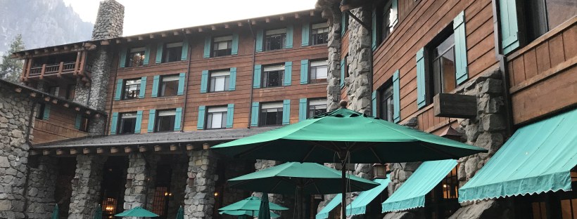
Saturday morning, we were not in a huge hurry to get going, as we planned to use our breakfast vouchers at the Majestic, so we got packed up and made our way down to the dining room.  While we would have preferred to order from the menu, it was pretty clear that having the buffet would be the thing to do, so we surrendered.  The buffet was good, and the food was fresh since there were a lot of people getting it, too.  Just one problem – the eggs Benedict was a very popular item, and it was out almost the whole time we were there.  I finally got one just when I was about to give up, and had the egg over the delicious lox they served.  It was time to say goodbye to Yosemite Valley, though we would still be in the park for quite a while longer.  After one last look at the lovely old hotel, we hit the road – turning east for the first time….

Our route would take us back out to California Highway 120, which would take us completely across the northern portion of Yosemite, and then we would take US 395 south for a bit.  It was a pleasant drive through parts of the park that we hadn’t seen, and there were lots of people hiking, camping, swimming, and hanging out on this holiday weekend.  We drove past Tuolumne Meadows and then caught a glimpse of Mt. Dana, the second-highest peak in the park, which still had snow on it!  Kim was getting her first practice at winding mountain roads after a few days of no driving at all.

We were almost out of gas, and we had heard all about a little gas station that had a great restaurant in it, but somehow we missed seeing it.  We went into the town of Lee Vining hoping to find it, but no luck.  We did find Lake Mono National Park, so we stopped there to see what it was and to find out about the gas station, which turned out to be just inside the park.  We had a look at Lake Mono, which is a big saline lake with some volcanic islands in it, and it’s a great place for birding.  It was already getting hot, and we had a lot of ground to cover, so back we went to the Mobil station (home of the Whoa Nellie Deli) to fill up, and then we were off, ready to cross the desert that is Nevada.

While US 50 across Nevada may have earned the title “Loneliest Road in America”, we would beg to differ with that opinion.  At least it had three little towns on it!  This southern route was much more deserted!  If not for the horses, cows, and extraterrestrials, we would not have seen any living things.  We saw not a single other car going in our direction!  Early in the route we went through the town of Tonopah, home to the creepy Clown Motel (calling David M!!) and then we saw not much else except the ‘town’ of Rachel (which was pretty much a trailer park). We enjoyed the Extraterrestrial Highway, but we disappointed not to have any (live) ET sightings. We stopped for gas in Caliente, the smallest incorporated town in Nevada (population around 1100) and admired the depot (which is also the library, town hall, and museum) that was across the street from the Sinclair station. We finally made it to the Utah border and found our way to the Holiday Inn Express in Cedar City.

Even though it was Saturday night, we barely made it to Centro Woodfired Pizza before it closed at 10 PM; however, the host seated us cheerfully and our server, Jacee, could not have been friendlier.  We shared a pizza – Kim had Fennel Sausage and I had Pollo Bianco – and had a beer and both were delicious!  The thin crust pizza was done perfectly and the toppings were plentiful and good.  We were enticed by the Nutella Piegato for dessert – “pizza dough filled with creamy Nutella, folded (Piegato) and baked in our wood fired oven until gooey and delicious. Finished with whipped cream and a nutella drizzle.”  Oh boy, was it good!  And we saved enough to give Jayce a couple of pieces, too.

We didn’t even try to blog or do pictures tonight, because tomorrow would be a LONG day and we needed to get some rest.


Majestic Yosemite

Friday, 1 September 2017

Yosemite National Park

Kim and I had big plans for the day today, as it was our last full day at Yosemite.  We had to check out of our Yosemite Lodge room before 11 AM and then check into the famous Majestic Hotel, but not until 4 PM, so we planned to pack up, load the car, and do a couple of hikes in the morning and then do a Valley tour in the afternoon before moving to our new not-so-humble abode.  I won’t say how much, but let’s just say in all of my travels, I have NEVER paid anywhere near as much money for a hotel room of any kind as we paid for 18 hours (maybe) at the Majestic.  We were sure hoping it wouldn’t have been a mistake!  (The only reason we were moving was because that was the only place in the park that we could get a room for the first night of Labor Day weekend.)

Anyway, we went to the Lodge’s food court for breakfast, and my mom told me if I couldn’t say anything nice, not to say anything at all.

We caught a shuttle bus right outside the front desk at the Lodge and rode it to stop #16, Happy Isles.  The bus was almost empty when we got on, and thirty minutes later, when we got off, it was packed to the gills.  Almost everyone got off with us – seemed a hike to Vernal Fall was on lots of people’s agendas this morning.  It was a gorgeous day – not nearly as smoky as it had been yesterday – and it was just starting to get hot.  The Vernal Falls hike (aka the Mist Trail) had been listed as ‘moderate to strenuous’ on the info sheet, but the info lady we had spoken to yesterday decreed that we would have no trouble with it.  The hardest part about it, she said, was that there was a pretty steep elevation change over a short distance, but that if we took it slow and easy, we’d be fine.  Right.

It didn’t help that we chose the wrong trail to start off on, but we got to see a stream measuring station and talk to the nice lady at the Happy Isles visitor center, and we weren’t the only ones who had made that mistake.  Off we went, back to the bus stop, across the bridge, and up the hill.  We were behind a large group of Asians who were about our age or older and who had grasped the idea of ‘slow and steady’.  I guess I am more hare than tortoise, and I have no problem stopping to rest and then moving on again.  With my long legs, it’s harder to go slowly than to move on a rest when I need to!  We had been warned to stay adequately hydrated, so every time we stopped, we had a drink of water.  I was loving the cool water ‘bottle’ that I bought at Tahoe and wishing I had purchased more than one.  I really wish my photos were a better representation of the elevation change and how strenuous it was.  Granted, some young people seemed to be having no trouble with it, but there were LOTS of people having way more difficulty than Kim and I were.


Before too long, we reached the footbridge and were rewarded with a fantastic view of the waterfall.  Our original plan was to refill our water bottles here (with the potable water available) and head back down, but the activities guy at the Lodge and implored us to continue up the hill for a better view.  So after we rested a bit and took some photos, off we went, looking for the big rock he had told us to climb to.  We found the rock, but kept going, always hoping for a better view around each turn.  We went until we reached the rocky stairway that led to the very top of the falls and decided we’d had enough – in fact, had we kept going, we wouldn’t have had time for the rest of our day’s agenda!  After a few more photos, back down the hill we went.  As expected, going down was as hard on the knees as going up was on the lungs, but it went lots faster!

This slideshow requires JavaScript.

We made it down to the bus stop just before another bus arrived to take us to the next stop, the Mirror Lake trailhead, which was about a mile away.  We had been told that there was still water in the lake (usually there was only water in winter and spring) and that it was a nice, easy hike on a paved road.  Thankfully, those reports were correct.  We had great views of Half Dome and the lake, while not full, did have enough water for people to frolic in and for us to cool off with.  We walked back part of the way on a trail instead of the road since it was shady and nice.  We didn’t have to wait long for a bus, so it looked like we would make it back to the Lodge in plenty of time for our planned 2:00 Valley Tour.

We not only made it back before the tour started, we had just enough time to grab a beer and make a quick rest stop.  Rejuvenated, we hopped on the tour train, sitting in the front row, since all others were taken.  That turned out to be great for several reasons – we had the whole row to ourselves, there was no one in our way when taking pictures, and we got to be the ranger’s pets.  Our ranger guide was Owain (pronounced Owen) who had been a ranger at our old favorite, the Great Smoky Mountains National Park.  He did a fabulous job pointing out the sites and telling us a lot of history about the park and filling us in on the flora, fauna, and geography of the park as well.  The tour was two hours, and we made two stops – one about 30 minutes in and one 30 minutes later – and even though it was really hot by mid-afternoon, we kept moving just enough to stay cool.  It really helped to be able to spread out a bit, too!  We got to see all of the most iconic Yosemite landmarks and we saw parts of the park we had not gotten to on our own, so it was a good activity for us.

By the time we got back to the Lodge, it was check in time at the Majestic, and we were hot, tired, thirsty, and pretty stinky.  We self-parked, lugged in our bags, checked in, and made our way to our room, only to find out that it was occupied!  Ack!  At least the couple lounging in there was fully dressed!!  I went back down to the desk and after many apologies and no one knowing quite what happened, we got a new room (a corner one!) and a voucher for a free breakfast (no small change there – that was a $45 value!).  Kim reported that we should be glad we were the ones to move, as a very large and very loud party had checked in to the room next door to our original room.  Thankfully, we were on the same floor, so our move was a short one.

Our room was plenty big and hooray!!  It had air conditioning!!!  Best of all, the shower was heavenly!!!  I think I took a 30 minute shower!  Once we were clean and fresh and ready to rejoin civilization, we went down to the Majestic Lounge and got a table on the patio, had a cocktail, and then enjoyed a nice supper.  We split a Caprese salad and a Cuban sandwich and then we each had a dessert – Kim had a chocolate chip cookie with ice cream and I had the famous Majestic boysenberry pie, also with ice cream.  It was the perfect end to our fun-filled and busy day!

We would be leaving Yosemite on Saturday morning, which also meant we would be heading east for the first time in two weeks….but we still have almost a week to go!

Walking Through Woods and Meadows

Thursday, 31 August 2017

Yosemite National Park

For the first time in weeks, we slept in because we had no place to be at any particular time and we didn’t need to be moving on.  It’s probably a good thing we didn’t have AC, because we might have slept until noon!  Kim was feeling pretty nervous about the forest fires in the area, and it didn’t help that it was very smoky outside – it was not going to be a great day for photos, that much was certain!  As it was, by the time we were ready to head out, we had pretty much missed breakfast, so we wandered over to Yosemite Village and got some lunch at the Yosemite Grill.  We had burgers and split an allegedly unbelievably good milkshake – neither were anything to write home about, but they hit the spot.

We had already decided that some pool time was going to be in order later in the afternoon, so we did the short hike back to see the beautiful Yosemite Falls.  This was a very easy, very flat trail, but we still got a kick out of some of the hiking attire sported, mostly by women.  Heels, flip flops, fancy jewelry, and my favorite, designer backpack/pocketbooks.  Seriously?  When we arrived at the base of the falls, lots of people (and many, many young children) were playing on the huge rocks, despite constant warnings of falls, swift water, slick rocks, etc.  So many people forget to pack their common sense when they go out into nature!   We learned that at Yosemite, if a waterfall is one single cataract, it is called a fall, like Bridal Veil Fall, but if it is made up of multiple parts, like Yosemite Falls, it is called falls.  Important distinction, evidently!

We walked on back to our room in the Willow building of Yosemite Lodge and got our suits on and headed for the pool, which was right next door.  We practically had the whole pool to ourselves, and yes, we not only got in, but we stayed in for a while and swam.  And impressed the lifeguards with our stellar floating abilities.  Until we heard them discussing body fat and its relationship to good floating…. Once we were fully refreshed and had maybe had a short nap in the sun, we geared up for more afternoon activities, starting with happy hour outside the Mountain Room Lounge.  We each had a Peach Mule and shared some popcorn.  A little squirrel may have been the recipient of some wayward kernels.

After our libations, we took a photo walk through Cook’s Meadow.  The light was great, but it was still too hazy and smoky to get really good rock/waterfall photos.  Thankfully, there were plenty of other great photo ops!  After our walk, we had a lovely dinner at the Mountain Room.  Kim had a smoked salmon flatbread and I had grilled salmon with sweet corn polenta and asparagus.  We split a decadently rich chocolate cake – so good!  It was dark by the time we walked back to our room, and the moon was gorgeous!  It was a fun day – restful and full of nature!

This slideshow requires JavaScript.

So Long, Long Hike, Longer than Expected Drive

Wednesday, 30 August 2017

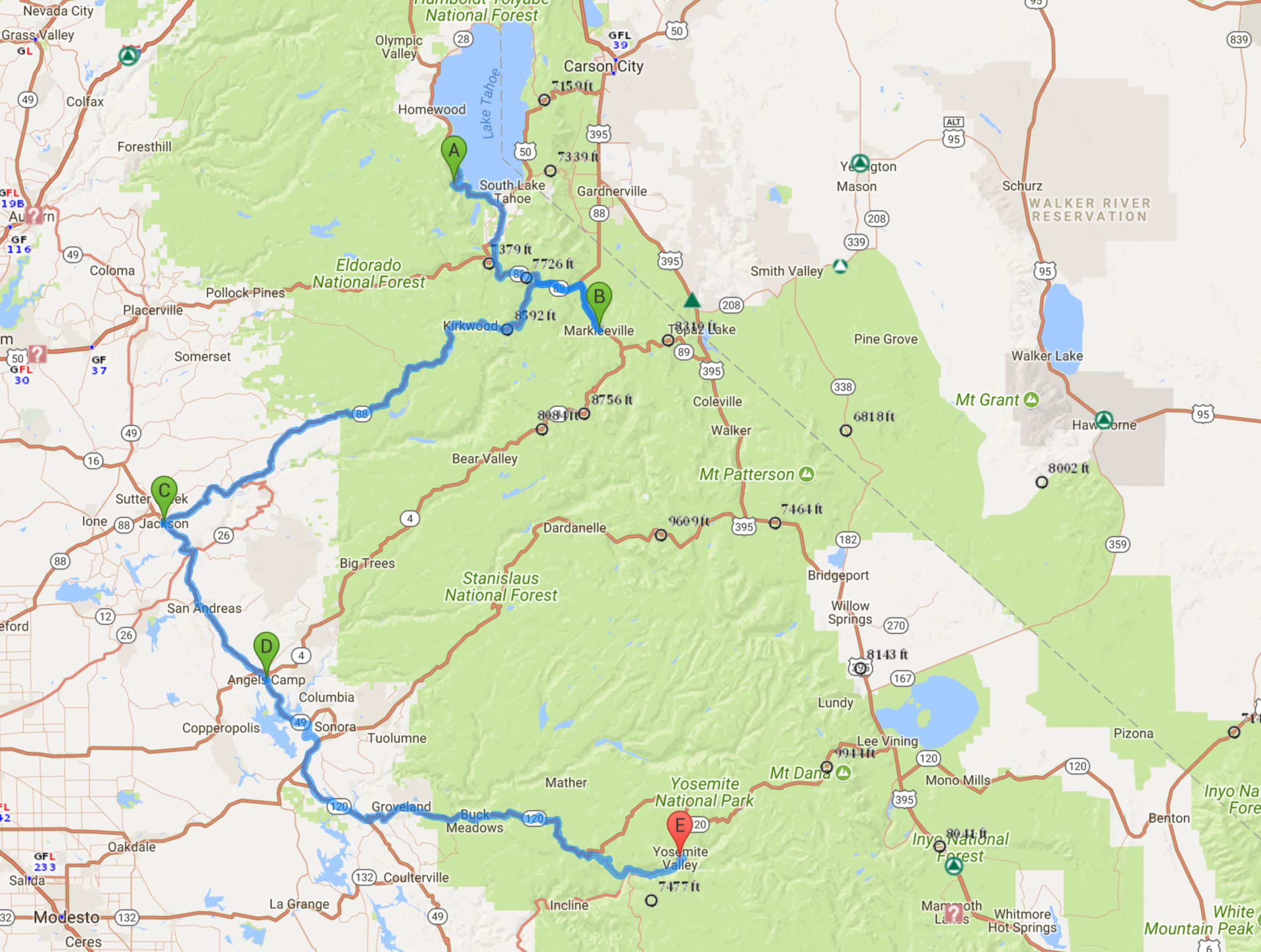
Lake Tahoe, California to Yosemite National Park, California, 245 miles

0901 Lake Tahoe to Yosemite Valley 245

Map credit: Google Maps 2017, courtesy AAA

Since it was our last morning in paradise, Kim and I wanted to take Laura and Don out for breakfast and one of their favorite places called Bert’s, which happens to be right across the street from Ernie’s.  Too funny!  Bert’s  would have been one of my go-to joints as well – my sausage Benedict was incredible, and Kim’s eggs, bacon, and blueberry pancake looked yummy.  We went back to the cabin and loaded our car, and then Kim and I headed up the lake toward Emerald Bay for a hike and a tour of Vikingsholm.  We parked the car at Eagle Point Campground and made our way to the trailhead of the Rubicon trail, which was about 1.5 miles from Vikingsholm, which was a private home built by Mrs. Lora Knight in 1929.

Rex and I had been to Vikingsholm before, but we had hiked down the driveway, which is a VERY STEEP 1 mile hike – killer on the knees going down and aerobically exhausting getting back up.  The Rubicon trail is longer, but on a much easier grade.  It was a fun hike, as we could see the tea house on Fannette Island and then even Vikingsholm on the way down the mountain.  Just before reaching the house, we crossed a bridge over a pretty running creek.  We got there just in time for the noon tour, which we thoroughly enjoyed.  Be sure to read more about Vikingsholm HERE, and visit it when you go to Lake Tahoe.

This slideshow requires JavaScript.

The hike back up was not bad at all, although it was a good bit warmer by the time we started up the hill.  Just as we reached the end of the trail, we met a couple and a Tahoe photography tour guide who were on their way to the Point, so we extended our hike long enough to see the view from there.  We were rewarded with panoramic views of the lake and of Emerald Bay, and we could even see Don and Laura’s place from there.  We saw a huge eagle’s nest on the way back, but no eagles – bummer!

Since we were going to Yosemite, we knew we needed to get on the road soon, so we didn’t delay any more, nor did we stop for a cold drink.  It was just as well, since the route we had decided to take proved to be impassable due to a forest fire.  Thankfully, we did not have to backtrack too far to get on a different path (thanks to a friendly sheriff who was in the right place at the right time for us – getting his mail from a rural mailbox where we just happened to be turning around!) and we made it to the Yosemite Valley Lodge just as darkness fell.  Turns out it was really good we talked to the sheriff, because the alternate route we would have taken was also closed due to a different fire!  Yosemite is one of those places that you have to wanna be – it was not an easy drive, but it was beautiful!  At least I was able to enjoy it – I had to keep telling Kim not to look, as it was a steep, curvy mountain road with very few guardrails.  We were very thankful to have gotten as far as we did before the sun started setting!

We got checked in, found our room (not without incident!), unloaded the car, and headed to the Mountain Room Lounge for a late dinner and a well-deserved adult beverage.  We opted to share a big appetizer platter of ceviche, a charcuterie, and chips and salsa while sipping on cocktails.  We had enough food for about six people and we did not eat it all!

After our long and tiring day (all 17,000 steps of it), we sort of collapsed into our beds and were asleep right away.  If only we’d had some air conditioning, we may have slept really well!  And if Kim hadn’t waked up worrying about forest fires!  Anyway, it was a fantastic day and we were thrilled to be in the park!


We’re on Tahoe Time

Tuesday, 29 August 2017

Lake Tahoe, California

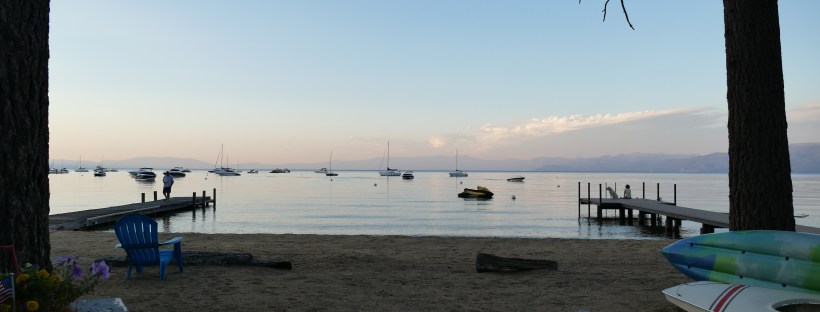
It sure felt great to wake up and know we didn’t have to pack things up and move on!  I woke up early and went out to see the sun coming up over the lake – what a sight!  I might get up earlier if I knew I would see that every morning!  Laura fixed us a wonderful breakfast of pastries and fresh raspberries and strawberries – so juicy and good. After breakfast, we just sat outside and watched the lake come alive here at the end of the summer.  Before long, we saw a huge yellow hot air balloon floating almost silently across the lake.  It was so quiet that we could hear the bursts of fire as the balloon went higher.  Laura showed us the barge where the balloon would land out in the middle of the lake (well, middle from where we were – it’s a BIG lake!).  So we watched the landing and we watched a parasailer, and we watched Laura’s friends and their dog go out on their paddleboards for a ride.  I brought my laptop outside and sat at the picnic table and wrote a blog post – it was a wonderful lazy morning!

After a while, Laura took us on a walk over to a historic section of Lake Tahoe called Tallac, which was very close to their neighborhood.  We saw old lake homes, boats, cars, and firetrucks that have been protected and restored – so fun to see how the really wealthy lived here, way back when!  From there, we walked to the Stream Research place where we could go inside a building and see the actual stream next to us – fish, crawdads, and other living things right in front of us.  The pine trees provided loads of shade for us near the old homes, and pines, birch, and other trees offered a canopy otherwise, until we crossed a meadow.  Going back, we followed the bike path, which was paved and faster, but not nearly as shaded.

Once back at the cabin, Laura fixed us a light lunch of corn chips with ground beef, salsa, and cheese – very yummy!  We spent the rest of the afternoon sitting outside and only going in to do some laundry.  I even got brave (and hot enough) to go swimming in the lake – pure refreshment!!   Way better than the fountain in Carson City!  It was not nearly as cold as I was afraid it might have been – I really enjoyed it.  The water is so clear – I could see the bottom way out past where I could touch it!  Before we knew it, it was time for a sundowner.

For dinner, Don grilled delicious pork tenderloins and Laura made salad, pasta, green beans, and hot rolls.  How lucky were we??  Thanks so much for your wonderful hospitality, Don and Laura!  Laura showed us some photos of the cabin (which was built by her dad back in 1956) and its evolution, along with family photos and photos of her new grandbaby.  We had a mini Historian lesson and then we all spent time on our laptops in front of the TV.  Oh, and we may have had a bit of ice cream…and of course we chattered all evening, as if we had all known each other for years!  Kim and I got the laundry done and got things packed up as best we could.  We were both sad to be leaving such a magical place the next day!


Carson City, Colin, and Cozy Cabin

Monday, 28 August 2017

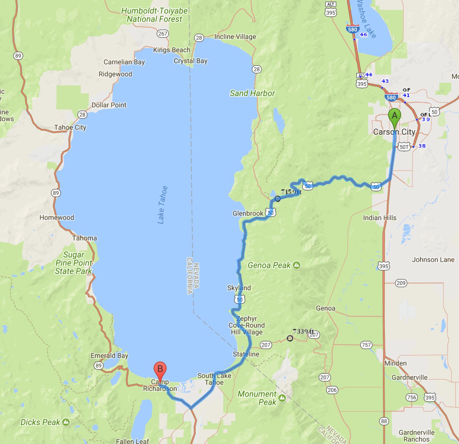
Carson City, Nevada to Lake Tahoe, California, about 35 miles

0828 Carson City Tahoe 33

Map credit: Google Maps 2017, courtesy AAA

We awoke to a bright sunny day in Carson City and decided to have some of our French silk pie from the night before for breakfast.  My, was it good – rich and chocolatey – and we didn’t even eat the whole piece.  Our plan for the day was to go see the capitol of Nevada and explore Carson City a bit and then drive the short distance to Tahoe early enough to enjoy the lake a bit and to get there before Happy Hour!

Carson City is not a big place, so it was easy to find our way into town, and we parked in a public lot behind the State Supreme Court, which is next to the silver-domed capitol building.  In between the court and the capitol is a lovely shaded greenspace full of monuments and lined with an arcade of leafy trees.  It was so cool and attractive there, especially on a hot summer day.  We saw a statue of Abe Curry, founder of the city, and Kit Carson, for whom the city was named.  There was a memorial to law enforcement officers killed in the line of duty and a statue honoring the miners from this state, which probably became a state due to the wealth of mineral deposits found and mined here.


The capitol building, completed in 1872, is a Victorian building made of sandstone quarried from a local quarry (owned by Abe Curry) using prison labor (no extra cost to the taxpayers) and whose cupola was topped by a real silver dome, back in the day.  Today’s dome only looks like it’s the real thing.  It’s not a big building, nor is it lavishly decorated.  The walls are made of Alaskan marble and there is an interesting painted border at the top of the walls that honors the many different minerals, metals, and rocks that are (or were) so plentiful in the state.  The original Supreme Courtroom here was big enough for about a dozen people to sit in.  The legislative branch is no longer housed in this building, either, but the House chamber was still set up as it had been.  The Senate chamber is now a museum about the capitol and Nevada’s history, so we spent some time in there.

While in the museum, we ran into a young man in biking clothes, so of course, we started talking to him.  Turns out he is riding his bike from Boston to San Francisco (and moving there) and we’re pretty sure he is the biker we passed on Highway 50 yesterday.  His name is Colin, and his blog is called No Edge Lines.  As I am writing this post, he is likely riding victoriously into San Francisco to the cheers of his friends and family.  Way to go, Colin!  We also met a Carson City resident and author named Don (check out his blog HERE), who told us about the city and some places to be sure to see and places we might want to eat.  Since it was getting on noontime, we decided it was time for lunch, so we walked a few blocks down to the Union, a new brewpub that Charlotte at the Hampton had recommended to us.  Good choice!

We sat outside (under shade) and started off with a shared flight of beer samples –  Peach Ale, Taco Truck Amber, Cherry Berliner Weisse, and a stout called Redheaded Stranger  – and a most satisfying heirloom tomato salad.  For lunch, Kim had a pepperoni and homemade sausage pizza, and I had a BLTA sandwich and a cup of onion lentil soup.  Our server, Heather, was so friendly and nice – we enjoyed chatting with her and with the two other tables of women out on the patio.  Since we were in no hurry, and since we were going to Scoups later for ice cream, we took time to enjoy another adult beverage.  Kim had a peach ale and I had the special of the day, a lavender lemonade (with a bit of gin).  One of the women next to us suggested that we go to the Nevada state museum, so when we were done, we headed that direction.  Sadly, it was closed on Monday, so we followed the blue line on the street per Don’s recommendation and went to see the home of Orion Clemens, former Secretary of the Nevada Territory and brother of ne’er do well Samuel, who became famous as Mark Twain after moving in with Orion to serve as his secretary and to get his act together.  Samuel went on to become a newspaper editor in nearby Virginia City, and well, you know the rest of the story!  The home is now a law firm, and was across the street from a sweet little Episcopal church which had won an award for the best stop on the Wine Walk.  My kind of church!

We were getting pretty hot and it was getting late, so we walked on down to Scoups, which is famous for its ice cream and for its soups, hence the name.  Kim splurged and had a brownie sundae with salted caramel ice cream and I just had a scoop of salted caramel with chocolate sauce.  Oh boy, did that hit the spot.  The ice cream parlor was right next to a splash pad where a mom was watching her two kids run through it in their bathing suits.  I was still so hot that I made them (and anyone else watching) laugh as I ran through the cold water, fully clothed.  Gosh, did that feel good!  And my hair looked great afterwards…

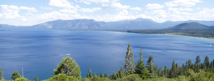
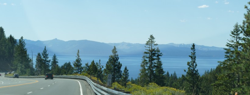
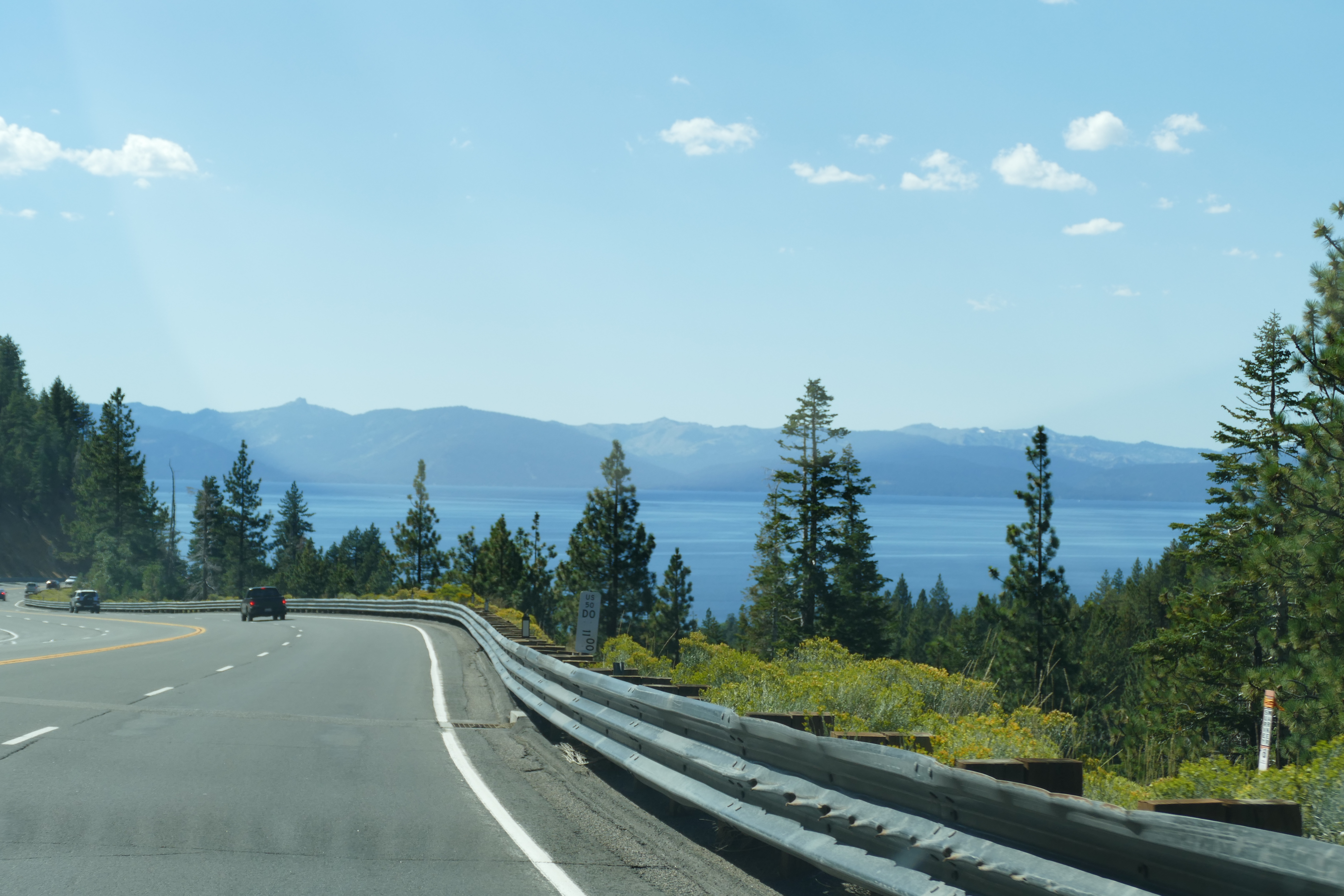
We walked back through the arcade on the capitol grounds and got ready to go to Lake Tahoe.  Laura had warned us to be sure to gas up in Nevada, so we made that stop on our way out of town, and it wasn’t long before we saw the huge blue shimmering water between the trees and mountains.  We also passed Colin going up the mountain, so we honked and waved at him.  If you have never been to Tahoe, I highly recommend it!  I had been here several times before, but it was a new experience for Kim, and it was new for me to have such a perfect place to land for a few days!  Thanks, Laura and Don!

P1090117

Our first glimpse of Lake Tahoe

Laura is one of my Facebook friends who I had gotten to know via pixels2Pages, and it just happened that she saw a post about our trip one night a couple of weeks ago.  When she heard we were headed west, she asked if we would be coming to Tahoe, and since it was a big part of our plans, I answered affirmatively.  She insisted that we stop by to meet her and talk to her about what to do, as she has been summering in Tahoe for her whole life!  The Sassy Sisters never turn down an invitation like that!  As it turned out, it took us so long to get there that we ended up being invited to stay with them in the most delightful cabin directly on the beach of the lake!!  It could not have been a more perfect place to stay! Laura is a great cook and Don is a fab grill master, and we even got to do laundry!  We slept like logs and woke up to the most spectacular sunrises over a lake that looked like glass.  We had cocktails every afternoon at five and we delighted in the ducks and dogs that frolicked nearby.  We met neighbors (lifelong friends of Laura and Don) and we had a blast sitting by the lake sharing stories and becoming ‘old’ friends.

I had read Colin’s blog to Kim as we were driving to Tahoe, and we knew his plan was to stay a day or so here, so we contacted him and invited him to join us for dinner.  Laura suggested a place called Freshies that was not far from where Colin was staying, so we left Don watching football and took off to meet Colin.  Freshies was awesome – fantastic healthy and fresh food as well as wine and beer – and Kim, Colin, and I all had tacos, and they were so tasty.  Laura, Kim, and I peppered Colin with questions about his ride, his new job, his old job, his schooling, etc. and he was a good sport and filled us in.  It was quite dark by the time dinner was over, so we offered Colin a ride home in Laura’s Santa Fe (just like Kim’s).  He took the wheels off his bike and we crammed it in the back of the car and dropped him off at his motel.


Back at Laura and Don’s, we gave Don his stir fry (I’m sure he was about to gnaw on his arm by then!) and we just sat and chatted and looked at photos and blogged a bit until time for bed.  What a fabulous day!


Staying on the Straight and Narrow

Sunday, 27 August 2017

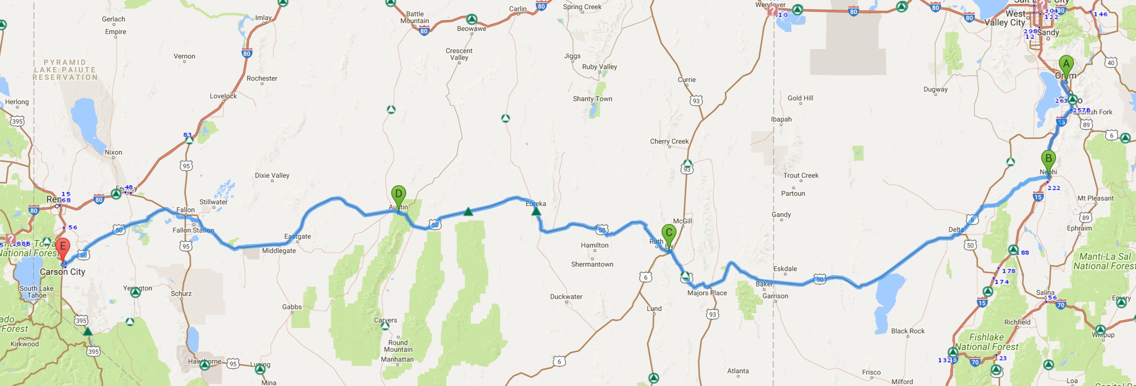
Orem, Utah to Carson City, Nevada  ~570 miles

0827 Orem to Carson City route 570

Map credit: Google Maps 2017, courtesy AAA

We tried to get off to an early start (you may be noticing a pattern here) and were excited about going to Guru’s for breakfast before hitting ‘The Loneliest Road in America”.  It was amazing how little traffic was on the road in Orem and Provo, compared to what we had seen the night before.  We pulled up to Guru’s and found a primo parking place; alas, it was closed on Sunday.  As was almost EVERY place around!  We decided to move on, wishing we had taken advantage of the free breakfast at our Hampton, and were just about to get on the highway when we saw a diner that was open.  Hold the bus!  We didn’t even have to wait to get seated at Café 300, housed in a gleaming chrome building just like diners of the past.  Soon we were fortified and ready to tackle the desert.

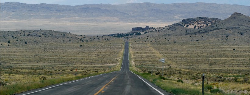
We still had quite a way to go to get out of Utah before we were actually on US 50 in Nevada, and we knew we needed to start that part of the trek with a full tank of gas, so we went ahead and filled up in Nephi, UT with plans to fill up again in Ely, Nevada.   At the gas station in Nephi, we ran into a whole group of antique car owners who had been to a big rally in Bryce Canyon.  Man, those cars were something else! We drove through the smallish town of Delta in Utah, where we picked up US 50, and saw some decent-looking motels – we were a little bit sorry we hadn’t kept driving the day before, until we remembered our wonderful dinner at Communal.  Driving along US 50, we passed a couple of interesting looking brick structures, so Kim u-turned it so we could check them out.  The highway sign said they were ‘Burining Pits”, but we are pretty sure that was a typo. The beehive-shaped charcoal ovens were used from 1876 through 1879 to help process rich silver ore that was discovered in Nevada. Once mining ended, the ovens were used to shelter travelers and even had a reputation as a hideout for stagecoach bandits. We were glad we stopped to investigate!  It was a warm sunny day, and one of us, not the driver, may have dozed off for a little bit…  The road was long and straight, except when it wasn’t, usually because we were going through a mountain pass.  We stopped briefly at the Nevada state line to take some pictures (but not to play the slots) and then went on to Ely and stopped to gas up.


Ely (pronounced eely) looked like a neat little town, so we went to the historic district and walked around a bit until it started raining on us.  There was a pretty park, some great murals, a duck pond with a man on a bike with a big sack of bread for the eager pigeons and ducks, a library, and the semi-famous Hotel Nevada.  It was nice to walk around a bit!  Ely is also the closest town to the Great Basin National Park, which we considered visiting until we realized how far off the route it was.  We definitely got the feel of being in a great basin, ringed completely by mountain ranges.  It reminded us of the Midland/Odessa area of Texas in the Permian Basin.

The only towns of note between Ely and Carson City are Eureka, Austin, and Fallon, so we didn’t anticipate too much excitement today.  We passed one bicyclist and two different walking people (who looked like they were walking across the country), and there were more cars than we expected, but it was a pretty uneventful drive.  We saw a huge archway made of antlers and we passed a large windmill farm.  We stopped in Austin because there was a little restaurant advertising “Breakfast, Lunch, and Dinner” and ice cream; unfortunately, it closed at 4 PM (early dinner, I reckon!) and it was 4:20 when we arrived.  Fortunately, the door was unlocked, and when we and a local father/son combo came in, they relented and sold us some cones (only vanilla, only small cones!) so we did have a little break.  Between Austin and Fallon, we passed some really sandy areas with some dunes and a lot of quicksandy-looking places right next to the road.  We didn’t stop to see if they were really quicksand though!

Fallon is the home of the NAS (Naval Air Station) made famous by the movie Top Gun.  We drove right past it but didn’t get to see any fancy flying going on.  We did get behind a driver who was either drunk, sleepy, or texting though – we kept our distance and finally called 911.  It was pretty bad! Fallon also had a unique irrigation system full of small dams and spillways right next to the highway.

Sooner than we thought, and before dark (YAY!), we arrived in Carson City and made our way to the Hampton Inn.  They even had covered parking there, and in the light of day, it appeared that the covers were actually solar panels.  Very clever!  We got a great recommendation for dinner and showed up slightly underdressed at Glen Eagles, where there were white linen tablecloths!  We sort of got a dining room all to ourselves, and we had HUGE portions of pasta Pomodoro (Kim) and scrumptious pork chops (not one, but TWO) perfectly grilled chops for me, along with mashed potatoes and veggies.  I could only eat one chop – so good!! – but we did get a French Silk pie to go and then didn’t eat it that night!

We were excited to spend the next morning exploring Carson City before meeting our new friend Laura, who had invited us to stay at her place at Lake Tahoe!  Our excitement was tempered by seeing the reports coming in about the horrible flooding taking place in Houston and the area between Houston and Galveston, as well as much of southeastern Texas.  I’d be lying if I said I wish I had been at home, but it sure seemed surreal but very believable and sad to see the damage and reports from afar.

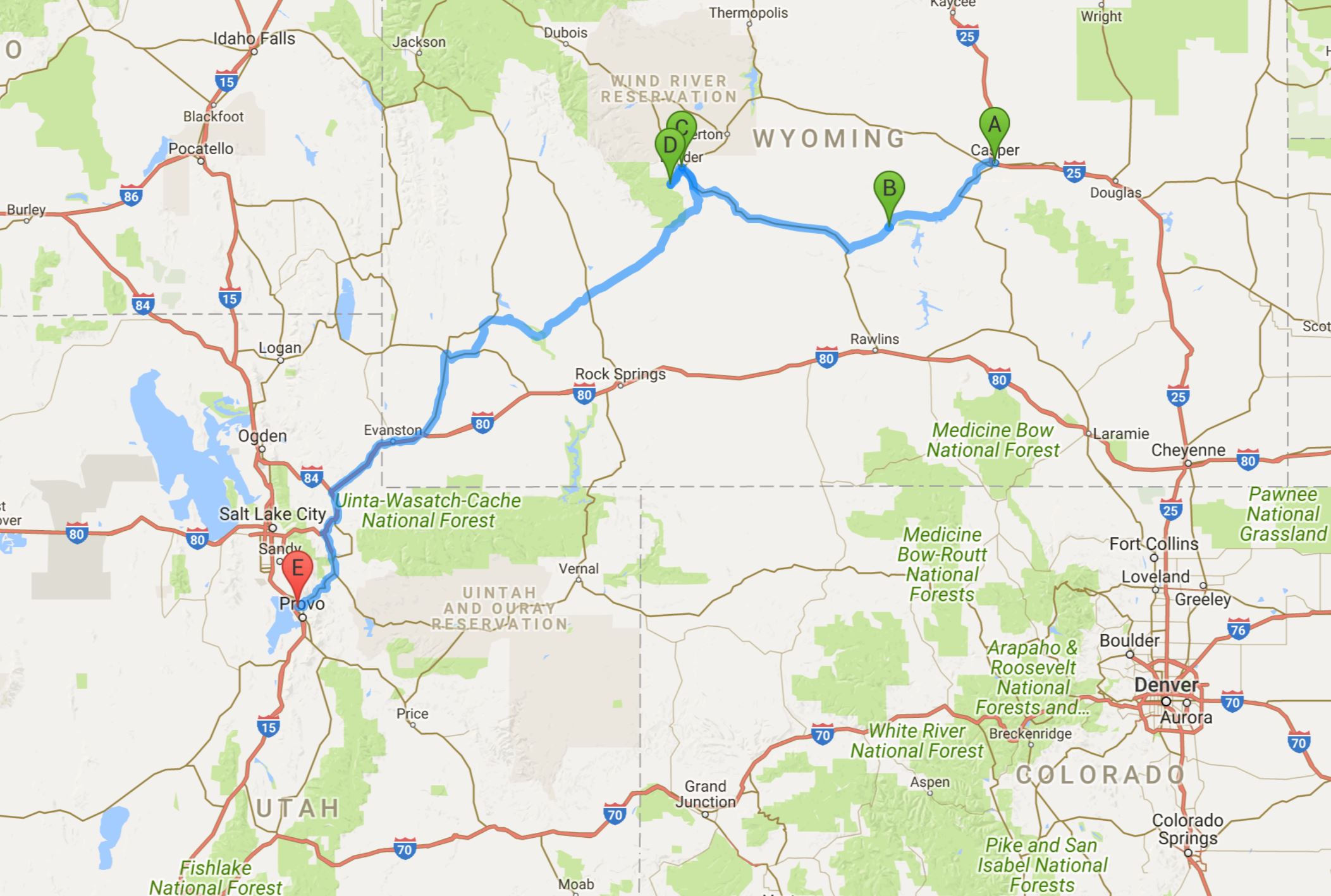
A Day Full of Forks

Saturday, 26 August 2017

Casper, Wyoming to Orem, Utah 475 miles

0826 Casper to Orem 475

Map credit: Google Maps 2017, courtesy of AAA

Breakfast at the Red Butte Lodge was being served at 7:30, so for once we were assured of a somewhat early start!  Ruth, our host, cooked a most delectable veggie omelet with fresh dill and served it along with a fresh fruit salad, a huge muffin, toast, and juice.  We had time to look around the property a bit and have our pictures taken next to the river and in front of the red rocks.  We were on the road by 8:30, with good suggestions from Gerise about places to stop along the way.  We checked in with Rex to see how things were doing on Tiki as Hurricane Harvey was making its way across the area.  So far, so good for us, but Houston was in for a very wet few days.

Our first stop was at Independence Rock.  All three of the main trails west, the Oregon Trail, the California Trail, and the Mormon Pioneer Trail all followed essentially the same route to this point and about 100 miles farther before they branched off to Oregon, California, and Utah.  Like Scott’s Bluff, Independence Rock was a ‘register rock’, where many pioneers carved their names into the granite monolith.  Wagon trains first passed it on Independence Day, 1832, which is how it got its name. It is estimated that 50,000 emigrants passed this rock in 1853 as pioneers continued moving west across America.  We walked around the northwest side of the rock where most of the names are carved, and along the way we saw lots of rabbits, hawks, and one little frog.  Again, we were reminded of our many blessings and vowed to be more patient and ever grateful, especially when travel plans don’t go just the way we want them to.

Our next stop was the small town of Lander, WY, which was just a short detour north at the first fork in the road.  We parked and wandered down main street, stopping to buy some jewelry in a local art gallery/shop called Alchemy.  The women there told us we must go a bit farther out of town to see a river that flows into an underground cavern and then comes back out again a ways downstream.  We were really thirsty though, so first we stopped at a cute restaurant called The Middle Fork and sat outside to have a glass of tea.  Our tea turned into lunch (the first time we’ve had breakfast and lunch in one day!) and Kim had a grilled cheese with wilted spinach and I had a BLTA and fresh fruit.  Once fortified, we were ready to ride up the canyon to see the river whose name we couldn’t figure out.  We passed a sign that said something about the middle fork of the Popo Agie, but that still didn’t ring any bells…

Soon we came to the Sinks of the Popo Agie visitor center, so we went in to check things out.  Turns out the river’s name is pronounced ‘Puh – Po Shuh, and it’s thought to be a native American word for ‘gurgling water’.  At any rate, it was very cool!  The river comes down the steep rocky bed and flows into a cavern, where it disappears from view.  We hiked down to the cavern, which had a rocky but very sandy trail ending on a sandy beach.  We went back up, then followed a sidewalk down the hill and across the street and down the hill a bit farther until we were at the ‘rise’ of the river.  At this point, there was a huge pool of crystal clear water bubbling up from the bottom, and it was full of giant trout!  Big brown trout and beautiful rainbow trout were feasting on food thrown by visitors – it was quite the site!  The river flowed on from there – it was really pretty, and we were glad we had taken the time to see it.

We drove back in to Lander and retraced our route back to the highway, where we opted to take the right fork in the road and continue on the more scenic drive away from the interstate for a bit longer. Eventually, we would be forced to hop on I-80, but we could wait for that!  Once we did get on the four-lane, we were not surprised to see it reduced to two lanes, no passing, due to construction…  We crossed the Utah border and bypassed Salt Lake City, since we have been there before and seen the capitol (albeit when we were 12 and 13) and since it was after five on Saturday afternoon.  We made our way to the Hampton in Orem/Provo, and realized we were lucky to have gotten a room, since there had been a BYU game that day and there was an outdoor concert right across the street.  We found a cool place to eat and decided to Uber to it so Kim could have a break (and a drink or two!)

The name of the restaurant where we ate was called Communal, and there was a long table where many people could sit as well as several small tables.  Kim and I had a two-top, and our waiter explained that the menu was designed to be shared.  We had no trouble agreeing on an heirloom tomato, watermelon, feta, and watercress appetizer and an almond-crusted smoked sockeye salmon with creme fraiche and capers with a side of succotash of edamame, local corn, asparagus, tomatoes, and chives.  Dessert was fabulous, and we didn’t share it.  Kim had a sundae of Marionberry pie and blackberry- Oreo ice cream with warm cinnamon-chocolate fudge sauce, and I had a Nutella-banana pudding with crumbled shortbread and whipped cream.  DIVINE!!  Oh, and we each had a couple of local beers.  It was a wonderful night out and we were still in at a decent hour, ready to rest up for our trip along the ‘loneliest road in America’ tomorrow.

Starting and Ending with Friends

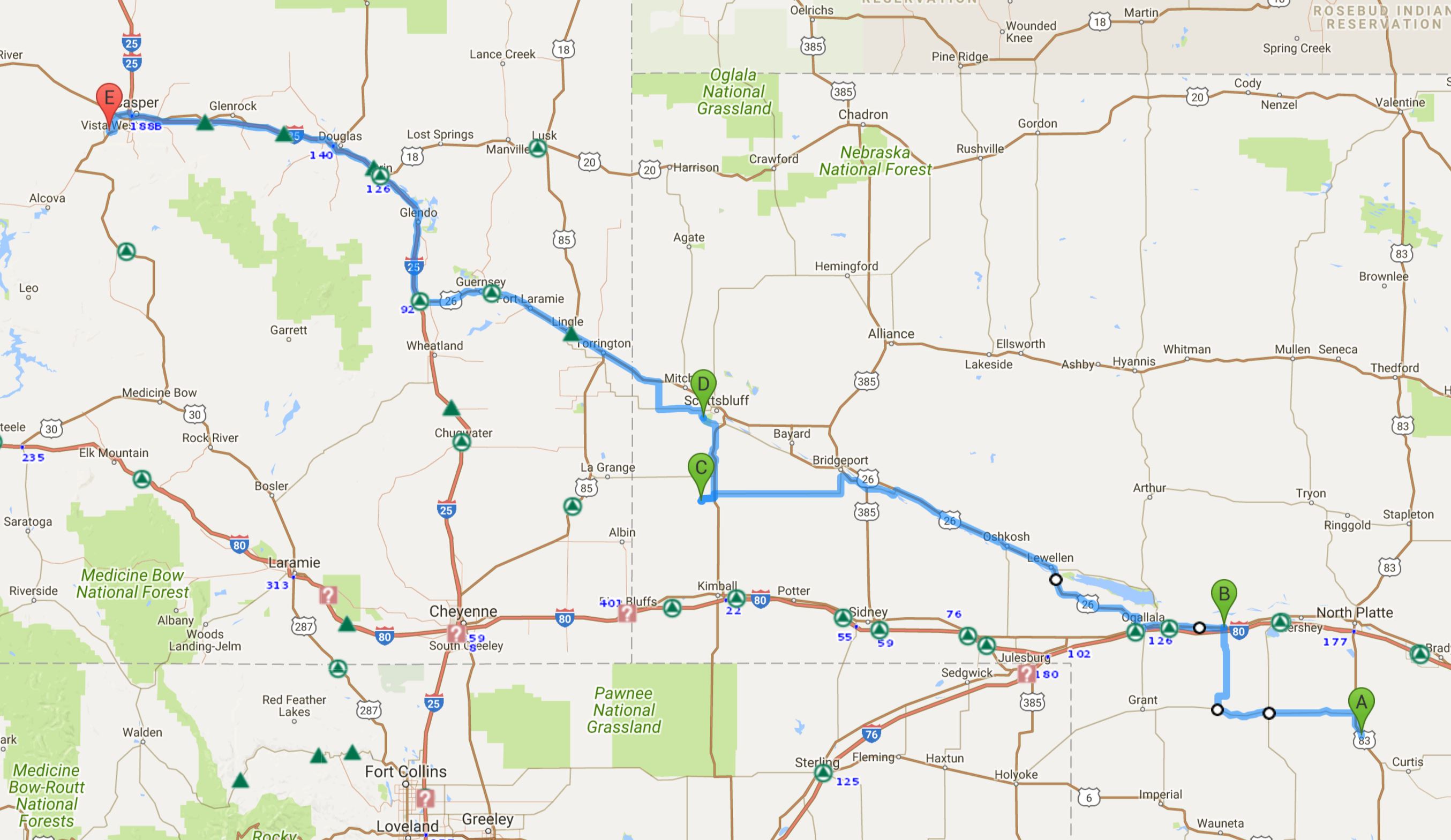
25 August 2017

Wellfleet, Nebraska to Casper, Wyoming 425 miles

0825 Wellfleet to Red Butte 425

Map credit: Google Maps 2017, courtesy AAA

We were excited to be able to hike the trails around Dancing Leaf Lodge and to have a look at the earthen lodge where we had stayed 10 years prior.  Les and Jan had left a map with hiking trails in our cabin, so we walked up to the lodge, which had a ‘no trespassing’ sign on it – sad face – so we just peeped in.  It was exactly as we remembered it, including the area around the lodge where we had enjoyed our breakfast many years ago.  We hiked on down the hill and came across a wooden swing (of course we got on it!) and an area that served as an outdoor kitchen and eating area, complete with an outhouse.  No, we didn’t peek it that!  We hiked on until we came to the spring and then we hiked back up the trail.  At one point, we saw a beautiful hawk resting on top of a pole and watched him until he flew to the top of a nearby tree.  As we walked up by the former mess hall (this area had been used by Boy Scout troops in the past), we saw a doe and an older fawn in the meadow.  The doe ran, but the fawn stood, transfixed, watching us.  Soon another fawn approached and we all played a little game of chicken.  Kim and I won, but not before we got some good shots of them.

Back at our cabin, we cleaned up, packed up, and I ate some more of my cinnamon roll, and we loaded up the car and went searching for Jan and Les so we could pay for our accommodation.  We chatted a bit about how sad we were that the lodge and museum are closed now and inquired about what would befall them in years to come, as Les and Jan do not have kids.  If you know of anyone who would love to live a cool, fairly isolated life in rural western Nebraska where there are lots of dinosaur fossils and an earthen lodge and campground, let us know – we’d love to find a good caretaker for it!

IMG_5490

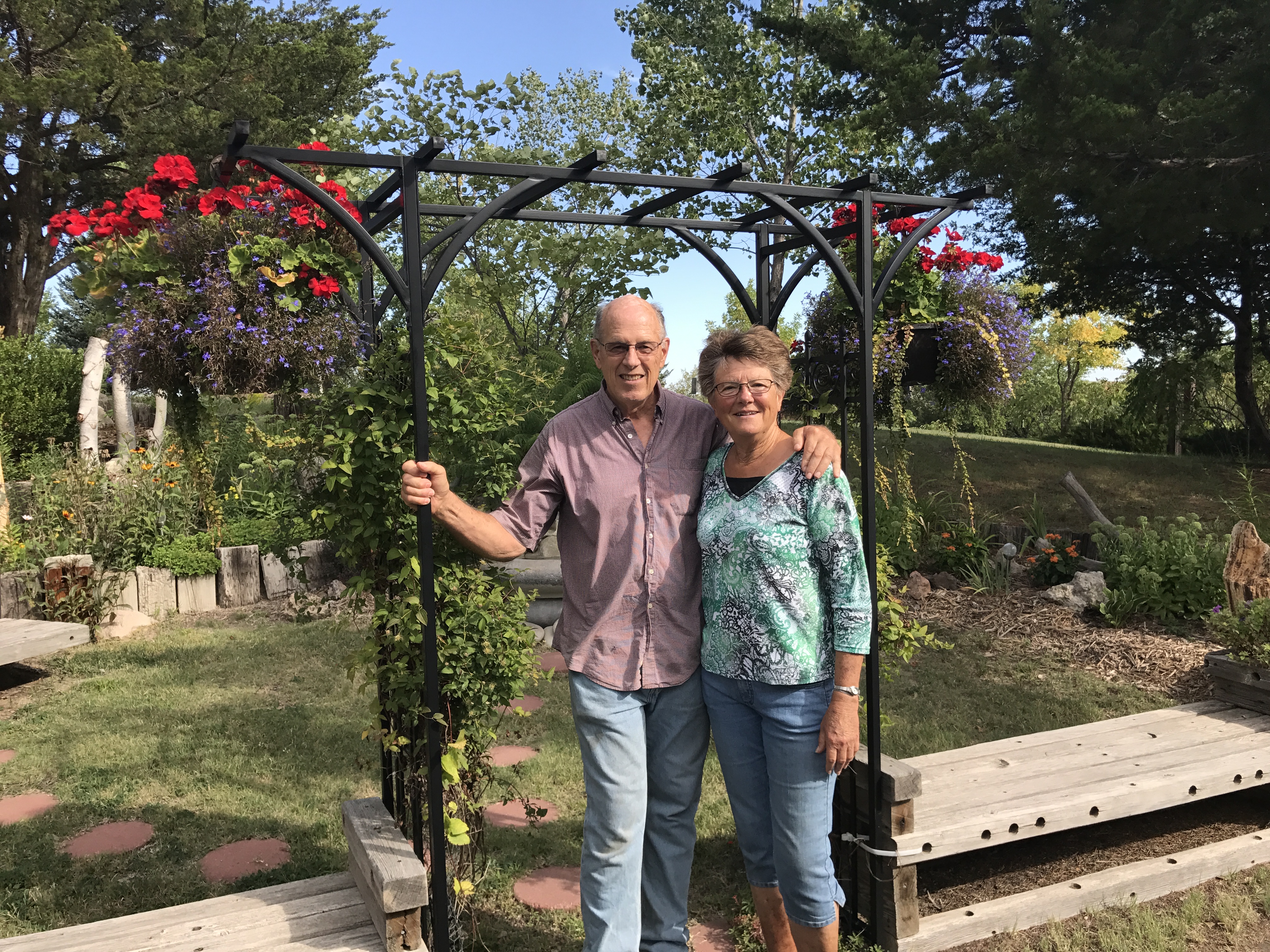
Our hosts, Les and Jan Hosick of Dancing Leaf Lodge

We struck out for Casper, via Ogallala and Scottsbluff, but we opted to take a bit of a side route to have a bite to eat at Ole’s Big Game Steakhouse in Paxton, since it was in our Nebraska Passport booklet.  The Official Passport Travel Program is in its 8th year – the Nebraska Tourism group selects 80 stops all over the state that give you a great overview of the state, from museums to good food to gorgeous scenery and more – our kind of program!  We were sad that we hadn’t known about this program earlier, since we’d already passed quite a few things before we got our passports in Holdrege!  But, should you plan a trip to Nebraska, be sure to play along!  I wish every state had something like this!  Ole’s was in the “Uniquely Nebraska” section, and boy, was it!  Full of mounted animals of all varieties – polar bears, leopards, owls, moose, giraffes – you name it, and Ole had hunted it! Since the restaurant was famous for its beef, and it was almost noon when we arrived, we both had a cheeseburger – very tasty!

Back on the road, we passed through Ogallala, the cowboy capital of Nebraska, and a place we’ve been twice before on our trips – in 2007 and in 2010 – and we didn’t stop at Homemade Heaven, a little sandwich shop we love (they have pie!) mainly because of their fabulous homemade bread, buns, and pies.  This trip, we veered northwest toward Scottsbluff, but again, we chose to take another side trip to the Double L Country Store and Café in Harrisburg.  It was late afternoon when we arrived, just in time for a little snack.  Kim had a yummy looking chocolate sundae and I had a piece of homemade peach pie, a la mode.  Oh my goodness!  The crust was divine – we were both happy with our choices.  I browsed around the little store a bit – very cute things made by local artists – and soon we were on our way to Scottsbluff.

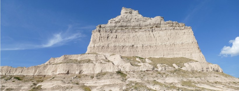
Our main reason for going to Scottsbluff, in addition to the fact it was on the route we had chosen, was to see the huge rock formation that had been a prominent marker for pioneers traversing the Oregon Trail, the Mormon Trail, and the California Trail.  Whenever we travel across the country, especially when we are on the old roads (and not the interstate highways), we can’t help but think about what it would have been like to have walked across the country beside a wagon carrying your children and all of your worldly possessions that you thought you had to have.  We try to put ourselves in the place of women who made this treacherous journey, and it’s hard to imagine how any of them made it!  We are so blessed these days, yet we let the least little things get to us…what, no cell service here??

Anyway, we saw a sign for the Legacy of the Plains Museum in Gering and realized it was in our Passport book, so we stopped in for a visit.  What a great museum it was!  Looked brand new, and it was so nicely done!  It was divided into seven themed sections – High Plains, Dwellings and Domestic Life, Commerce and Trade, Irrigated Farming, Dryland Farming, Ranching and Livestock, and Trails, Transportation, and Communication – all housed in one giant room.  The displays were really nicely done – we could have spent longer here, but wanted to get to the big rock and get to Casper before dark!  Thankfully, the Scottsbluff National Monument was just a few miles down the road – we could see the rock from the museum, so off we went.  First, we walked along the path of the old Oregon Trail, where you could see wagon ruts and up high enough to get a good view of the prairie behind us and the mountains looming ahead.  Kim and I decided we knew how so many little communities were established along these trails – from women who put their feet down and said, “You can keep going, honey, and the kids and I will be waiting for you here!”  There was a nice road up the rock, so we drove through a few tunnels up to the summit where there were incredible views!

While there were a few more things in the area that were in the passport book, we knew we needed to get on the road to Wyoming, because we were staying at a bed & breakfast out from town and we needed to be able to find our way before dark.  Also, we were meeting up with our friend Gerise for a late dinner in town!  We made good time and found the Red Butte Lodge (no help from Waze, who got us almost there, but sent us the long, gravel road way when we could have driven on a paved road!).  I was glad I had seen a photo of the entryway on the website, or we would still be driving around trying to find it!  Ruth, the proprietor, had the Australia room all ready for us – perfect!  Ruth is from New Zealand, lived in Australia for 18 years, and has been in the US since 2002.  We were very comfortable in her home.  We got settled and then went to town to meet Gerise for dinner at J’s Pub & Grill.  Gerise brought us a lovely book about Wyoming, full of spectacular photographs, and we had a wonderful time visiting and enjoying a lovely dinner.  Thanks, Gerise, for making time for us, for the book, and for your wonderful recommendations!  Next time we will see the studio!

We filled the gas tank on our way home and settled in for the night, ready for another big day tomorrow!  While I am glad to be having fun on our trip, I’m so sad to hear about the calamitous rain, wind, and storms hitting the Gulf coast of Texas and the city of Houston and surrounding areas.  Rex reports that other than some minor damage to our dock and downspouts on our gutters, all is well at Tiki; however, our Houston friends and many in between are in a bad way.  If you feel inclined to contribute, please consider giving to the Red Cross.  And all prayers are appreciated!

A BIG Day in Nebraska

24 August 2017

Lincoln to Wellfleet, Nebraska, 256 miles

0824 Lincoln to Wellfleet route 256

Map credit: Google Maps 2017, courtesy AAA

Since we had not done good reconnaissance the night before, we had no idea our hotel was adjacent to a lovely greenway/walking trail, so we had opted to try and get our steps in by sightseeing today.  We slept in a teeny bit since we had gotten in so late the night before, but we rolled out and took off for Tina’s Café for breakfast and to see what was so special about her cinnamon rolls.  We had no problem finding Tina’s, and what a treasure it was!  With a NASCAR theme and a couple of funny and friendly servers, we had a blast at breakfast.  Another pair of sisters heard all of our talk of maps and road trips and stopped by our table to investigate.  Our server insisted that we try a cinnamon roll, even though one was more than enough to serve about eight people!  Seriously – it looked like it was baked in an 8×8” pan and it was two stories high, covered in frosting AND our server heated it up and put butter on the top!  Kim ate about 1/16th of it and I ate most of the rest of that half…  And the rest was wrapped up for later…  At this point, I should probably not mention that we had regular breakfast, although I skipped potatoes and bread!  Kim felt the need to try the blueberry pancakes (also a specialty) and said they were delectable.

While munching away, we were looking at our Roadside America app to make sure we didn’t miss anything in Lincoln or along the way when we saw that the National Museum of Roller Skating was on the SAME STREET we were on, albeit about 30 blocks away.  Since Kim’s daughter Kerry did roller derby for a number of years, we were obliged to visit.  It was a real treat – housed in a building with a slate roof and copper gutters, it contains everything you could want to know about roller skating, from roller hockey to roller derby to skate dancing to speed skating and everything in between.  We were greeted at the door by Rhonda, an ex-skater, who told us all about the museum and got our visit started off right. An hour later, we were making our way to the Nebraska State Capitol, which is one of only four skyscraper capitol buildings in the US.  Can you name the other three?  Kim and I have been to two of them on Sassy Sister trips and to the other one separately.

We really enjoyed our quick tour of the Nebraska capitol, since we got to go inside this time.  Last time we were here, on our 2010 trip, we arrived too late to go in.  First, we rode the tiny ancient elevator up to the 14th floor observation deck and looked at Lincoln from above and saw the interior of the dome.  Later, we went down to the main floor and admired the gorgeous mosaics and paintings – there was lots of symbolism (as always, in capitol buildings) and since this is Nebraska’s 150th year of statehood, it was fun to learn more about the state and its capitol.

Of course, it was well after noon before we started west – so much for getting to Scottsbluff today, as we had other stops to make.  In York, we were treated to a water tower painted to look like a hot air balloon, and we stopped in to visit Lee’s Legendary Marble Museum.  Lee himself was kind of legendary – he was wearing one of those visors with the built in wild wigs – think Rod Stewart hair – and his shop was FULL of marbles, antiques, coins, possible collectables, and junk.  After today, Kim and I have determined that Nebraskans do not throw anything away.  Ever.  Somehow we made it out without even making a purchase.

Our next stop was Minden, also known as Nebraska’s Christmas City, and the home of Harold Warp’s Pioneer Village.  I was expecting something like the frontier village we had seen in Jamestown, North Dakota (site of our hilarious stagecoach ride!), or possibly something like Roadside America in Shartlesville, Pennsylvania (one of our very favorite attractions!), but this was neither of those.  This was one man’s ENORMOUS collection of artifacts from Nebraska’s pioneer days until the 1980’s, and it was housed in 26 separate buildings, each with its own theme.  The transportation collections were incredible – from wagon trains to buggies and carriages to horseless carriages to vintage autos to planes (like Orville and Wilbur’s), boats, trolley cars, trains, and more.  Many of the buildings were historic themselves – log cabins, a sod house, a prairie church, a carousel, a train depot, and a land office, for example – and then they were full of accompanying exhibits.  The interesting thing about this collection was that it was really mostly that – a huge collection of items that were categorized and on display, but you could tell that as time went on and more items were added to certain displays, they just kind of got added to the pile.  There was not as much explanation of what the more modern things were or their significance, but the pioneer relics were very well organized and arranged.  Many of the pioneer pieces belonged to Mr. Warp’s parents and grandparents, so there was a lot of family history along with those.  One huge building was devoted to homes and work and had rooms set up as they would have been in different decades – kitchens, living rooms, and bedrooms, all full of period pieces.  But it was this buiding which seemed to have become a bit of a repository for things people wanted to be rid of but didn’t want to throw away.  We spent about two hours there and went to almost every building – pretty good, since the lady who greeted us told us most people stay between 4-6 hours!

By the time we left, it was time for us to consider two important questions – where would we find dinner and where would we spend the night.  One of the hazards of taking the road less traveled is that there are not as many choices for either of those things, but you often get really lucky anyway.  A quick look at our apps found us a few choices for dinner, with the best one being nearby but not opening for another 30 minutes (at 5:30) and then a good look at the map told us we weren’t going to get too far before dark, so we opted to call our old friends at the Dancing Leaf Lodge near Wellfleet to see if we could find a bed (or a pallet of deer skins) for the evening.  We were in luck!  We learned that the lodge itself is no longer available for overnight guests, but the cabin was open.  With that decided, we turned the car toward Holdrege and the Speakeasy.

What a find!  Out in the middle of NOWHERE (and I am not kidding!) was a little brick building next to a grain silo.  We entered through a dark, narrow hallway and halfway expected to have to know a password, but happily, we were seated and presented with an incredible looking menu!  Go figure!  Kim had a local beer and I had an Old Fashioned (there are perks to not being the driver) and we scarfed down the warm bread that was served.  We learned about a Nebraska favorite salad dressing called the ‘Dorothy’ (it’s good!) and when our meals arrived they were humongous!  Kim had beef tips over mashed potatoes and I had a pork Osso Bucco style over mashed potatoes and broccolini.  When the server told us dessert was pots de crème, we couldn’t resist, thinking it was chocolate, but we were in for a surprise!  It was a vanilla custard topped with maple syrup and it was heavenly!  Not too sweet or too rich – we scraped the sides of the little Mason jar it was in!

We didn’t linger, except we did get our Nebraska passports stamped and learned about Faceless Fred, the Speakeasy’s ghost, and then we were off to Wellfleet, hoping to arrive before dark.  And we made it!  It was good to see Les and Jan again, and the place looked great.  We settled in for the night and kind of enjoyed not having wifi for a change!  We didn’t make if far today, but we saw plenty of good stuff!  Not only that, we have decided that the Nebraskans we have met along the way could be Southerners – they are so friendly!  Not a glum face all day!

Good to be back at the Dancing Leaf Lodge!

Good to be back at the Dancing Leaf Lodge!

Hair Today, Lincoln Tomorrow

Wednesday, 23 August 2017
Jefferson City, MO to Lincoln NE, ~ 400 miles

0823 Jeff City to Lincoln route 400

Map credit: Google Maps 2017 courtesy AAA

Kim and I arose to almost chilly temperatures in Jefferson City and drove a couple of miles west to Binder Lake park for a short hike.  Other than lots of bugs in the parking lot there, the walk was a nice one.  It was still very dewy, so we opted to walk along the road next to the perfectly still lake.  Except for one fisherman, the lawn mowers, and the garbage man, we were the only ones around.  We didn’t see much wildlife except for one heron who had staked out a good fishing spot, and the numerous frogs we heard but didn’t see in a lily-pad covered pond.

IMG_5269

Binder Lake State Park

After we showered and dressed, we back-tracked into the city to have breakfast at Oscar’s Classic Diner, which we chose based on its name (in memory of my fabulous father-in-law).  As expected, Oscar did not disappoint!  We had the most delightful server and breakfast was tasty – Kim had a ham and cheese omelet and I had eggs benedict, but over tomato slices and avocado instead of bread and meat.  We both had the grilled hash browns, which were delicious!  The other great things about Oscar’s were the décor – we ate right under Roy Rogers and Dale Evans and Bogart and Bacall – and the hysterical ladies room (Beauty Salon – Miracles Performed Daily!).


Finally on the road after 11 AM (we just cannot seem to get an early start no matter what…) we hopped on US 50 and headed west.  Kim had done some ‘places we might want to stop’ research and our first stop was not too far away – a water tower painted like an 8 ball in Tipton – and we thought it would just be a fun photo op/drive by.  Until we read a note that said the parking lot of the Dutch Bakery was a good place to take the photo….of course we had to go in!  At least 30 minutes later, armed with snacks for the road, we were off.

A little later down the road, we came upon the town of Sedalia and saw a giant structure covered in white sheets.  Wondering if some humongous Civil War monument was under wraps, we veered off to investigate.  We still aren’t sure what it was – our best guess is a water tower being painted – but we loved the quaint little downtown and ended up spending another 30 or 45 minutes walking around.  We learned that Scott Joplin invented ragtime here, and we went in a wonderful old hotel that was where Harry Truman launched his political career.  There was a fabulous old theater that has been turned into an art gallery and several colorful murals painted on buildings, and we saw our second Statue of Liberty (so far).  You may be understanding now why we don’t make particularly good time on these trips…

Back on the road, we were determined not to stop again until we made it to our next planned destination, Leila’s Hair Museum in Independence.  I will tell you that since Kim had made this list, I wasn’t sure what to expect at a hair museum, but what we saw at Leila’s wasn’t it!  In my next lifetime….  It was fascinating, for sure, and very unique, as was Leila, who gave us a private tour.  Leila is 85 years old and she has been collecting hair art since 1956.  She is also a cosmetologist and she teaches hair art lessons now.  She has written three books and is working on a fourth, and she has the largest hair art collection in the world.  Possibly the only one…
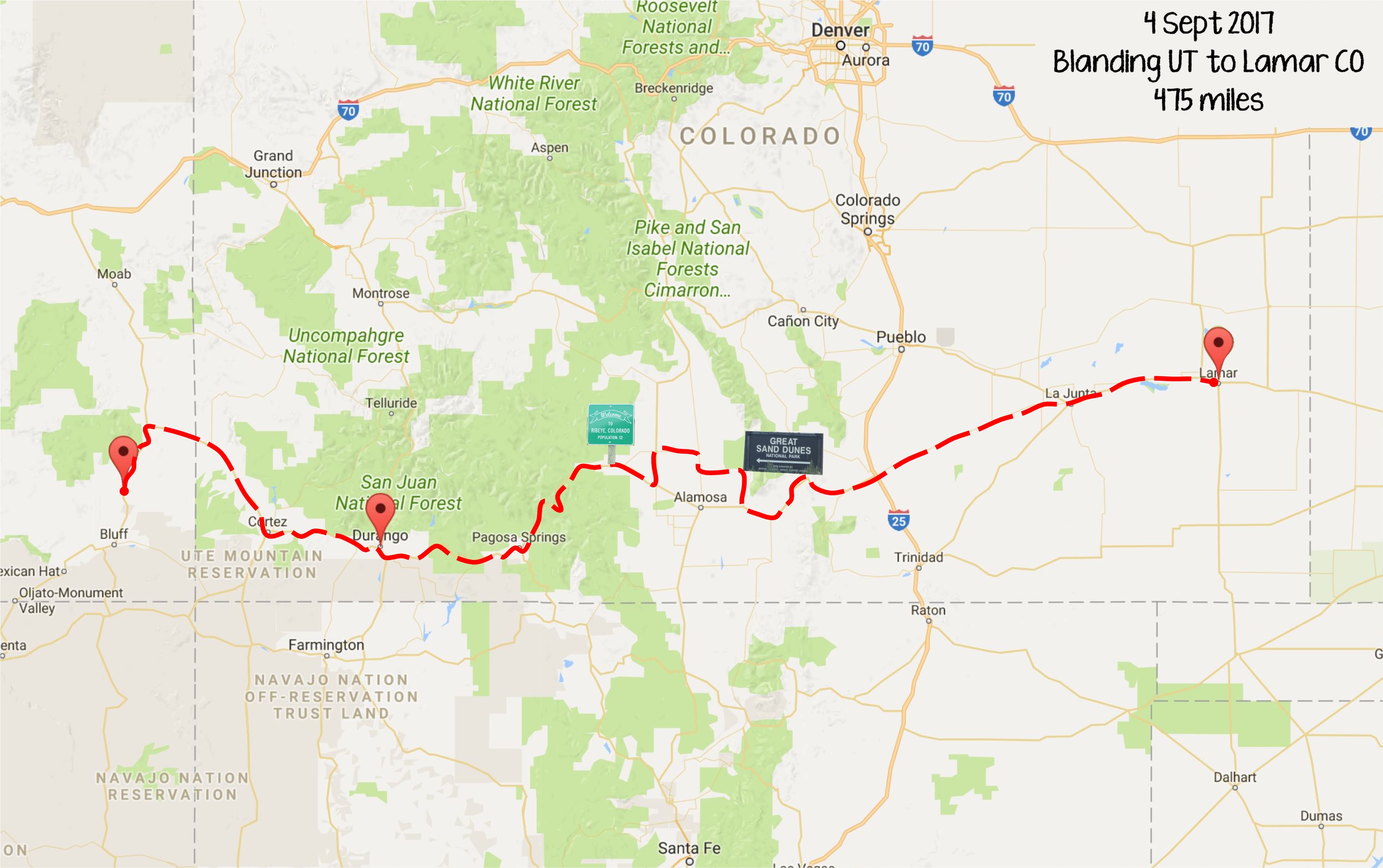
So here’s the thing – hair art dates back centuries, but became mostly extinct with the advent of family photography.  Women used to ‘embroider’ with hair from different family members, thus making a unique family tree – imagine what you could learn about your family with all of that DNA!! – and these flowers/vines/nuts/etc. made from hair were put together in a way that made a pretty arrangement and then framed in boxes lined with satin (think inside of a coffin, because that’s often who made the hair art boxes).  Anyway, you’ve probably never seen anything like it!  There was more – gentlemen had watch chains made from the hair of their wives/mothers/lovers – and all sorts of things.  You have to see it all to believe it, and we were not allowed to photograph anything in two of the rooms of the museum.

This slideshow requires JavaScript.


By the time we left Leila’s, we knew we would not make it to Topeka in time to tour the capitol building, but we decided to go anyway.  I have done the Kansas state capitol tour, so we thought we’d just photograph the outside and find a place to eat before continuing to Lincoln for the night.  Good call!  We got great shots of the capitol and the sculptures around it (including the Statue of Liberty) and we saw the outside of the First Presbyterian Church which is famous for its Tiffany stained glass windows.  We tried several doors….


The best thing that happened in Topeka was dinner!  We found a little restaurant called the Rowhouse that was just a few blocks from the capitol – what a gem!  It was in an old row house (surprise!) and it served a set prix fixe menu, so we didn’t even have to make decisions!  The dinner was five courses, including three small entrée servings and three desserts (!!) and it was divine!  Since it had been a long time since breakfast (no snacks, either!), it hit the spot!  And Zach, our waiter, was just great.

Sufficiently sated but not stuffed, we turned north and rolled into Lincoln well after dark.  Another day of adventure in the books!

Over the Rivers and through the Fields

Tuesday, 22 August 2017
Paducah, KY to Jefferson City, MO, ~300 miles

0822 Paducah to Jeff City 300

Map credit: Google Maps 2017, courtesy of AAA

We decided to walk down by the river this morning, so we parked near the new Holiday Inn and walked along Riverfront Park.  The Queen of the Mississippi was in port, so we got a better look at her this morning.  Once we got to the Crounse Corporation, we started walking down the street, and before we knew it, we were just walking up and down blocks and blocks of Paducah’s downtown, snapping photos and having a little stroll down memory lane, trying to remember which storefront was which, back in the day.

We walked over to Lower Town and took pictures of some of the decorated fire hydrants and looked at the houses and studios.  If you don’t know about Paducah’s Artist Relocation program and the Lower Town Arts District, please check it out HERE.  It’s one of the main reasons Paducah is a UNESCO city for creative arts.  We then made the fateful decision to have breakfast at Gold Rush.  No problem with the food – we just got ‘accosted’ by a totally crazy woman who sat down next to us and talked non-stop (to us) the entire time we were there.  And when I say crazy, I mean seriously mentally ill.  It was sad, truly, and it did put a damper on our day, at least for a little while.  As soon as we could escape gracefully, we did, and we stopped by the Visitor’s Bureau to say goodbye to Mary, then we stopped by the River Discovery Center to see if there were any eclipse t-shirts left.  No luck!

We drove back to the hotel and got cleaned up and loaded the car, and we were off, but not until after noon!!  Kim bravely decided that she could drive across the old, narrow, iron grate-bottomed, scary Irvin Cobb Bridge over to Brookport, Illinois, so off we went, with no plan and no paper map of Illinois!  We opted to cross the Mississippi at Chester instead of going all the way to St. Louis, and on the way we went through Metropolis, Vienna, Anna, and Jonesboro.  We went through a bit of a hard rain between Vienna and Anna, but it had almost stopped raining by the time we saw a sign for the site of one of the Lincoln-Douglas debates.  It doesn’t take much for us to stop…

As we drove into Chester, we noted that it was the home of Popeye (the Sailor Man) and his assorted motley crew, so again, we were forced to stop for some photo opportunities.  Kim crossed another old bridge here, and we went from being high on a bluff to in the flatlands of Missouri.  Before long though, we were in some hilly-ish country.  As usual, we opted to stay off of interstates as much as possible, but we did have to hop on for a few miles to get up to Festus.  Shades of Gunsmoke!

From looking at the map, it looked like we could make it to Jefferson City for the evening, and it also looked like our best chance for a meal before then was in St. Clair, a little town on Route 66.  We had eaten at the Lewis Cafe there for breakfast back on our second Route 66 venture back in 2007, and we were pleasantly surprised to see that the restaurant was still open!  Since they butcher their own meat, we opted for burgers and shared a plate of homemade onion rings.  And since they had pie….

Once done with dinner, we made our way to Missouri’s capital city, arriving at our hotel before 8 PM!  Since we had toured the capitol building on our 2010 road trip, we did not need to redo that, even though the capitol is one of my favorites – and it is massive!  We spent our evening looking through photos and blogging, and wondering where the next day would find us!


Totally Experiencing Totality!

At long last, the day of the eclipse was upon us!  Kim and I went for a walk and it was hotter than any of the previous days, even though we got an earlier start – not a great sign!  The sky was clear, though, so we were hoping it would stay that way.  Judy had gone to Red’s for doughnuts, so we all shared a big box of pure sweetness – heavenly!

We got downtown and found parking spaces with no problems, and we just wandered around a bit prior to time to enter the party area.  Soon it was time, so we staked out a table in the breeziest section of the yard.  We were joined by Jeanne and Pat, a delightful couple from Chicago who had come to Paducah for the big event.  They were a hoot and we loved having them celebrate with us!  It was plenty warm, so Jim and Alex went back to their car to get a couple of golf umbrellas, as we had no shade at all.  Thankfully, we could go into the Carson Center for beer and bathroom breaks.  Lunch was served about 11:30, but we waited a good bit later so that the line was not so long.  BBQ, baked beans, hash brown casserole, cole slaw, cookies, and Moon Pies were on the menu, and they were delicious!

I had a great eclipse timer app, so we were able to know the exact moment when first contact would appear at our location – it was so exciting!!  Things started moving quickly after that, and we were all so surprised that our eclipse glasses worked so well, because you could not see one thing out of them in normal light!  We decided to try some pinhole ‘cameras’, and that was fun.  We took pictures of the eclipse shadows on our hands, on eclipse handouts, and on plain paper.  It took us a while to work out the best angles and positions, but we did it!

At one point, we noticed that shadows of the leaves on the sidewalk had changed, and anywhere there was a hole in a leaf, there was a crescent-shaped shadow.  We took off the tablecloth on the table next to us in hopes of seeing shadow bands (at second and fourth contact) on the white surface.  And we did, but it was really hard to get a good photo of them.  Blissfully, as it got closer to time for the full eclipse, the temperature dropped significantly.  There were no animals around to observe ‘strange’ behavior, and before we knew it, the total eclipse was happening!  We saw the diamond ring, and then we heard the app tell us “Glasses off!!” – the moment of totality was finally here!  I got a couple of great photos, and noticed lots of bugs hitting my arms.  Then the app told us to observe the horizon, and we say what looked like a beautiful sunset.

All too soon, it was time to put our glasses back on and prepare for fourth contact.  Pat had recorded a video during totality, and we were shocked to hear the crickets chirping and cicadas humming during it.  That explained the bugs hitting me – as if it were nightfall!  The big post-eclipse excitement was learning that Paducah would be in the path of the next one, which just happens to be on Jenny’s birthday in 2024!!  Pat and Jeanne are planning to join us, wherever we end up watching it!

Lots of people started leaving fairly soon, even though the moon still had a ways to go before the sun was uncovered.  Between the heat and the fear of huge traffic jams, many were ready to get out of there!  Jim and Alex left after a while to get back to Memphis, but Jenny and Judy had some shopping to do.  We were able to see the last bit of the eclipse before leaving.

On our way back to the hotel, we drove by PTHS (our high school) and we stopped by the Chief Paduke statue.  J & J headed back to Nashville hoping not to run into a big traffic jam, and thankfully, they were rewarded!  None of our group hit traffic, but we talked to several who had a seven hour ride back to Louisville (about twice what it would normally be)!!

Kim went to visit her friend Francie, and I did some laundry for us, and then we both enjoyed the Homewood happy hour.  On our way downtown for dinner, we drove by our old house, and then we made our way to Max’s, where we enjoyed delicious salmon and a perfect gin and tonic.  After dinner, we walked back down to the river to see the Queen of the Mississippi, and then we called it a day.  And what a special one it was!!

P1080286.jpg

It’s finally here!  Let’s have a cookie!

P1080324

Sundrop/Moon Pie Eclipse Party is about to begin!

P1080332

Judy has her first Moon Pie

P1080328

Jim and Kim taking in the action.

P1080336

Jenny has the eclipse in her hand.

P1080340

It took a team effort to get the pinhole pictures!

P1080344

Another pinhole shadow

P1080347

One more

P1080356

Jenny getting a good view

P1080357

The whole crowd was into it!

P1080360

It’s hard to see, but these were the shadow bands…

P1080364

Glasses off – TOTALITY!!

P1080367

It was almost like sundown…

P1080368

Looking toward the river during totality

IMG_5096

We stopped by the Chief Paduke statue before Jenny and Judy left town.

IMG_5101

Our old house is looking pretty good.

IMG_5103

Our home away from home for a few days – neat clouds on eclipse day!

IMG_5107

The Queen of the Mississippi was docked in Paducah

IMG_5112

Love this sign!

IMG_5113

Kim and I went to Max’s for dinner.

IMG_5115

A delicious eclipse Hendrick’s and Fever-Tree

Let’s Get This Party Started

Sunday, 20 August 2017
Paducah KY

For the second day in a row (off to a good start!), Kim and I got a walk in.  We drove over to Noble Park where we walked through the park, on top of the levee, and on the greenway to Stuart Nelson Park and back.  By the time we got back and cleaned up, Judy and Jenny were back from church and Jim and Alex were almost here.  The girls enjoyed the service at Grace Episcopal and thought the church was beautiful.  The guys had no problem getting here – no traffic jams between here and Memphis.

Soon we were off in search of lunch downtown, where we found that quite a few people had the same idea.  Shandie’s was packed and reported an hour wait, so we opted for Kirchhoff’s instead.  Good call! Our sandwiches were huge, tasty, and the bread was divine!  Most of us could not even finish our meals!  After lunch, we walked over to the National Quilt Museum, where we spent the next couple of hours admiring the incredible fiber arts on display there.  As is always the case, our guests, who were humoring us by agreeing to go to the museum, were amazed by what they saw!  This is NOT your grandma’s quilt museum!  Should you ever find yourself in Paducah, whether you are a quilter or not, male or female, young or old – please trust me and spend an hour in the National Quilt Museum.  You will not be disappointed – except that you can’t take photos!  Judy, Jenny, Jim, and Alex all agreed that the museum is badly named and they were glad we insisted they visit it.  Like I said – just trust us.  I go every time I’m in town, as the exhibits change regularly.

By the time we walked back in the hot sun, we were all screaming for ice cream, so back we went to Curls & Cream – since Jim and Alex had missed yesterday’s run.  I opted for S’mores this time -so good!  Kim had Oreo with pecans, caramel sauce, and whipped cream.  Yum!  We wanted to show the gang the Hotel 1857, and it just happened that the bar was open and the AC was going strong, so we ended up spending the rest of the afternoon there, chatting with Jacob the bartender and with other patrons (including a bourbon purveyor). Before we knew it, it was time to go to Doe’s Eat Place for dinner.  Doe’s was packed and the place was hopping!  Somehow, we managed to eat most of our steaks and shrimp – again, Doe’s knows steak!

By this time, we were all about to crash, so we headed back to the hotel so that we could rest up for the big event!  Thanks, Kim Ford, for having Kim & me!!

21016134_1656617697681996_5868405463538483964_o

Grace Episcopal Church, Paducah KY

IMG_5063

Greenway trails

20934189_10211314609879938_483875381906172865_o

The duck pond at Noble Park

IMG_5062

Walking along the levee

IMG_5056

Why did the ducks cross the road?

IMG_5069

Such good bread!

IMG_5073

Eclipse cookies at Kirchhoff’s

IMG_5075

Lewis & Clark and Sacajawea in front og the Quilt Museum

IMG_5076

The Yeiser yak is ready for the eclipse

P1080289

Love the Curls & Cream t-shirts!

P1080299

This is how they roll the ice cream – so cool!

P1080303

My s’mores cup with Reese’s, chocolate syrup, and whipped cream. And toasted marshmallows, of course!

20988116_10211314610159945_5976205651662839769_o

The J team!

Out on the Town

18 August 2017
Houston, Texas to Memphis, Tennessee to Paducah, Kentucky

My flight left Houston about the time it was supposed to land in Memphis, so our afternoon plans got messed up before I even arrived, but no worries – we adapted.  After Kim picked me up, we drove out to her house to get her bags and load the car, then we stopped for a quick bite of sushi at a cool restaurant in a newly renovated old home in Midtown.  From there, we went to the High Cotton Brewing Company for a work party for Kim.  It was fun to meet her co-workers, and the brewery was in a fantastic space.  The food looked great, and we managed to not sample anything (but the beer, of course!).  After the party, we took off for Paducah, knowing that my friends Judy and Jenny, who were joining us for the eclipse weekend, would get there before us.

Once we made it out of Memphis, it was smooth sailing to get to Paducah – no eclipse traffic jams yet.  We heard from J & J that they had checked in to our hotel and we sent them to the Mellow Mushroom in the old Coca Cola Bottling Plant.  And yes, we know it’s a chain, but I haven’t ever seen another M M in our beautiful Art Deco Coke building!  It’s a spectacular building – read all about it and follow it on Facebook!  Best of all (and the pizza was scrumptious) was that the neon on the dome was shining again!  We got checked in by about 11 PM or so, and of course we all stayed up talking too late!  It’s good to be home!

Saturday, 19 August 2017
Paducah

Kim and I got up and went for a walk – tomorrow we must get an earlier start – it was already really hot by the time we went out.  We each had lunch plans with former classmates – Kim and her friends met at JP’s downtown, and my friends and I were planning to go to Flamingo Row, but it was packed!  We opted for Jasmine instead, and after a delicious meal, we all traipsed to Roof Liquors in search of Kentucky bourbon and anything else we might find.   At this point, everyone went their separate ways, and I took Judy and Jenny the nickel tour of Paducah.  After showing them our old house and neighborhood, schools, and church, we drove downtown to see the goings-on down there.  We checked out the floodwall murals, walked along the riverfront, and then met Kim.  It was blazing hot, with no shade on our side of the floodwall, so we were ready for a respite from the sun and some cold ice cream.  Never having heard of ‘rolled ice cream’ until lunch today, we opted to try Curls & Cream downtown.  Good call!

After getting rejuvenated, we did some window shopping and real shopping, then we went to the 1857 in hopes of having a drink.  Sadly, it was closed for a private party, so we went to Tribeca instead.  From there, we took in the art exhibit at the Yeiser Art Center in the old Market House, and then we met Judy W at the Freight House for dinner.  It was PACKED, and there was a very long wait for our food, but it was worth it!  It was after 10 before we made our way back to the hotel.  Long day, and a fun one!

HERE are some photos.

You Can Go Home Again

I love to travel, especially by car.  I’ve been to all fifty states, most of them more than once.  In fact, I think Alaska is the only state I’ve only been to one time.  I’ve been to a lot of state capitols –  gone through security (for the few that have them!), signed their guest registers, taken tours, taken tons of photos, and marveled at the grandeur of some and the simplicity of others.

I’ve lived in four states – Kentucky, Tennessee, North Carolina, and Texas.  A couple of years ago, my sister and I, who grew up in Kentucky, went inside the Kentucky state capitol in Frankfort for the first time ever.  Care to guess three other state capitols I have NOT been inside?  Bingo – Tennessee, North Carolina, and Texas! Why do we do that?  Why is it that we make it a point to see the unfamiliar while we ignore what’s in our own backyard?

I’m on the road again, with my sister, and we spent the past day or so touring eastern Kentucky, traveling on roads through counties we’d only heard of (our whole lives!) but had NEVER been near.  We sat through a traffic jam (due to a bad wreck) in Hazard (yes, that same Dukes of Hazzard Hazard!), stopped at farmers’ market in Corbin (home of the Colonel Sanders Cafe and Museum), sat down and listened to Loretta Lynn in Butcher Holler, gazed at the strip mines and the stuff that came out of them, passed through towns like Eighty-eight, Rowdy, Sassafras, Seventy-six, and Dice, and we started our day the best way – admiring a spectacular rainbow caused by Cumberland Falls.

We traveled on US highways, state highways, county roads, roads with four numbers that are barely over two lanes wide and are very curvy, parkways, scenic byways, and even a few miles (less than twenty!) on interstates.  We dodged critters – deer, dogs, cats, and raccoons – and saw (and smelled) plenty of evidence of those that didn’t get out of the way fast enough.  We delighted in the thousands of lightning bugs we saw last night, and we noticed that even the smallest of towns in eastern Kentucky seemed to have Dollar General Stores, Arby’s, McDonald’s, Subway, Long John Silvers, KFC, and of course, Wal-Mart.  A dismal commentary, in my mind!

We traversed the Daniel Boone National Forest, much of which probably hasn’t changed since Daniel Boone passed through, and we rode up the Country Music Highway.  We have a new appreciation for the other end of our home state, and I wouldn’t be surprised if we come back some day.  So what’s in your backyard that you haven’t explored?  What is it you don’t appreciate or that you just take for granted?  I’ll bet that if you made it a point to treat your home town or state as an exotic location, you’d find jewels just like we have!

SS KY state capitol

Kentucky State Capitol, Frankfort, 2009

Rainy Days and Tuesdays

Tuesday, 7 June 2011
Ripley WV to Pittsburgh PA  240 miles

As we made our way down to the car with our bags this morning, we had to dodge the masses of people waiting for the Mega Gold Roadshow to begin at our hotel.  Oh yeah, the ‘bring your gold to sell for LOTS of money’ show was in town!  But we managed to maneuver the minefield and we were on our way.  We opted for breakfast at the Belrock Cafe in Belpre, Ohio.  Kim reverted to her old standby, ham and eggs, and I had a cheese omelet, and we both had big fluffy biscuits.  It was a good choice for brekky!

Since we had crossed the river already, we just drove up the highway on the Ohio side of the river instead of the WV side.  Our plan was to cross back over at Sisterville (photo op, you know) and continue on to Moundsville, where we had plans.  Along the way, though, we took a little detour in Belpre and found an old brick road along the riverfront and just enjoyed seeing that little town.

Alas, as we drove along the river, the skies got darker and darker, and before too long, they opened up and the rain came pouring down!  Lightning flashed and thunder roared, and the water just poured over the road.  To top things off, when we got to the town across from Sisterville, there was no bridge – just a ferry!  Kim pronounced that we were NOT crossing the Ohio River on a ferry in the middle of a huge thunderstorm.  We may be sassy, but we’re not stupid!  The rain got so heavy that we even pulled off the road for about 15 minutes, and once we got going again, we saw a sign for Marv’s Place in Sardis, OH.  Even though it hadn’t been long since breakfast, we decided to stop and check it out. Good call!  Kim had some ice cream and I had a homemade cherry custard pie – both were delicious!  Just think of it as breakfast dessert.  Or morning tea…. We chatted with Ethel, the proprietor (Marv’s daughter, who has taken over the place since Marv and her mom died) and she told us to go up a hill to the cemetery for the best view of the river.  Off we went!  She was right – too bad it was still raining pretty hard!  GIven that it’s only rained once on Tiki Island since January, I had not even thought of bringing rain gear.  Thankfully, Kim had two of a three-pack of ponchos, and so I was good to go.  If I could have gotten it on!!  It took a while, but I got it!

We had two things we wanted to do in Moundsville WV – the Marx Toy Museum and the WV State Prison – so off we went.  We crossed the river at Martinsville, where one of the first streets we saw was Paducah Drive!  We rolled into Moundsville in plenty of time to get to the toy museum before it closed, and we were not disappointed!  We had great toys as kids, and we played with them a lot!  One of our favorite things was our Gunsmoke set, which we got when we were about 5 and 6.  We still have it – I have pieces of it on display in my house today.  It was made by Marx Toys, as were Rock’em Sock’em Robots and tons of other fun things!  I think ALL of them were on display here – we had such a good time strolling down Memory Lane!  Mr. Marx was ahead of his time – he had made toy sets out of almost all of the TV shows of the 50’s and 60’s – Amos and Andy, Dick Tracy, the Flintstones, Johnny West, Zorro, the Lone Ranger, Yogi Bear – you name it, it was there!  If you’re a toy lover, be sure to make your way here someday!  We had a great time chatting with the lady in charge – she has a sister that she enjoys doing things with and she shared our love of Marx toys.  Oh, and Elvis had found us again, as had Matt Dillon.  They can’t resist us!

Where the Wind Blows Us, Day 2

Monday, 6 June 2011
Cumberland Falls KY to Ripley WV  324 miles

We started our day with a big delicious breakfast at the Dupont Lodge.  The dining room looks out over the Cumberland River, and one wall of the room is windows.  Just outside the windows is a garden with lots of bird feeders.  Brilliant yellow gold finches were feasting on thistle seeds and ingenious squirrels were doing their best to get a free meal, too.  The window next to our table had little paw prints on it, about two or three feet up.  We weren’t sure which animal had made them until we saw a raccoon out there scrounging around!  We had a good laugh when we looked up to see a man in plaid shorts and a beret out there, too!

We were thrilled to see country ham on the breakfast menu – we had come home!  We shared a breakfast of country ham, potatoes, cooked apples, biscuits, redeye gravy, and eggs.  It was the perfect way to start the day and it made us think of Daddy, who LOVED country ham and redeye gravy.  After our meal, we went up to the patio and took some pictures of the river and the valley below, and then we were off to the Falls.

Cumberland Falls is the only waterfall in the western hemisphere that has a regular and predictable moonbow.  Victoria Falls in Africa is the only other waterfall that does, although Niagara sometimes has one.  A moonbow occurs only during a full moon, just after the moon has risen high enough in the sky to cause enough light to shine on the falls in a way that forms a spectrum like a rainbow.  Sadly, we weren’t there during a full moon, but we enjoyed the rainbow that was vibrant and big on this day!  Lots of photos later, we were ready to hit the road.  Never mind that it was after noon before we left – it took us a while to get back in road trip mode!

The first town that we came to was Corbin, home of the Colonel Sanders Cafe and Museum.  Given our late start, along with other things that we wanted to do and see, we didn’t stop…but we did stop at a Farmer’s Market to buy some fresh peaches.  Even though Kim and I grew up in Kentucky, neither of us had been much east of I-75, so we were looking forward to exploring Appalachia in our home state.  It was surprising to us to see so many coal mines still operating.  Our drive through the mountains was beautiful, though, especially in the Daniel Boone National Forest.

Another surprise along the way – a traffic jam in Hazard – go figure!  It was caused by an accident, but still!  Our main route today was Highway 23, also known as the Country Music Highway because of the multitude of talent born and raised along this route.  We stopped at the Country Music Highway Museum in Paintsville to learn some more about these singers.  It was a small museum, but pretty new and very nicely done. The most famous singers from this area are Loretta Lynn and her baby sister, Crystal Gayle, who were born in nearby Butcher Holler.  Other big names that you may recognize are Tom T. Hall, Keith Whitley, Ricky Skaggs, Naomi and Wynonna Judd, Billy Ray Cyrus, Dwight Yoakam, and Patty Loveless. There were others, but that should give you some idea!  The woman in the museum was so friendly and helpful – we were glad we had stopped!

From Paintsville we continued north on US 23 until we were almost to West Virginia.  We crossed the Ohio River on the Kentucky side of Huntington and hopped on US 60 into Charleston.  Highway 60 goes all the way across Kentucky to Paducah, so it was fun to be on it in West Virginia.  We had hoped to stop in at the Blenko Glass museum in Milton, but it was after five by the time we got there, so we just kept going.  Thankfully, the capitol building in Charleston was open until 7 PM, so we knew we would get to see it!  Charleston was much prettier than I expected it to be, and the capitol was big and domed.  It was not the prettiest one we’ve seen, but by no means was it the ugliest, either! My favorite thing there was a cool statue of Abe Lincoln out front.  It was called “Lincoln at Midnight” and he is pacing the halls in his bathrobe.  Oddly enough, just a few yards away was a statue of native son Stonewall Jackson.  That unpleasantness really caused big divisions, didn’t it?

A couple of high school kids were getting their (prom? graduation?) pictures taken on the capitol steps, so that was some good entertainment for us.  She was in a short bright royal blue dress and had a matching blue streak in the front of her very blonde hair.  She wore 4″ high heels (black) and her bra was almost completely exposed in the back as her strapless dress rode lower and lower.  Her boyfriend was wearing a blue tie that matched her dress, and someone’s mom was playing photographer.  A little brother was getting over it pretty quickly.  We just snickered.  And took a couple of pictures.  So mean.

We had thought we would spend the night here, but it was early enough when we left the capitol that we thought we’d move on, provided we could find a place to stay that wasn’t too far away.  Once we got that taken care of, off we went.  Ripley was our destination, and we got there with no problem.  Our biggest fear once there was that we wouldn’t find a place for dinner, and breakfast was a LONG time ago!  The only non-chain restaurant in town (that we could find out about) was a Mexican joint in a nearby strip shopping center, so that’s where we went.  Kim had enchiladas and I had a chili relleno and a burrito.  Not bad!  So there you have it – day two, in the bag!

Where the Wind Blows Us, Part 1

Sunday 5 June 2011
Nashville TN to Cumberland Falls KY  210 miles

My flight was late, but my bags made it (long story, just know it’s a minor miracle that they made it to Nashville with me and not to Austin with Rex.  Rex’s bag was found a few days ago in Baltimore…) and Kim picked me up at BNA about 4 PM.  We were both starving, so we totally broke one of our major Sassy Sister Road Rules and stopped at Wendy’s for a little snack.  It just turned out that we had exited on US 31E, which is exactly where we needed to be, so after we were not starving, off we went.  Our destination – Cumberland Falls State Park in Kentucky, allegedly 3.5 hours from Nashville.  And what was the first photo that we took?  It was a pink elephant!  Who knew it would not be the ONLY one we saw?!?

As we drove along admiring the many large horse farms, old tobacco barns, and the gently rolling hills of middle Tennessee, we realized that a big storm must have recently passed through.  We saw branches and even trees down, and lots of leaves and sticks all over the place, and the road was still wet.  Glad we missed that!  Before long we were in Kentucky, and it was here that I had to really start paying attention to the maps and navigating.  Those of you who have followed us in years past will be glad to know that we remembered to gas up before we got off the main highway!  We also had to stop around 9 PM or so at an Arby’s (twice in one day we are ordering from chain restaurants!!) and get some food to take with us so that we could have a little supper if we ever arrived.

Along the way, we saw lots of critters – dogs, cats, alpacas, skunk (well, we mostly smelled them, and knew we were home again!), and LOTS of deer.  Our favorite critters of the night – a rock formation on the side of the road that was painted to look like a cow jumping over the road, and the thousands of fireflies that decorated the countryside and transported us back to our childhoods.  Kim did a great job dodging the deer, many of whom jumped out onto the road as if they wanted to ride with us.

We’ve learned a few things about the numbering system of highways – the big US highways are usually one digit or two; state roads are often double or triple digits; county roads are the triple digits; and the four digit roads….well, they are often like single lane streets, and they don’t always find their way onto printed maps.  We’ve become pretty familiar with some of them over the past few years!   We found ourselves on routes 90, 92, 27, 700, 1162 (as well as some un-numbered and unnamed roads), and 90 again before we made it to Cumberland Falls, but of course, we made it.  One other observation from our evening drive – we are still baffled by roundabouts, especially when listening to the Garmin!

We checked into DuPont Lodge at Cumberland Falls State Park, found our room (not without a bit of difficulty, and without the benefit of elevators), and had a bit of a laugh about it.  We had been told it was a small room, but we figured any room that was big enough for two queen sized beds couldn’t be too small.  Let’s just say it was big enough for two queen sized beds.  But it also had a chair, a table with a TV (old kind, not flat screen) on it, and a night stand.  That was pushing it a little!  We got settled, enjoyed our little Arby’s picnic, and hit the sack, ready for a big adventure.

Three States, Snake, Center, and Tower

Wednesday, 4 August  2010

Medora ND to Gillette WY  ~390 miles

P1010097

While I worked on the computer this morning, Kim went for a walk around the old West town of Medora.  While out, she spotted a good place for breakfast, which was right behind our hotel.  The Cowboy Cafe is known for its sour cream raisin pie, which is evidently a local favorite.  We haven’t tried it yet, and today would not be the day, either, as they hadn’t made the pie yet.  But we were here for a substantial breakfast, and we got one!  We each had eggs and meat and shared a fruit bowl, then we sat on the terrace of the newly restored Rough Rider Hotel and Conference Center and wrote some postcards to Mom, since we were right next door to the post office.  And then we were off to explore nearby Theodore Roosevelt National Park.

DSC_0311 dsc_0313

This park is the northern reaches of the Badlands, which stretch all the way to southwestern South Dakota.  The park was dedicated in 1949, and it is a real monument to Teddy Roosevelt and his love of the Badlands of the west.  We found it prettier than the Badlands in South Dakota, probably because there was more vegetation here. It is very close to the interstate, and there is a 36 mile loop (two way, thankfully!) that you can drive, stopping for photos, hikes, or whatever.  Just after we began there was a huge prairie dog town, so we stopped for a minute or two to listen to the chattering animals and watch them peeking up out of their burrows.  We got some good photos from several of the scenic pull-off areas, and then we decided to take a short little ‘nature’ hike.  Little did we know what an exciting National Geographic moment awaited us…We were just ending a delightful, not too hard Ridgeline Nature Trail walk – on the steps on the way down to the parking area, when right next to my right foot (clad in open sided Keens, not hiking boots!) I heard the unmistakable rattle of a you know what.  So what if I’d never heard it before or that I couldn’t see anything – I skeedaddled!  Behind me, Kim (wearing sensible hiking boots and socks) actually SAW the source of the noise and stopped.  And backed up!  So now we were separated by a snake!  Just as Kim finished telling me it was a small one, it decided to cross the path.  Suffice it to say that any snake that is as long as the path is wide does not fit my definition of small… Kim changed her mind, too, both about ‘small’ and about crossing the path anytime soon.  I, of course, took the opportunity to get some really great photos!  Once the snake decided to stay put (it actually acted like it might cross again, and at one point Kim reported it was in ‘strike position’) Kim got brave and scampered down the path.  We quickly alerted the family with three young kids coming up the path to the danger, and they opted for another fun activity.  The dad tried to get some pix, but the snake was no longer cooperating.  So down we all went to the parking area, where I was able to at least share the pictures on my camera.  We finished the rest of the loop without incident (and without getting out of the car!) and then went to Painted Canyon, another part of the park several miles east of the main entrance.  We had been told not to miss it, but we were underwhelmed.

IMG_0940

Leaving the Badlands behind, we retraced our route toward Dickinson, ND, and turned south towards the geographic center of the United States.  In 1959, the US Coast and Geodetic Survey officially designated a point 20 miles north of Belle Fourche, SD, as the Geographic Center of the Nation.  While we drove right past the actual point, we stopped in Belle Fourche (pronounced ‘Bell Foosh’) to see a newly built monument.  It was the map of the US mounted atop a compass and surrounded by flags of all of the states, and it was made of South Dakota granite.  It was in the back yard of the Tri-State Museum, so of course we checked it out, too.  The ride down here was the most boring so far.  Kim kindly drove and I unkindly slept!  But it was my turn back at the wheel, as we were off on another detour.

IMG_0944

We should have known better, but we were lured by the promise of a fun, funky, fifties roadside attraction called Boondocks, just south of nearby Deadwood, SD.  Since we skipped both Deadwood and Sturgis when we were out here three years ago (www.roadsidegiants07.blogspot.com) we decided to give it a try.  And why should we have known better?  Because we know that the first Saturday in August is Bikers’ Week in STURGIS, SD!!!  And this was on the first Wednesday of August…we may as well have been invisible, arriving as we did in our Prius, which makes NO NOISE.  All told, we could have done without Deadwood (now officially designated as the Sassy Sisters’ Gatlinburg of the Badlands) and we had to drive through it TWICE, and we sat in a diner at Boondocks for easily ten minutes without being acknowledged (or finding anyone who cared) and yes, it was open.  But, we got some pix and we can say we have been there, done that and we never need to wonder if we have missed something good!  Onward we went to Devil’s Tower, which we did miss the last time we were near.  However, due to our time wasted in Deadwood, we decided not to actually go into the park, as we figured we had seen what we came for!  We were so hungry by now (breakfast being a LONG time ago now!) that we even ate at the KOA Kampground.  Not worth wasting words on, but at least we were no longer hungry and they served beer.

DSC_0375

The sky had been gorgeous all day, but it was clouding up.  While that meant we might get a beautiful sunset (and we did), it also meant we likely would not get to see the Northern Lights (we didn’t) on the last night possible.  It also meant there was a big storm coming, which we really wanted to avoid.  We had heard at the Tri-State Museum that they had had six INCHES of HAIL the day before.  If you follow along with us regularly, you know that we attract hail like some attract lightning.  I think my insurance company would get suspicious if I asked for a third hail repair…So without further ado, we made a beeline for Gillette, WY, and shelter from the night at a Hampton Inn.  We got there just before the sky opened up!

Tomorrow will be another fun one!

Jan

Day 3 Medora ND to Gillette WY

Buffalo, Bismarck, Big Bugs, and Bears

Tuesday, 3 August 2010

Jamestown ND to Medora ND ~365 miles

Bugs!

After a fantastic night’s sleep at the Jamestown Quality Inn (which was packed – where did all of these people come from??) we repacked our bug-spattered car (ick!) and headed out in search of breakfast.  We tried a place across the street which didn’t open until eleven, but some of the women working there pointed us in the direction of the Depot Cafe downtown.  After a bit of searching we found it, in the “mall”.  It was a happening place, although we were the youngest patrons in there by about 20 years.  But they knew how to make a good breakfast!  The place was full of railroad memorabilia and all of the menu items had train names.  Kim and I both had “The Fireman”, a ham and cheese omelet with hash browns and toast.  Good way to start the day!

Breakfast at The Depot Cafe

After a short ride through downtown, we arrived at Frontier Village and the National Buffalo Museum – what a great time we had! Frontier Village was great – an old West street lined with museum quality shops and services – a newspaper office, post office, saloon, blacksmith, dentist’s office, barber shop, church, school, law office, bank, general store, etc.  Writer Louis L’Amour grew up in Jamestown, so there is a Writer’s Shack that honors him and his books. There was a stagecoach, so we paid our $5 fee and hopped aboard.  What a ride! We were practically hysterical!  It was fun for ten minutes, but we determined that we would have been whiny pioneers!  We rode out of the village and past a few buffalo grazing, then returned back to the stagecoach station.  From there we walked down to see the World’s Biggest Buffalo, which is one of Hampton Inn’s Landmarks.  We first discovered these mostly restored pieces of Americana on Route 66, and now we are on the lookout for them.  It was a big buffalo, all right – 60 tons!!  We walked through and looked at most of the exhibits, then drove down to the buffalo museum to try to see White Cloud, an the only female albino buffalo in North America.  It was a hot day (for North Dakota) so she was down in the shade of the trees, pretty far away, but we got a few photos of her.  It was almost noon and we had not gotten on the road, so we opted to skip the museum and get going.

World's Largest Buffalo, Jamestown ND

Our goal today was to get to Medora, in extreme western North Dakota.  We had been duly warned about the boringness of North Dakota, so we had searched high and low for places of interest so that the drive wouldn’t just be interstate all the way.  Our first detour took us south of Jamestown to pick up a section of “A Very Long Straight Road” which goes from Hickson to Streeter, North Dakota.  They were not exaggerating!  What we didn’t expect along this straight road through the prairie was lots of water!  And it came right up to the road, in lots of places!  It appeared that some of the water had appeared unexpectedly and had flooded out areas.  There were even seagulls!  What was really odd was that it wasn’t clear from where the water came – no rivers, just seemingly random ponds and lakes.  We enjoyed the drive out in the country and on our own. Shortly after the town of Gackle (spelled out in red, white, and blue tires) we turned back north and rejoined the interstate, headed for Bismarck and another state capitol.  Best things about the interstates out here – no traffic (NONE!) and 75 mph speed limits!

A Long, Straight Road

On the way to Bismarck, we passed the World’s Largest Sandhill Crane in the town of Steele.  It was behind the Lone Steer Motel/Cafe/Lounge and there was a pretty little memorial garden there.  It was a nice little diversion…

World's Largest Sandhill Crane

The North Dakota state capitol in Bismarck is one of only four capitol buildings in the US that are skyscrapers (you may remember the Louisiana state capitol in Baton Rouge from last year’s trip, and Florida and Nebraska are the other ones).  We didn’t think the building was very pretty from the outside, but we loved the art deco interior.  Again, symbolism abounded inside.  We had a wonderful tour guide, Taryn, who shared some of the fun facts about the capitol.  Here are a few things we learned: The sculptures in the huge Memorial Hall represent farming and mining, the two largest industries in ND; the chandeliers represent heads of wheat, weigh 1000 pounds each, and contain 109 light bulbs each; the lighting in the House chamber represents the stars and moon at night, while that in the Senate chamber represents sunrise and sunset; the bronze doors of the elevators depict the pioneer experience; and there’s a really cool room that serves no particular purpose (it’s a back entrance to the Secretary of State’s office) that is lined in “monkey wood” – you can see the faces of different animals in it.  We enjoyed the views from the 18th floor, especially of the mall with “North Dakota” spelled out in flowers.  Across the way from the capitol was the state historical museum and a statue with Sacajawea and her papoose.

North Dakota State Capitol

From Bismarck, we went south to see Fort Abraham Lincoln, but when we got there, we learned that the park had just closed (at five PM), so we turned around and visited the ND Veterans’ Cemetery next door, then continued west, bound for the Enchanted Highway.  But first, we saw the World’s Largest Holstein Cow, “Salem Sue”, a statue of a cow so big (38 feet high and 50 feet long!) that we could easily see her from the interstate.  We just took pictures from the road and chose not to stop for this one.  Erected in 1974, Sue honors and advertises the dairymen of the area, their superior herds, and the production of high quality milk.

Salem Sue, World's Largest Holstein Cow

The Enchanted Highway runs from Regent, ND, to the interstate due north, and it is lined with some of the World’s Largest (are you spotting a theme here?) Metal Sculptures.  It was easy to see where to get off the highway, as “Geese in Flight” holds the Guinness World Record as the largest scrap metal sculpture in the world.  It was erected in 2001 and is built of used oil well pipe and oil tanks.  Other sculptures along the way were The Deer Family (2002), “Grasshoppers in the Field” (1999), “Fisherman’s Dream” (2006), “Pheasants on the Prairie” (1996), “Teddy Rides Again” (1993), and “Tin Family” (1991).  Which one is your favorite?

"Geese in Flight" World's Largest Scrap Metal Sculpture

On the Enchanted Highway, we saw lots of pheasants by the road.  They hang out right along the sides of the road (something we had noticed on our Roadside Giant Tour in 2007) and this year I even got some good photos of them!  We also saw beautiful fields full of sunflowers in full bloom (second largest cash crop in ND) and we enjoyed the rolling green hills dotted with big rolled bales of hay.  By the time we got to Dickenson, we were pretty hungry, so we stopped at the first place we found, El Sombrero, and wolfed down some pretty good Mexican food.  It was dark by the time we pulled into Medora, so we found our hotel and lugged in our stuff.  We loved having our own little Teddy bear to greet us!

Teddy!

Thinking North Dakota was a lot more fun to cross than Kansas,

Jan

Day 2 Jamestown to Medora ND

Rollin’ up the River Road

Thursday, Sept 24, 2009

We weren’t in a big rush this morning, since we didn’t have far to go today.  On the agenda – breakfast, a visit to Graceland Too in Holly Springs (allegedly open 24/7, in the home of an eccentric Elvis-loving man), a stop at Kim’s house in Memphis, and ending up in Paducah in time to eat at Doe’s (we were already craving chocolate cobbler…)  It was a little drizzly and foggy – the perfect weather for dawdling.  We weren’t sure where to eat, but since Oxford is a college town, we knew there would be some great breakfast places nearby.  Sure enough, a little research on the iphone took us straight to Big Bad Breakfast, which was tucked away in a little strip shopping center.  I was pretty sure I would like it just from the name, but when we walked through the front door, which was clearly recycled from a college classroom and bore the label “Organic Chemistry” I knew we had come to the right place!

The menu looked great – obviously lots of dishes were prepared with locally grown and/or fresh ingredients, although you can probably guess that there weren’t many ‘heart-healthy’ items on the list.  Kim chose the Big Bad Breakfast, which was scrambled eggs, bacon, home fries, and toast.  I got the Secret History, which was fantastic!  It was a huge omelet, made with shallots, fresh herbs, tomatoes, and Swiss cheese, and it was served with home fries and a big biscuit.  Best part about the biscuit (which I couldn’t finish) was the homemade raspberry jam.  Great way to start the day!  Another thing we loved about it was the light fixtures over each booth.  All different and all made from recycled items – see for yourself!

Holly Springs and Graceland Too are just up the road from Oxford, so off we went.  Kim’s daughter, Kerry, has visited GT many times, so we had an idea what to expect.  It would be a little hard to describe, and many others have tried.  Sadly, there were two things that we weren’t prepared for – first, the house is not pink and second, contrary to ALL published accounts and first-hand reports, NO ONE CAME TO THE DOOR!  We rang the bell, we knocked, we honked, we yelled, we circled the property, we attempted to agitate the dog, we stood around for much longer than we should have, and we DIDN’T GET IN!!  Bummer. NOTE: It is permanently closed as of 2014, when the owner died.

Spurned by the host who is always home, we dejectedly got back in the car and headed for Memphis.  We arrived just about the time we knew that Jim would be on his lunch break, and sure enough, we tracked him down.  Since we were still stuffed from breakfast and Jim had finished lunch, we just settled for hugs in the parking lot.  We stopped by Kim’s house just long enough for her to gather up some things she needed, clean out the car a little bit, off-load some things we wouldn’t need any more, and to give Kim some time to take care of a little business since she’d been gone for a couple of weeks.

In one of our less than stellar moves, we decided to take the “scenic” route to Paducah, and rather than taking the normal, albeit boring route up the parkway from Fulton, we got back on the Great River Road and toured rural (very rural) western Kentucky.  There had been so much rain lately that the road itself looked like a river in places!  There was not much to see, although we did see a magnificent heron taking flight.

We had some fond memories of family outings and picnics at Columbus-Belmont State Park, so we set our sights for it.  To give you a little background – Columbus Belmont is right on the Mississippi River, and it’s where Confederate troops got the bright idea to stretch a giant chain across the river in an attempt to stop the advancing Union troops.  You get a gold star if you figured out that the plan didn’t work.  But here’s a piece of the chain and a look at the river!

Columbus was called the “Gibraltar of the West” by the Confederates, and was considered by them the key to their defense of the upper Mississippi River valley.  The anchor weighs six tons…

It was dreary and raining a little bit while we were here, and it probably goes without saying that we were the only ones visiting this out of the way state park today.  I’m not even sure if the rangers were there!  We are impressed by the Kentucky State Park system, though.  Many of the parks have gorgeous and challenging golf courses, and most of them have pretty decent lodging and camping facilities.  Much better than the NC state parks I’ve seen!  As we left the park, we just decided to make a beeline for Paducah (not that there is a very direct route from here to anywhere…) but we got stopped by a commotion in the middle of the road.


It was almost dark by the time we got to town, so we checked into our new home away from home (it’s really strange to stay in a hotel room in the town you grew up in) and then we went straight downtown to Doe’s.  The Barbeque on the River fest was in full swing, although given the lateness of the hour and the rain that was starting to fall, we were able to get a parking place without too much trouble.  The lower blocks of Broadway and Jefferson were closed to vehicles, and there were still LOTS of people downtown.  Thankfully, most of them were eating barbeque, so we got a great table right in front of the Ole Miss – South Carolina football game on the big screen.  Gotta love Thursday night football!  Doe’s was worth the wait – man, is their food good!  Kim opted for their famous tamales and chili, but I splurged on a nice big rare filet and a perfect baked potato.  Good eats!  But the best was yet to come – the main reason we came was for the chocolate cobbler, and we were not disappointed!  Don’t miss Doe’s when you come to Paducah!

 We were excited to be back in our hometown and were looking forward to reconnecting with our high school classmates over the next few days.  But for now, stuffed and sated and sleepy, it was dreamtime!

Dreaming of chocolate…

Jan